MyTopo
Fourmile Canyon Nevada US Topo Map
Couldn't load pickup availability
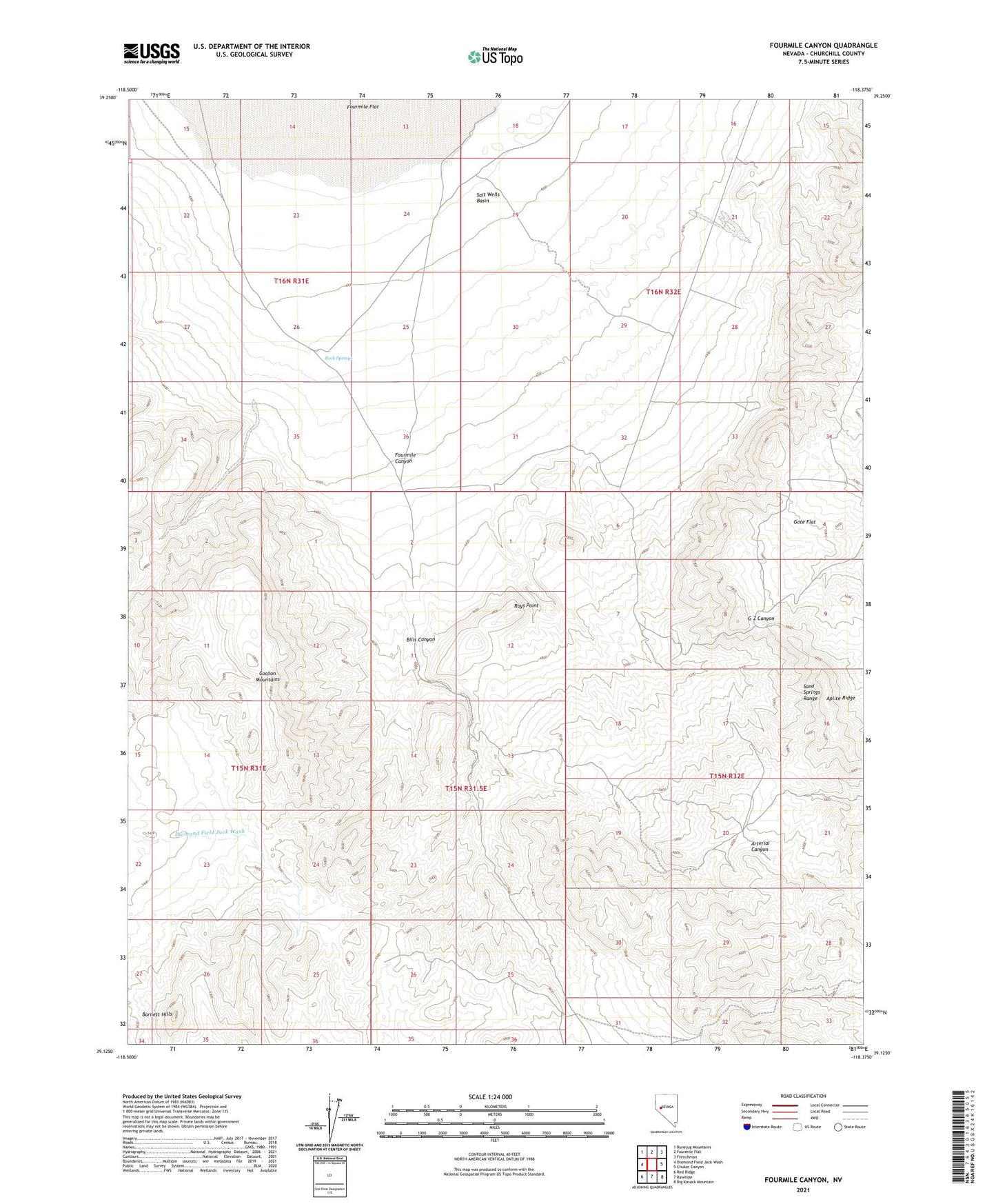
2021 topographic map quadrangle Fourmile Canyon in the state of Nevada. Scale: 1:24000. Based on the newly updated USGS 7.5' US Topo map series, this map is in the following counties: Churchill. The map contains contour data, water features, and other items you are used to seeing on USGS maps, but also has updated roads and other features. This is the next generation of topographic maps. Printed on high-quality waterproof paper with UV fade-resistant inks.
Quads adjacent to this one:
West: Diamond Field Jack Wash
Northwest: Bunejug Mountains
North: Fourmile Flat
Northeast: Frenchman
East: Chukar Canyon
Southeast: Big Kasock Mountain
South: Rawhide
Southwest: Red Ridge
Contains the following named places: AEC Test Site, AEC Well Number 3, Aplite Ridge, Atomic Well, Bills Canyon, Bucky O'Neil Well, Fourmile Canyon, Gote Flat, Hunt, Project Shoal Monument, Red Ant Mine, Rock Springs, Roys Point, Station, Wightman Well