MyTopo
Grafton New Hampshire US Topo Map
Couldn't load pickup availability
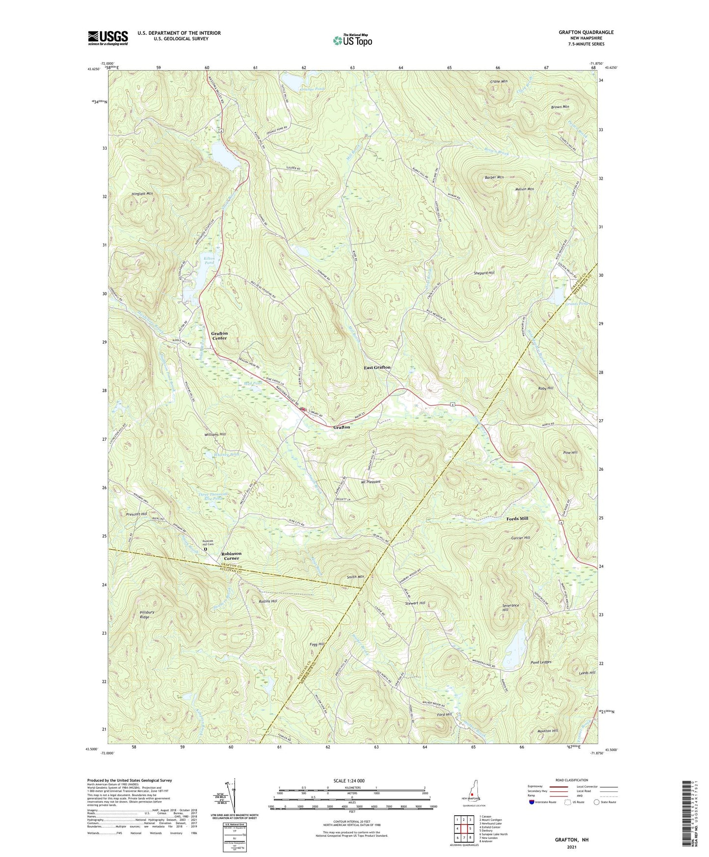
2021 topographic map quadrangle Grafton in the state of New Hampshire. Scale: 1:24000. Based on the newly updated USGS 7.5' US Topo map series, this map is in the following counties: Grafton, Merrimack, Sullivan. The map contains contour data, water features, and other items you are used to seeing on USGS maps, but also has updated roads and other features. This is the next generation of topographic maps. Printed on high-quality waterproof paper with UV fade-resistant inks.
Quads adjacent to this one:
West: Enfield Center
Northwest: Canaan
North: Mount Cardigan
Northeast: Newfound Lake
East: Danbury
Southeast: Andover
South: New London
Southwest: Sunapee Lake North
Contains the following named places: Barber Mountain, Brown Brook, Brown Mountain, Cardigan Station, Crane Mountain, Currier Hill, East Grafton, Fogg Hill, Ford Hill, Fords Crossing, Fords Mill, Garnet Mine, Golden Valley Ranch, Grafton, Grafton Ambulance Association, Grafton Center, Grafton Police Department, Grafton Post Office, Grafton Volunteer Fire Department, Grants Pond, Grants Pond Dam, Halfmoon Pond Brook, Hoyt Brook, Hoyt Brook Dam, Hoyt Brook Pond, Isinglass Mountain, Kilton Pond, Kilton Pond Dam, Leeds Hill, Manfeltree Brook, Melvin Mountain, Mill Brook, Moulton Hill, Mount Pleasant, Mud Pond, Orange Pond, Pillsbury Ridge, Pine Hill, Pond Ledges, Prescott Hill, Prescott Hill Cemetery, Robinson Corner, Roby Hill, Rollins Hill, Sanders Brook, Severance Hill, Shepard Hill, Smith Brook, Smith Mountain, Stewart Hill, Tewksbury Pond, Three Thousand Acre Pond, Town of Grafton, Unification Church, Waukeena Lake, Whitney Pond, Williams Hill, ZIP Codes: 03230, 03240