MyTopo
Allentown New Jersey US Topo Map
Couldn't load pickup availability
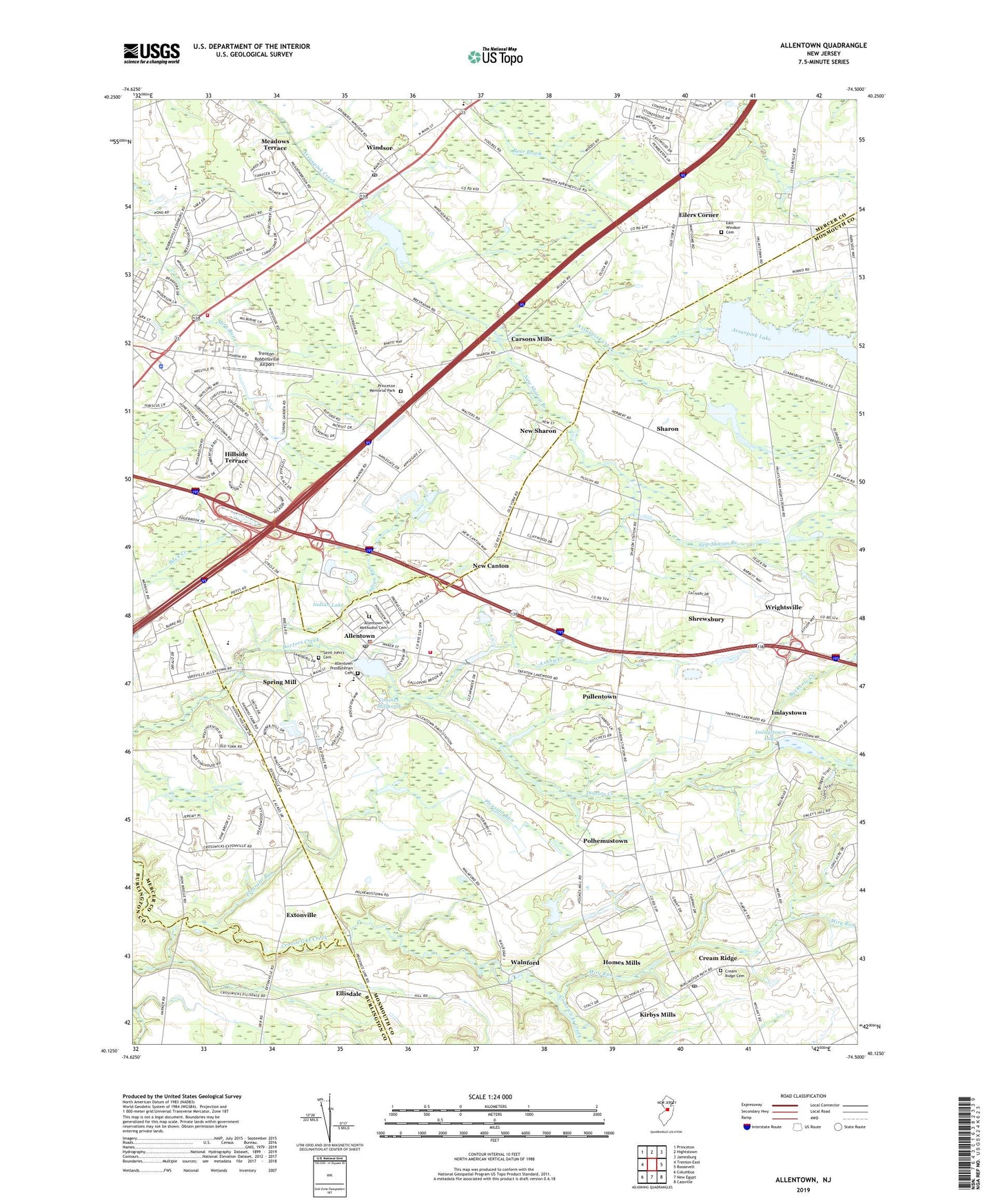
2019 topographic map quadrangle Allentown in the state of New Jersey. Scale: 1:24000. Based on the newly updated USGS 7.5' US Topo map series, this map is in the following counties: Monmouth, Mercer, Burlington. The map contains contour data, water features, and other items you are used to seeing on USGS maps, but also has updated roads and other features. This is the next generation of topographic maps. Printed on high-quality waterproof paper with UV fade-resistant inks.
Quads adjacent to this one:
West: Trenton East
Northwest: Princeton
North: Hightstown
Northeast: Jamesburg
East: Roosevelt
Southeast: Cassville
South: New Egypt
Southwest: Columbus
Contains the following named places: Allens Station, Allentown, Allentown Dam, Allentown First Aid Squad, Allentown High School, Allentown Methodist Cemetery, Allentown Police Department, Allentown Post Office, Allentown Presbyterian Cemetery, Ashby Creek, Borough of Allentown, Buckhole Creek, Carsons Mills, Conines Millpond, Cooleys Corner, Cream Ridge, Cream Ridge Cemetery, Cream Ridge Census Designated Place, Cream Ridge Post Office, Davis Station, East Windsor Cemetery, Eilers Corner, Ellisdale, Extonville, Hillside Terrace, Homes Mills, Hope Fire Company 1, Imlaystown, Imlaystown Lake, Imlaystown Lake Dam, Indian Lake, Indian Lake Dam, Indian Run, Kirbys Mills, Meadows Terrace, Miry Run, Nelsonville, New Canton, New Sharon, New Sharon Branch, Pages Corner, Pleasant Run, Polhemustown, Princeton Memorial Park, Pullentown, Robbinsville, Robbinsville High School, Robbinsville Township Fire Department, Robbinsville Township Police Department, Saint John's Cemetery, Saint Johns Church, Sharon, Sharon Elementary School, Shrewsbury, Spring Mill, Township of Robbinsville, Township of Upper Freehold, Trenton-Robbinsville Airport, Upper Freehold Regional Elementary School, Walnford, Windsor, Windsor Census Designated Place, Windsor Post Office, Wrightsville, ZIP Codes: 08501, 08691