MyTopo
Oswego Lake New Jersey US Topo Map
Couldn't load pickup availability
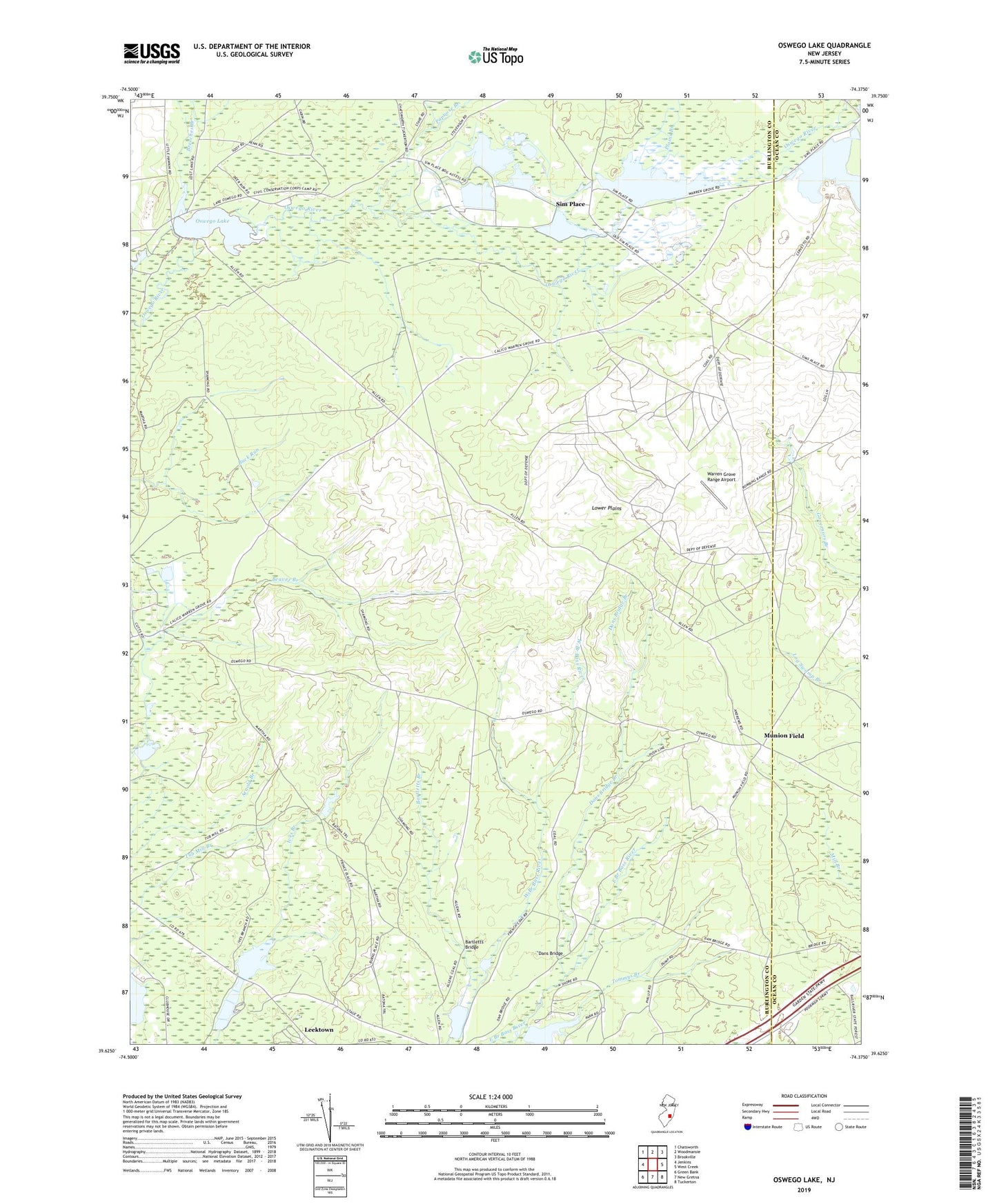
2019 topographic map quadrangle Oswego Lake in the state of New Jersey. Scale: 1:24000. Based on the newly updated USGS 7.5' US Topo map series, this map is in the following counties: Burlington, Ocean. The map contains contour data, water features, and other items you are used to seeing on USGS maps, but also has updated roads and other features. This is the next generation of topographic maps. Printed on high-quality waterproof paper with UV fade-resistant inks.
Quads adjacent to this one:
West: Jenkins
Northwest: Chatsworth
North: Woodmansie
Northeast: Brookville
East: West Creek
Southeast: Tuckerton
South: New Gretna
Southwest: Green Bank
Contains the following named places: Bartletts Branch, Bartletts Bridge, Bass River State Forest, Breeches Branch, Dans Bridge, Dans Bridge Branch, Dry Branch, High Bridge, Lake Absegami, Lake Absegami Dam, Lower Plains, Munion Field, Oswego Dam, Oswego Lake, Papoose Branch, Penn Place, Penn State Forest, Plains Branch, Sim Place, Tommys Branch, Township of Bass River, Warren Grove Range, Warren Grove Range Airport