MyTopo
Sandy Hook East New Jersey US Topo Map
Couldn't load pickup availability
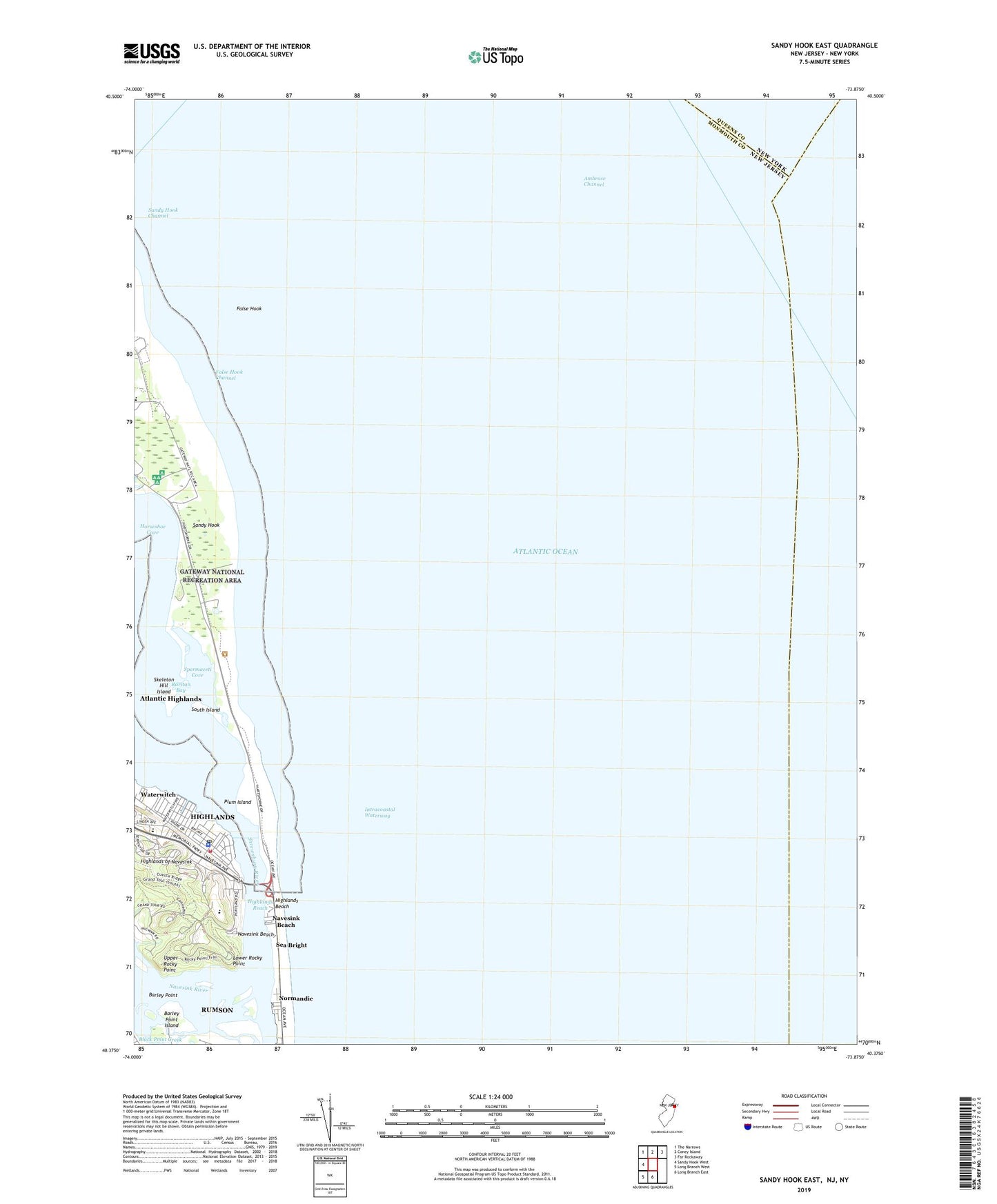
2019 topographic map quadrangle Sandy Hook East in the state of New Jersey. Scale: 1:24000. Based on the newly updated USGS 7.5' US Topo map series, this map is in the following counties: Monmouth, Queens. The map contains contour data, water features, and other items you are used to seeing on USGS maps, but also has updated roads and other features. This is the next generation of topographic maps. Printed on high-quality waterproof paper with UV fade-resistant inks.
Quads adjacent to this one:
West: Sandy Hook West
Northwest: The Narrows
North: Coney Island
Northeast: Far Rockaway
South: Long Branch East
Southwest: Long Branch West
Contains the following named places: Ambrose Channel, Barley Point, Barley Point Island, Battery Gunnison, Black Point Creek, Borough of Highlands, False Hook, False Hook Channel, Gedney Channel, Hartshorne Woods County Park, Henry Hudson Regional High School, Highlands, Highlands Air Force Station, Highlands Beach, Highlands Elementary School, Highlands Fire Department, Highlands First Aid Squad, Highlands Police Department, Highlands Post Office, Highlands Reach, Highlands Seaplane Base, Horseshoe Cove, Lower Rocky Point, Navesink Beach, Navesink Lighthouse, Navesink River, Navesink River State Wildlife Management Area, Normandie, Our Lady of Perpetual Help School, Plum Island, Sandy Hook, Sandy Hook Channel, Skeleton Hill Island, South Island, Spermaceti Cove, Twin Lights State Historic Site, Upper Rocky Point, Waterwitch, ZIP Code: 07732