MyTopo
Abreu Canyon New Mexico US Topo Map
Couldn't load pickup availability
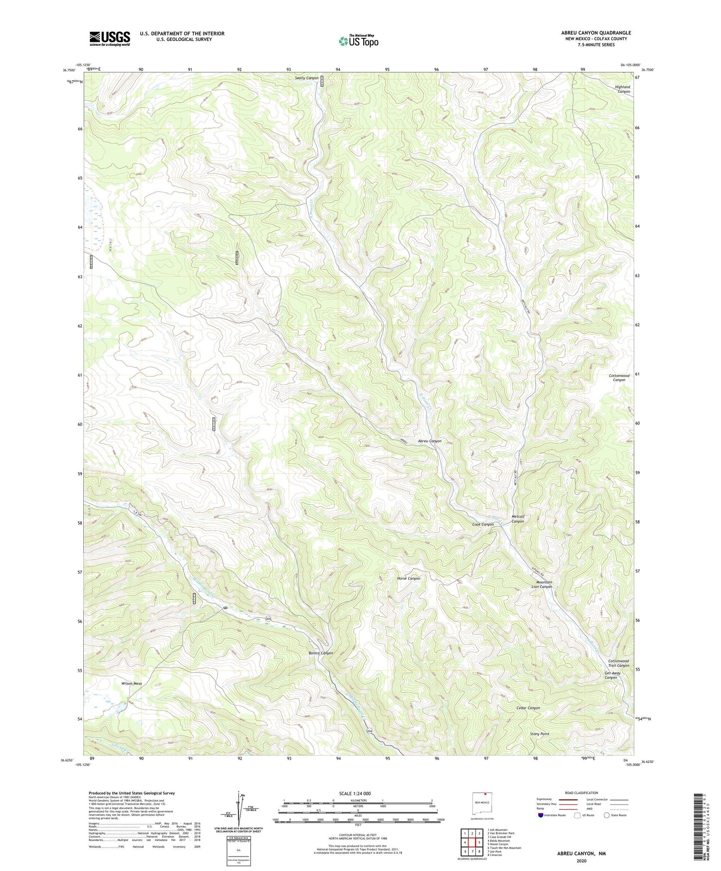
2020 topographic map quadrangle Abreu Canyon in the state of New Mexico. Scale: 1:24000. Based on the newly updated USGS 7.5' US Topo map series, this map is in the following counties: Colfax. The map contains contour data, water features, and other items you are used to seeing on USGS maps, but also has updated roads and other features. This is the next generation of topographic maps. Printed on high-quality waterproof paper with UV fade-resistant inks.
Quads adjacent to this one:
West: Baldy Mountain
Northwest: Ash Mountain
North: Van Bremmer Park
Northeast: Casa Grande SW
East: House Canyon
Southeast: Cimarron
South: Ute Park
Southwest: Touch-Me-Not Mountain
Contains the following named places: A Camp, Abreu Canyon, Bent Camp, Bonita Canyon, Cook Canyon, Cottonwood Trail Canyon, Dan Beard Trail Camp, Elliot Barker State Wildlife Area, Get Away Canyon, Metcalf Canyon, Mountain Lion Canyon, Old Camp, Seally Canyon, Stern Post Office, Stern Ranch, Stony Point, Valle Vidal Unit, Wilson Mesa