
MyTopo
Animas New Mexico US Topo Map
Couldn't load pickup availability
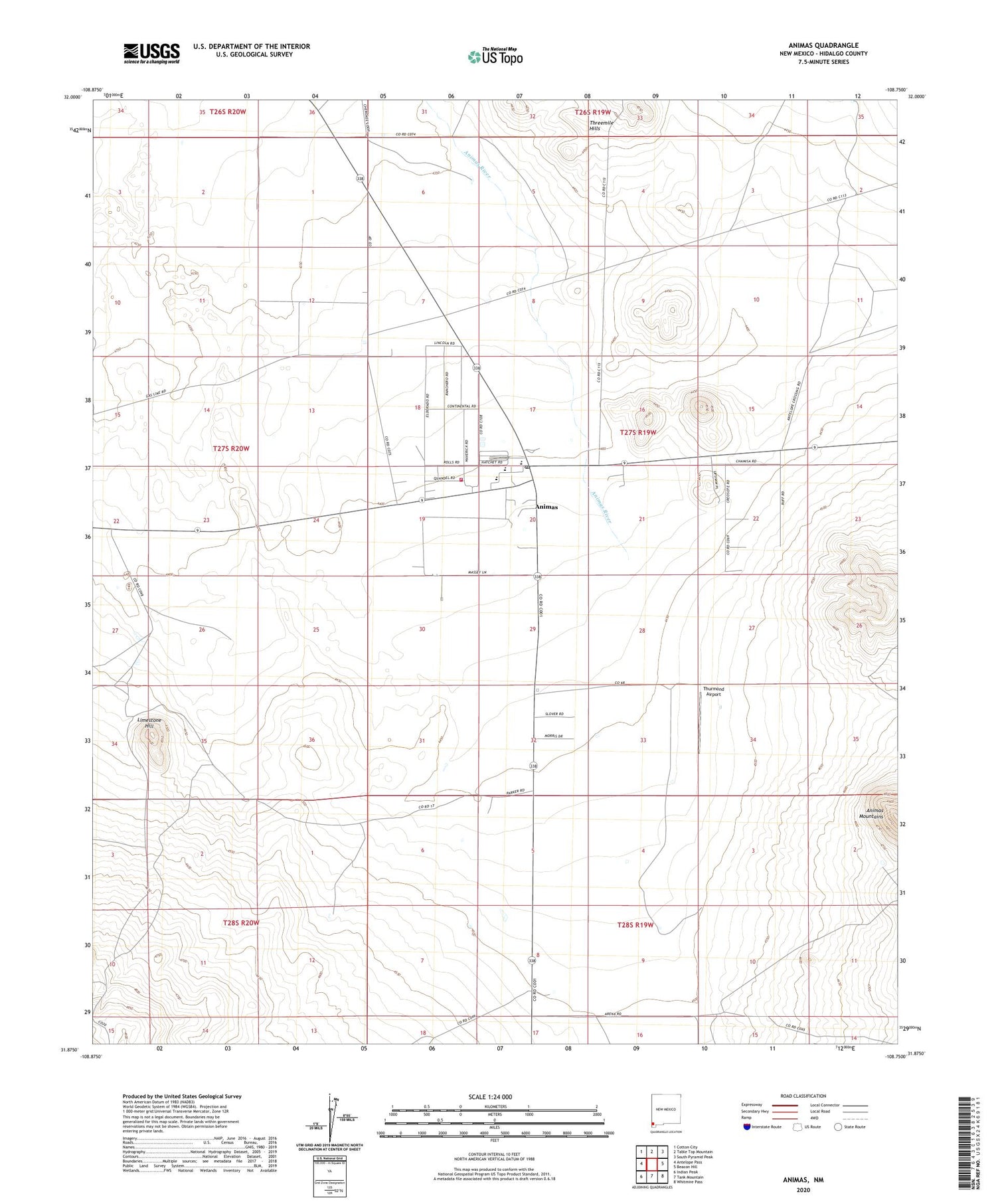
2020 topographic map quadrangle Animas in the state of New Mexico. Scale: 1:24000. Based on the newly updated USGS 7.5' US Topo map series, this map is in the following counties: Hidalgo. The map contains contour data, water features, and other items you are used to seeing on USGS maps, but also has updated roads and other features. This is the next generation of topographic maps. Printed on high-quality waterproof paper with UV fade-resistant inks.
Quads adjacent to this one:
West: Antelope Pass
Northwest: Cotton City
North: Table Top Mountain
Northeast: South Pyramid Peak
East: Beacon Hill
Southeast: Whitmire Pass
South: Tank Mountain
Southwest: Indian Peak
Contains the following named places: 10087 Water Well, 10135 Water Well, Animas, Animas Census Designated Place, Animas Emergency Medical Service, Animas High School, Animas Post Office, Animas River, Animas Volunteer Fire and Rescue Department, Animas Weather Station, Box Canyon Historic Site, Brushy Creek Historic Site, Clanton Draw Site-LA 4979, First Baptist Church, LA 54042, LA54049 Historic Site, LA54050 Historic Site, LA593 Historic Site, Limestone Hill, Little Historic Site, Lunch Box Historic Site, Maddox Ranch Historic Site, Metate Historic Site, Pigpen Creek Historic Site, Saddle Bronc Historic Site, Saint Joseph Catholic Church, Smugglers Trail Historical Marker, Sycamore Well Historic Site, Threemile Hills, Thurmond Airport, Timberlake Historic Site, X T Wells


