MyTopo
Cerro Pelon New Mexico US Topo Map
Couldn't load pickup availability
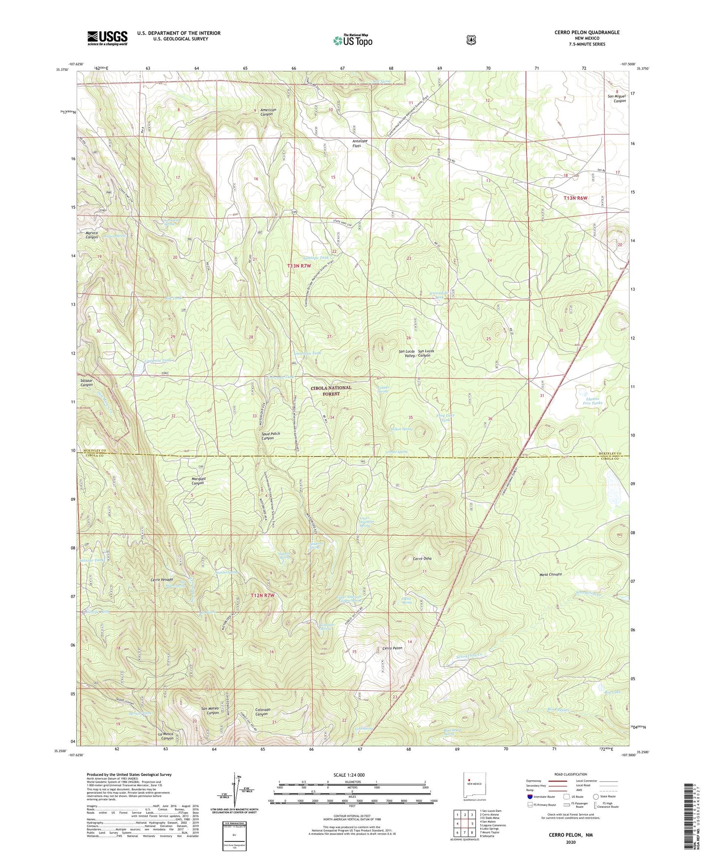
2020 topographic map quadrangle Cerro Pelon in the state of New Mexico. Scale: 1:24000. Based on the newly updated USGS 7.5' US Topo map series, this map is in the following counties: Cibola, McKinley. The map contains contour data, water features, and other items you are used to seeing on USGS maps, but also has updated roads and other features. This is the next generation of topographic maps. Printed on high-quality waterproof paper with UV fade-resistant inks.
Quads adjacent to this one:
West: San Mateo
Northwest: San Lucas Dam
North: Cerro Alesna
Northeast: El Dado Mesa
East: Laguna Canoneros
Southeast: Seboyeta
South: Mount Taylor
Southwest: Lobo Springs
Contains the following named places: American Canyon, American Tank, Antelope Flats, Antelope Tank, Big Canyon Spring, Big Lake, CCC Spring, Cerro Osha, Cerro Pelon, Cerro Venada, Cold Spring, Cold Spring Water Well, Colorado Spring, Colorado Tank, Corner Spring, Effran Tank, Elkins Camp, Elkins Spring, Escondido Tank, Fernandez Camp, Frog Lake Tank, George Tank, Gobbler Spring, KLLT-FM (Grants), La Cuchilla, La Cuchilla Pit Mine, La Mosca Lookout Tower, Laguna Largo, Lagunita Tank, Llanito Frio Tanks, Lower American Spring, Manuel Spring, Maruca Canyon, Maruca Spring, Ojo Piedra, Salazar Spring, Salazar Tank, San Lucas Spring, San Mateo Spring, San Mateo Springs Tract Number Two, Sandoval Spring, Seco, Silt Tank, Spruce Tank, Spud Patch, Spud Patch Canyon, Upper American Canyon Spring, Willow Spring