MyTopo
Correo New Mexico US Topo Map
Couldn't load pickup availability
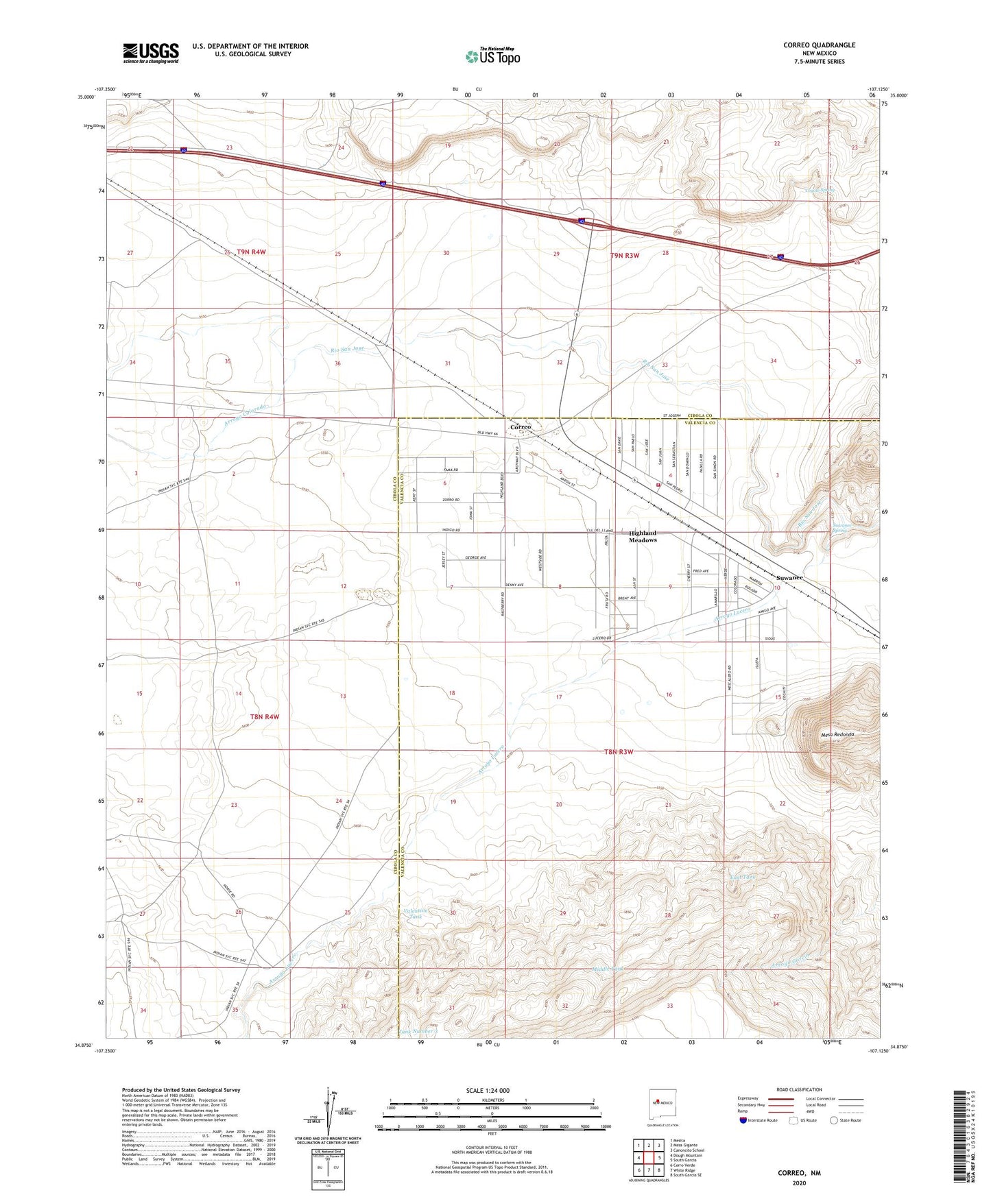
2020 topographic map quadrangle Correo in the state of New Mexico. Scale: 1:24000. Based on the newly updated USGS 7.5' US Topo map series, this map is in the following counties: Valencia, Cibola. The map contains contour data, water features, and other items you are used to seeing on USGS maps, but also has updated roads and other features. This is the next generation of topographic maps. Printed on high-quality waterproof paper with UV fade-resistant inks.
Quads adjacent to this one:
West: Dough Mountain
Northwest: Mesita
North: Mesa Gigante
Northeast: Canoncito School
East: South Garcia
Southeast: South Garcia SE
South: White Ridge
Southwest: Cerro Verde
Contains the following named places: Arroyo Colorado, Arroyo Lucero, Correo, Coyote Spring, East Tank, Highland Meadows Census Designated Place, Highland Meadows Volunteer Fire Department, Lower T X Ranch, Marys Windmill, McGaughys Windmill, Mesa Redonda, Middle Tank, Millet Windmill, RWP-15 Water Well, Suwanee, Suwanee Spring, Tank Number 3, Tranquilino Windmill, Valentine Tank, Windmill Number 10, ZIP Code: 87026