
MyTopo
Cunavea Basin New Mexico US Topo Map
Couldn't load pickup availability
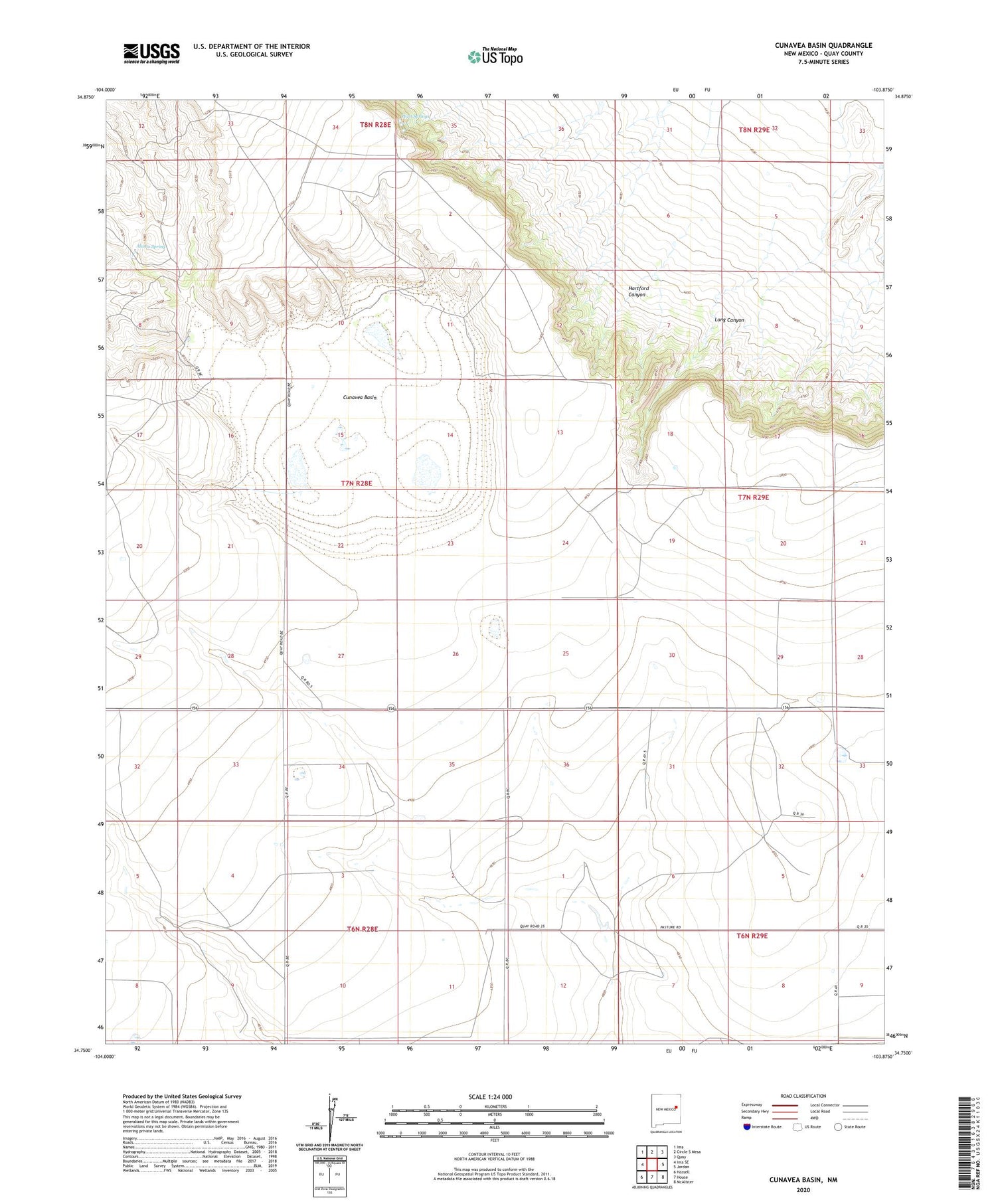
2020 topographic map quadrangle Cunavea Basin in the state of New Mexico. Scale: 1:24000. Based on the newly updated USGS 7.5' US Topo map series, this map is in the following counties: Quay. The map contains contour data, water features, and other items you are used to seeing on USGS maps, but also has updated roads and other features. This is the next generation of topographic maps. Printed on high-quality waterproof paper with UV fade-resistant inks.
Quads adjacent to this one:
West: Ima SE
Northwest: Ima
North: Circle S Mesa
Northeast: Quay
East: Jordan
Southeast: McAlister
South: House
Southwest: Hassell
Contains the following named places: 10068 Water Well, 10092 Water Well, 10093 Water Well, 10150 Water Well, 10321 Water Well, 10322 Water Well, 10323 Water Well, 10345 Water Well, 10365 Water Well, 10526 Water Well, 10528 Water Well, 10529 Water Well, 10530 Water Well, 10538 Water Well, 10539 Water Well, 10540 Water Well, 10548 Water Well, 10549 Water Well, 10555 Water Well, 10556 Water Well, 10560 Water Well, 10561 Water Well, 10562 Water Well, 10649 Water Well, 10651 Water Well, 10685 Water Well, 10706 Water Well, 10706-B Water Well, 10707 Water Well, 10734 Water Well, 10735 Water Well, 10736 Water Well, 10737 Water Well, 10738 Water Well, 10740 Water Well, 10779 Water Well, Alamo Spring, Cunavea Basin, Hart Springs, Hartford Canyon, Jennings, Long Canyon, Lyons, Shoemaker


