MyTopo
Dalies New Mexico US Topo Map
Couldn't load pickup availability
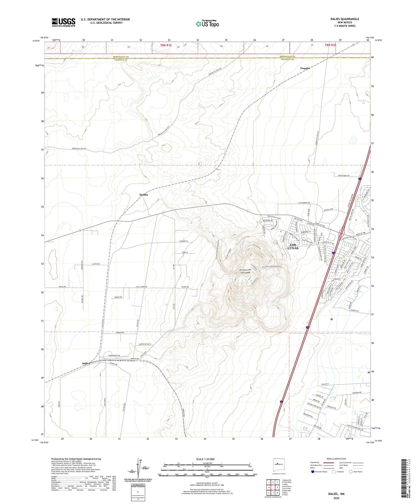
2020 topographic map quadrangle Dalies in the state of New Mexico. Scale: 1:24000. Based on the newly updated USGS 7.5' US Topo map series, this map is in the following counties: Valencia, Bernalillo. The map contains contour data, water features, and other items you are used to seeing on USGS maps, but also has updated roads and other features. This is the next generation of topographic maps. Printed on high-quality waterproof paper with UV fade-resistant inks.
Quads adjacent to this one:
West: Rio Puerco
Northwest: Dalies NW
North: Wind Mesa
Northeast: Isleta
East: Los Lunas
Southeast: Tome
South: Belen
Southwest: Belen NW
Contains the following named places: 10008 Water Well, 10017 Water Well, 10026 Water Well, 10027 Water Well, 10028 Water Well, Artistic Park, Central New Mexico Correctional Facility, Central New Mexico Correctional Facility Level I, Central New Mexico Correctional Facility Level II, Central New Mexico Correctional Faciltiy Library, Central New Mexico Correctional Honor Farm, Dalies, Dalies Oil Well, Dalies Post Office, El Cerro De Los Lunas, Grasslands Water Well, Gutierrez and Sedillo Grant, KARS-FM (Belen), Los Lunas High School, Los Lunas Wasteway, New Belen Ditch, Paquita, Prison Lateral, San Clemente Grant, Sandia, Sandia Post Office, Valley View Park, Village of Los Lunas