MyTopo
El Morro New Mexico US Topo Map
Couldn't load pickup availability
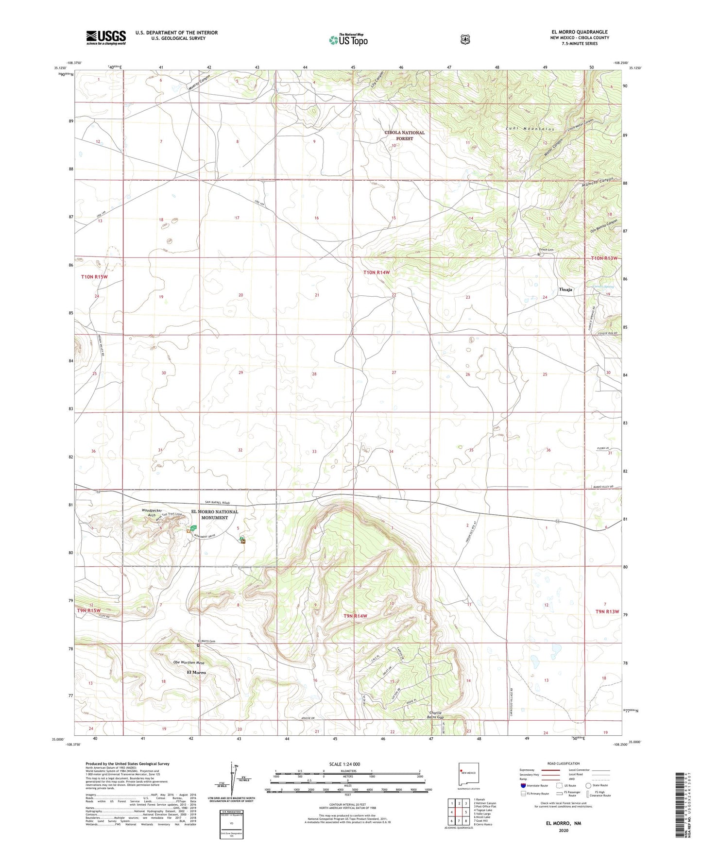
2020 topographic map quadrangle El Morro in the state of New Mexico. Scale: 1:24000. Based on the newly updated USGS 7.5' US Topo map series, this map is in the following counties: Cibola. The map contains contour data, water features, and other items you are used to seeing on USGS maps, but also has updated roads and other features. This is the next generation of topographic maps. Printed on high-quality waterproof paper with UV fade-resistant inks.
Quads adjacent to this one:
West: Togeye Lake
Northwest: Ramah
North: Kettner Canyon
Northeast: Post Office Flat
East: Valle Largo
Southeast: Cerro Hueco
South: Goat Hill
Southwest: Nicoll Lake
Contains the following named places: Alamosa Canyon, Atsinna, Canocico, Caruco Spring, Charlie Barns Gap, Davis Brothers Water Well, El Morro, El Morro Cemetery, El Morro Lookout, El Morro National Monument, El Morro National Monument Inscription Rock Historical Marker, El Morro Post Office, El Morro Valley Census Designated Place, El Morro Water Well, El Morro Weather Station, Inscription Rock, Lava Beds Historical Marker, Lily Canyon, Little Water Canyon, Muerto Canyon, Obe Worthen Mesa, Ojo Bonito Canyon, Pueblito, Pueblito Well, Pueblo Revolt Tricentennial Historical Marker, Sand Corner, Tinaja, Tinaja Cemetery, Water Canyon, Woodpecker Arch, ZIP Code: 87321