MyTopo
El Porvenir New Mexico US Topo Map
Couldn't load pickup availability
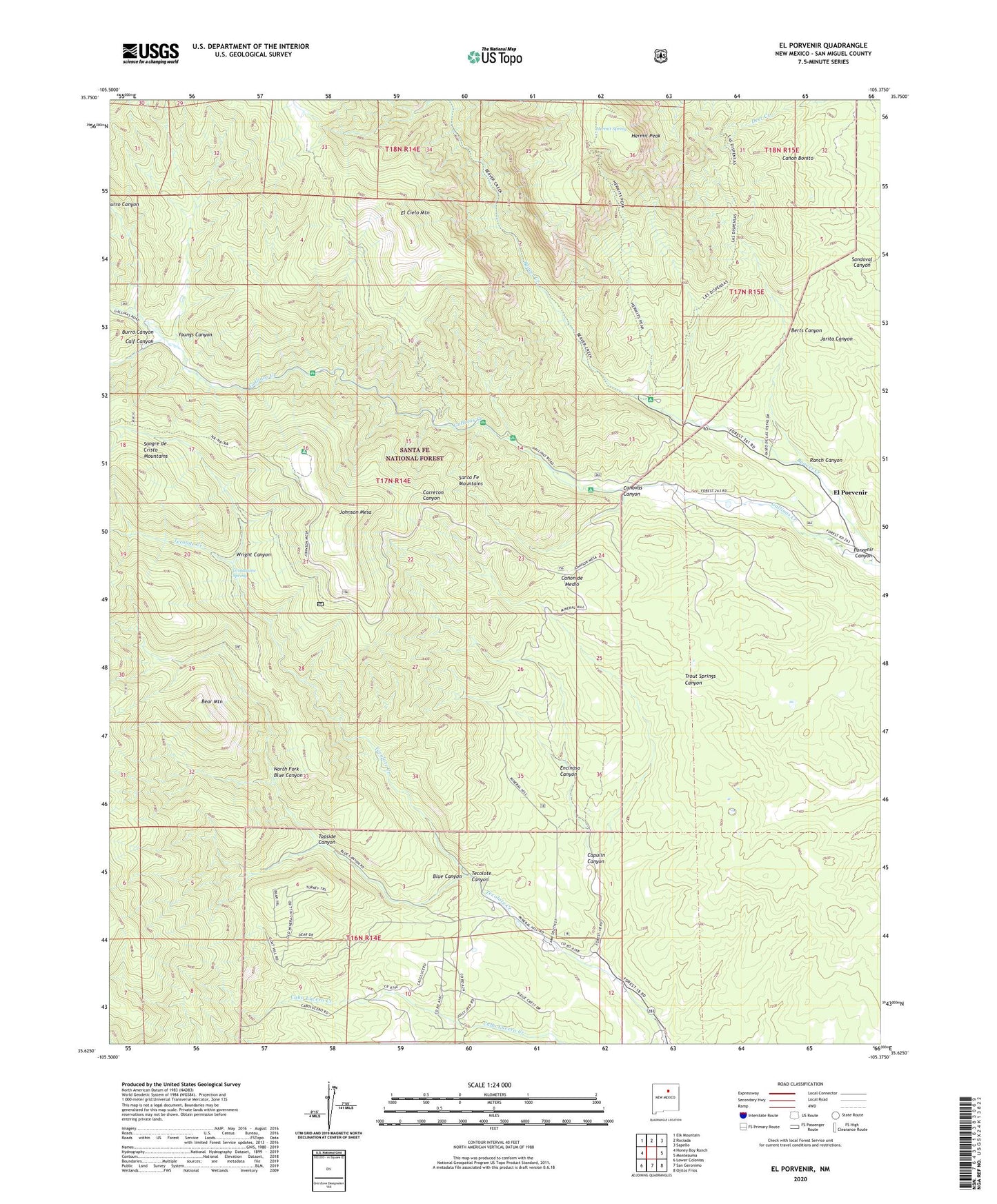
2020 topographic map quadrangle El Porvenir in the state of New Mexico. Scale: 1:24000. Based on the newly updated USGS 7.5' US Topo map series, this map is in the following counties: San Miguel. The map contains contour data, water features, and other items you are used to seeing on USGS maps, but also has updated roads and other features. This is the next generation of topographic maps. Printed on high-quality waterproof paper with UV fade-resistant inks.
Quads adjacent to this one:
West: Honey Boy Ranch
Northwest: Elk Mountain
North: Rociada
Northeast: Sapello
East: Montezuma
Southeast: Ojitos Frios
South: San Geronimo
Southwest: Lower Colonias
Contains the following named places: Baker Flat Picnic Area, Baker Gulch, Bear Mountain, Beaver Creek, Beisman Ranch, Big Pine Picnic Area, Black Nugget, Blue Canyon, Blue Haven Camp, Burro Canyon, Calf Canyon, Camp Long Campground, Camp Monakiwa Girls Camp, Canovas Canyon, Capulin Canyon, Carreton Canyon, Crespin, El Cielo Mountain, El Porvenir, El Porvenir Campground, El Porvenir Post Office, El Povenir, Encinoso Canyon, EV Long Campground, Evergreen Valley Ranch, Fishing Hole Picnic Area, Gallinas Cabin, Grindstone Spring, Hermit Peak, Hermit Spring, Hermits Peak Historical Marker, Johnson Mesa, Johnson Mesa Picnic Area, Long Ranch, Medina Meadows, North Fork Blue Canyon, Oak Flats Picnic Area, Porvenir Canyon, Ranch Canyon, San Antonio Church, Santo Nino, Sparks-Stone Number One, Strike Valley Historical Marker, Tecolote Canyon, Tilted Rock Picnic Area, Topside Canyon, Trujillo Ranch, Western Life Camp, Wright Canyon, Youngs Canyon