MyTopo
Eunice New Mexico US Topo Map
Couldn't load pickup availability
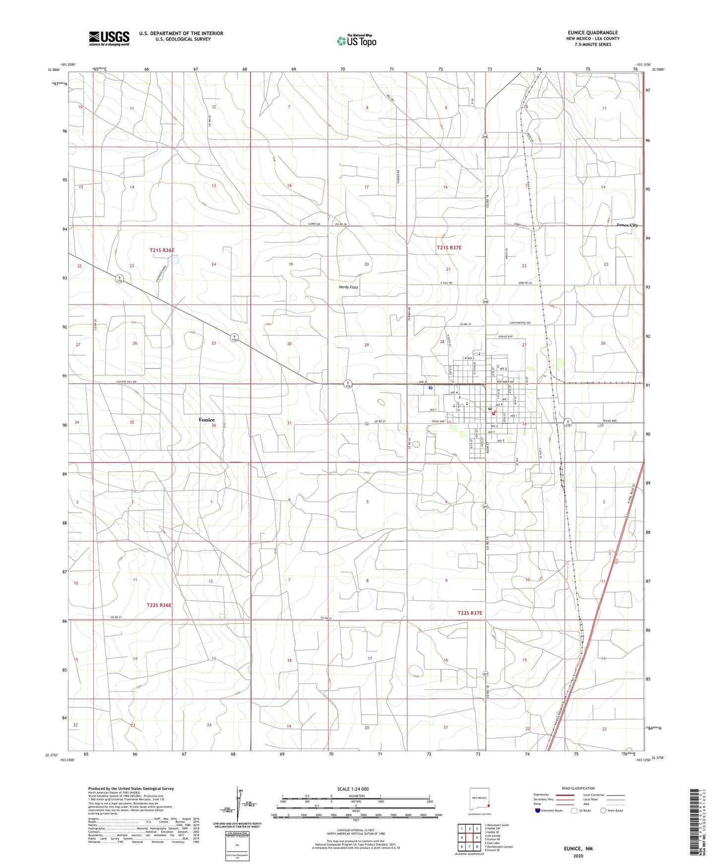
2020 topographic map quadrangle Eunice in the state of New Mexico. Scale: 1:24000. Based on the newly updated USGS 7.5' US Topo map series, this map is in the following counties: Lea. The map contains contour data, water features, and other items you are used to seeing on USGS maps, but also has updated roads and other features. This is the next generation of topographic maps. Printed on high-quality waterproof paper with UV fade-resistant inks.
Quads adjacent to this one:
West: Oil Center
Northwest: Monument South
North: Hobbs SW
Northeast: Hobbs SE
East: Eunice NE
Southeast: Eunice SE
South: Rattlesnake Canyon
Southwest: East Lake
Contains the following named places: Armstrong and Armstrong, Brunson Memorial Cemetery, Calvary Baptist Church, Caton Junior High School, Church of Christ, City of Eunice, Cobb Well, Eunice, Eunice Airport, Eunice Division, Eunice Fire and Rescue Department, Eunice High School, Eunice Holiness Academy, Eunice Library, Eunice Municipal Recreation Area, Eunice Police Department, Eunice Post Office, Eunice Public Library, First Baptist Church, Hardy Flats, Highland Baptist Church, Jones City, KPCE-FM (Eunice), Lea County Sheriff's Office Eunice, Mettie Jordan Elementary School, Trinity Lutheran Church