MyTopo
Gunsight Canyon New Mexico US Topo Map
Couldn't load pickup availability
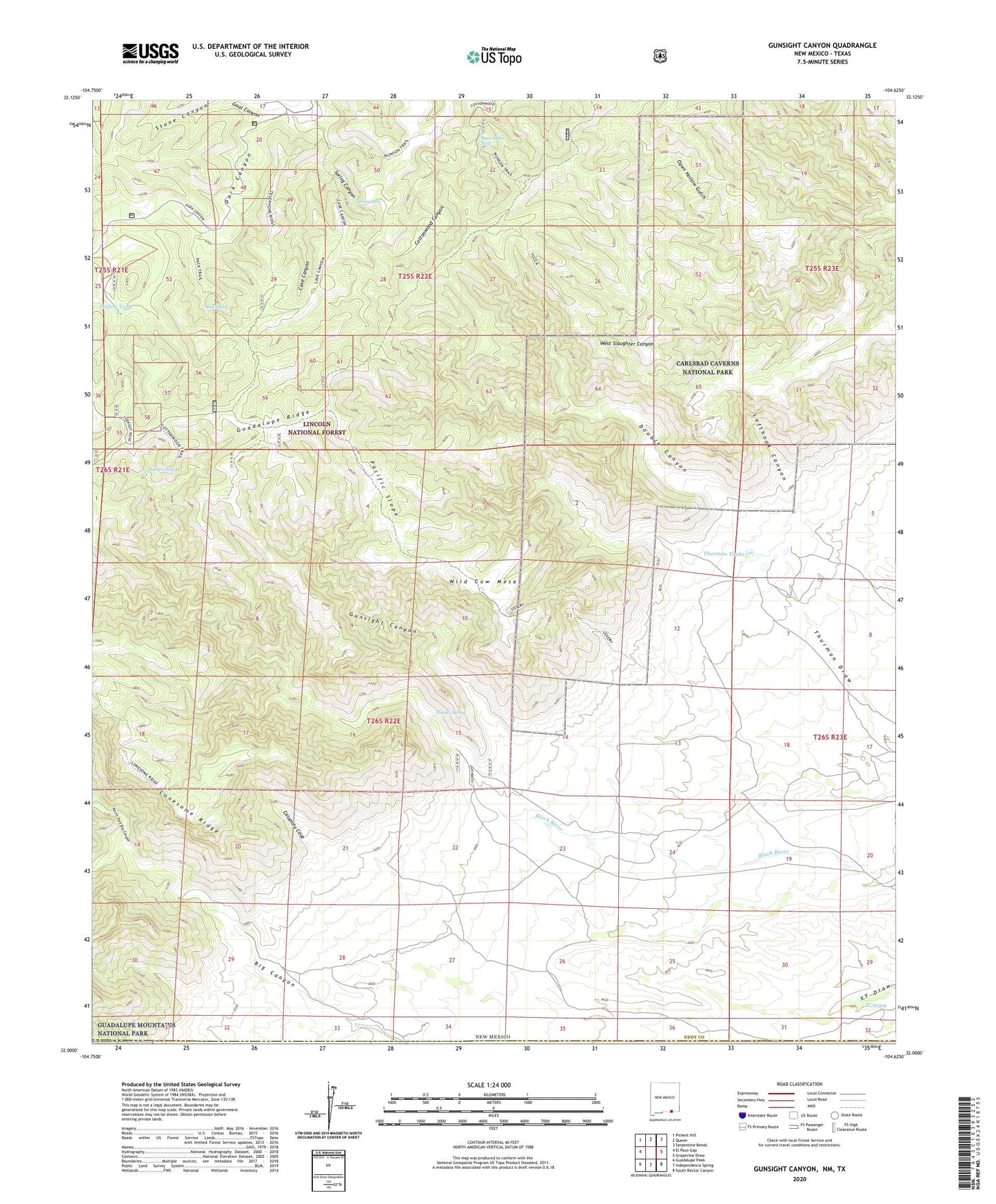
2020 topographic map quadrangle Gunsight Canyon in the state of New Mexico. Scale: 1:24000. Based on the newly updated USGS 7.5' US Topo map series, this map is in the following counties: Eddy, Culberson. The map contains contour data, water features, and other items you are used to seeing on USGS maps, but also has updated roads and other features. This is the next generation of topographic maps. Printed on high-quality waterproof paper with UV fade-resistant inks.
Quads adjacent to this one:
West: El Paso Gap
Northwest: Pickett Hill
North: Queen
Northeast: Serpentine Bends
East: Grapevine Draw
Southeast: South Rector Canyon
South: Independence Spring
Southwest: Guadalupe Peak
Contains the following named places: Aqua Dulce Seep, Black Canyon, Calamity Cove, Cave Canyon, Dark Canyon Lookout Tower, Double Trail, Franks Canyon, Franks Spring, Goat Canyon, Golden Stairway Trail, Gunsight Canyon, Helton Creek, Helton Tank, Hidden Seep, Lefthook Canyon, Lonesome Ridge Wilderness Study Area, Middle Fork Big Canyon, Munson Reservation, North Fork Big Canyon, Old Hepler Ranch, Open Hollow Gulch, Pacific Slope, South Seep, Spring Canyon, Spring Seep, Thurman Tanks, Ussery Trail, Wild Cow Mesa, XT Spring