MyTopo
Hudson New Mexico US Topo Map
Couldn't load pickup availability
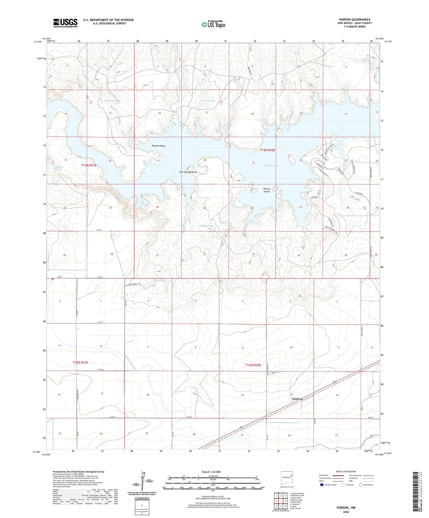
2020 topographic map quadrangle Hudson in the state of New Mexico. Scale: 1:24000. Based on the newly updated USGS 7.5' US Topo map series, this map is in the following counties: Quay. The map contains contour data, water features, and other items you are used to seeing on USGS maps, but also has updated roads and other features. This is the next generation of topographic maps. Printed on high-quality waterproof paper with UV fade-resistant inks.
Quads adjacent to this one:
West: Bascom Camp
Northwest: Hampton Ranch
North: Montesito Creek
Northeast: Logan North
East: Logan South
Southeast: San Jon NW
South: Lesbia
Southwest: Tucumcari
Contains the following named places: 05504 Water Well, 05505 Water Well, Barnett, Burr/ Springs, Conservancy Fire District Station 3 Main Station, Cow Springs, Cow Springs Draw, Dowell, Dripping Springs, Favor, Hudson, Hudson Lateral, Hudson Post Office, Middle Dipping Vat Well, Mowle, Ochenta Tank, Romero Draw, Simms Ranch, Ute Reservoir, Watson Island, Willow Tank