MyTopo
Javelina Basin New Mexico US Topo Map
Couldn't load pickup availability
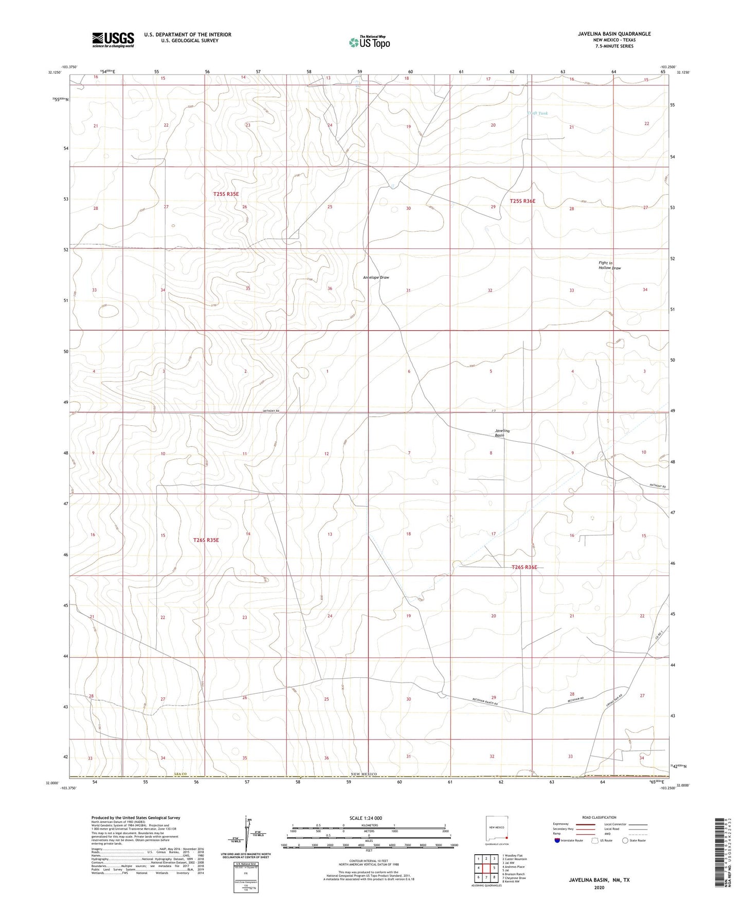
2020 topographic map quadrangle Javelina Basin in the state of New Mexico. Scale: 1:24000. Based on the newly updated USGS 7.5' US Topo map series, this map is in the following counties: Lea, Winkler, Loving. The map contains contour data, water features, and other items you are used to seeing on USGS maps, but also has updated roads and other features. This is the next generation of topographic maps. Printed on high-quality waterproof paper with UV fade-resistant inks.
Quads adjacent to this one:
West: Andrews Place
Northwest: Woodley Flat
North: Custer Mountain
Northeast: Jal NW
East: Jal
Southeast: Kermit NW
South: Cheyenne Draw
Southwest: Brunson Ranch
Contains the following named places: 10117 Water Well, 11570 Water Well, 11571 Water Well, 11573 Water Well, 11574 Water Well, 11575 Water Well, 11576 Water Well, 11578 Water Well, 11604 Water Well, 11605 Water Well, 11606 Water Well, 11616 Water Well, 12958 Water Well, 12959 Water Well, 13634 Water Well, Antelope Draw, Anthony Ranch, Beckham Ranch, Big Windmill, Croft Tank, Dirt Tank, Fight in Hollow Draw, Hutchin Windmill, Javelina Basin, Kammerer Tanks, Medlin Place, Natural Tank, New Windmill, Pipeline Windmill, Rock Lake, Tank Windmill, West Windmill