MyTopo
Kansas Valley New Mexico US Topo Map
Couldn't load pickup availability
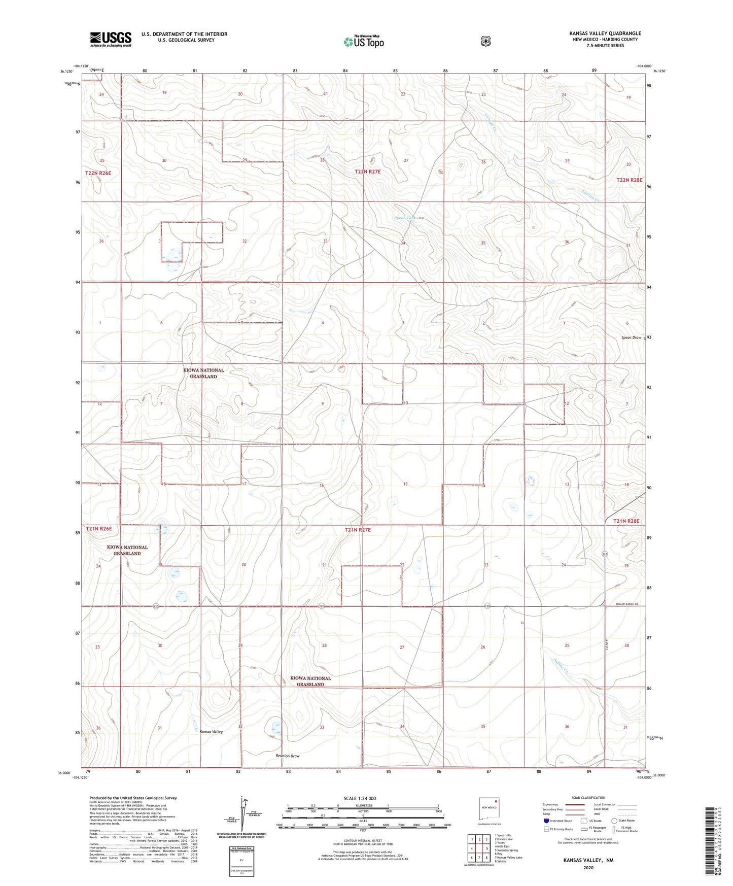
2020 topographic map quadrangle Kansas Valley in the state of New Mexico. Scale: 1:24000. Based on the newly updated USGS 7.5' US Topo map series, this map is in the following counties: Harding. The map contains contour data, water features, and other items you are used to seeing on USGS maps, but also has updated roads and other features. This is the next generation of topographic maps. Printed on high-quality waterproof paper with UV fade-resistant inks.
Quads adjacent to this one:
West: Mills East
Northwest: Spear Hills
North: Divine Lake
Northeast: Yates
East: Valencia Spring
Southeast: Sabino
South: Kansas Valley Lake
Southwest: Roy
Contains the following named places: Canon Windmill, Jackson Windmill, Kansas Valley, Kiowa National Grassland, Nugen Windmill, Slusher Windmill, Spear Tank, Spear Windmill, West Spear Windmill