MyTopo
Liberty Mesa New Mexico US Topo Map
Couldn't load pickup availability
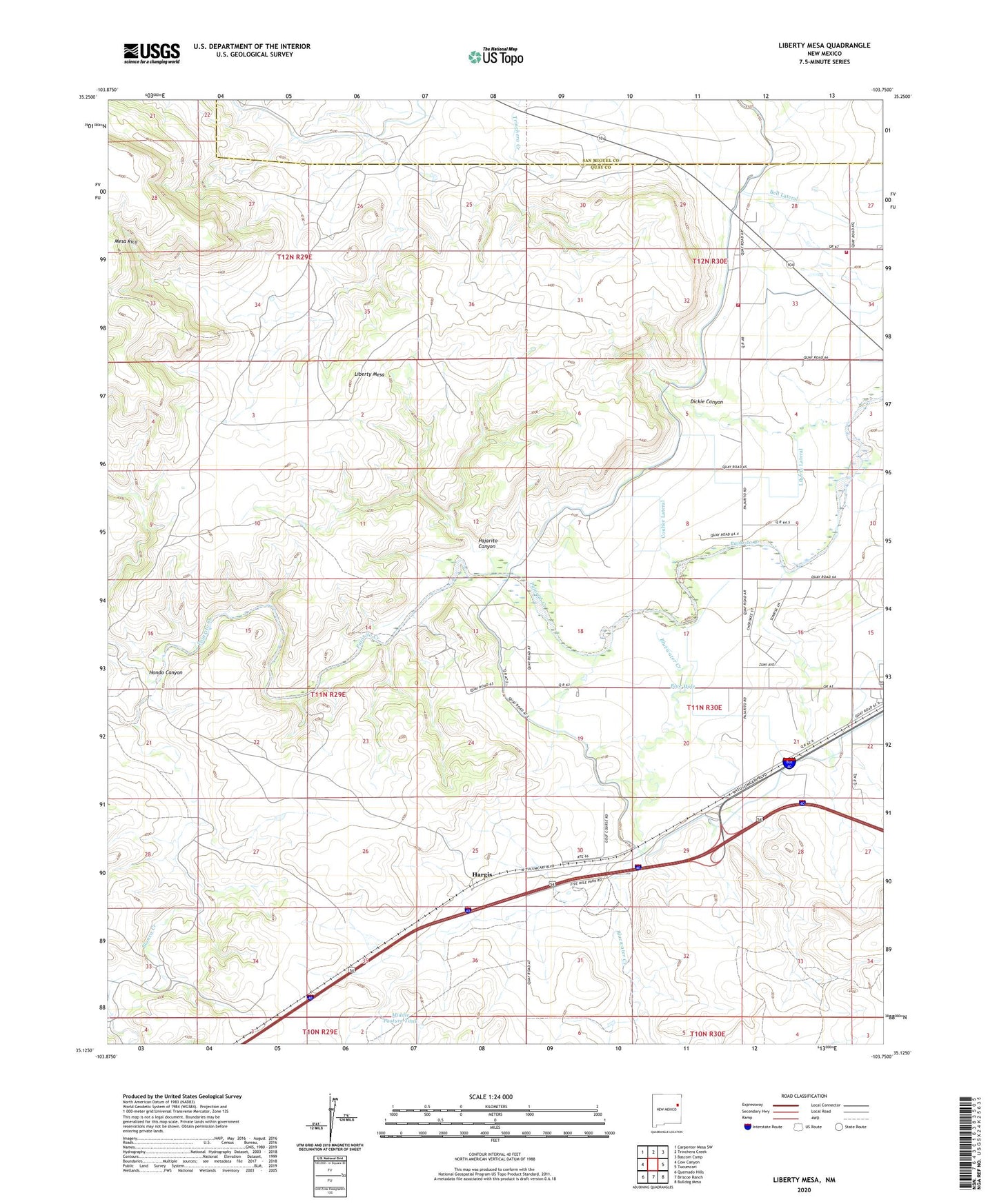
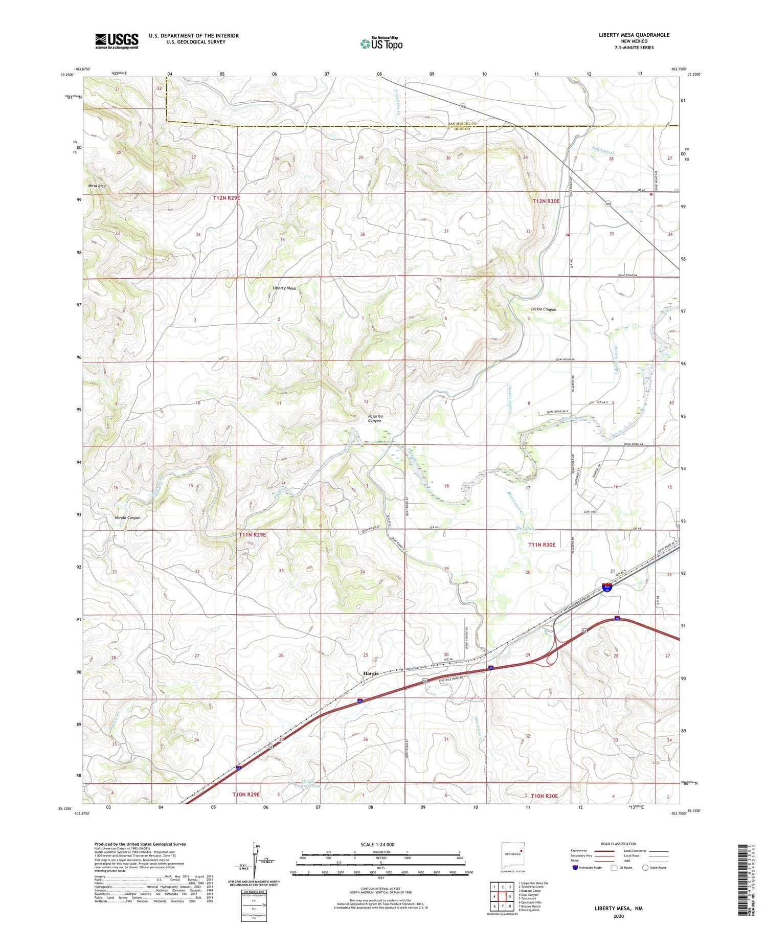
2020 topographic map quadrangle Liberty Mesa in the state of New Mexico. Scale: 1:24000. Based on the newly updated USGS 7.5' US Topo map series, this map is in the following counties: Quay, San Miguel. The map contains contour data, water features, and other items you are used to seeing on USGS maps, but also has updated roads and other features. This is the next generation of topographic maps. Printed on high-quality waterproof paper with UV fade-resistant inks.
Quads adjacent to this one:
West: Cow Canyon
Northwest: Carpenter Mesa SW
North: Trinchera Creek
Northeast: Bascom Camp
East: Tucumcari
Southeast: Bulldog Mesa
South: Briscoe Ranch
Southwest: Quemado Hills
Contains the following named places: 10107 Water Well, 10108 Water Well, 10109 Water Well, 10110 Water Well, 10112 Water Well, 10113 Water Well, 10115 Water Well, 10116 Water Well, 10117 Water Well, 10118 Water Well, 10119 Water Well, 10120 Water Well, 10129 Water Well, 10133 Water Well, 10134 Water Well, 10135 Water Well, 10136 Water Well, 10137 Water Well, 10138 Water Well, 10140 Water Well, 10146 Water Well, 10147 Water Well, 10148 Water Well, Blanca Creek, Blue Hole, Bluewater Creek, Bugg, Conservancy Fire District 1 Substation, Conservancy Fire District 3 Substation 2, Coulter Lateral, Dickie Canyon, Hargis, Hondo Canyon, Leslie Windmill, Liberty Lateral, Liberty Mesa, Middle Pasture Tank, Pajarito Canyon, Roberts Lateral, Tucumcari Metropolitan Park