MyTopo
Punta de Agua New Mexico US Topo Map
Couldn't load pickup availability
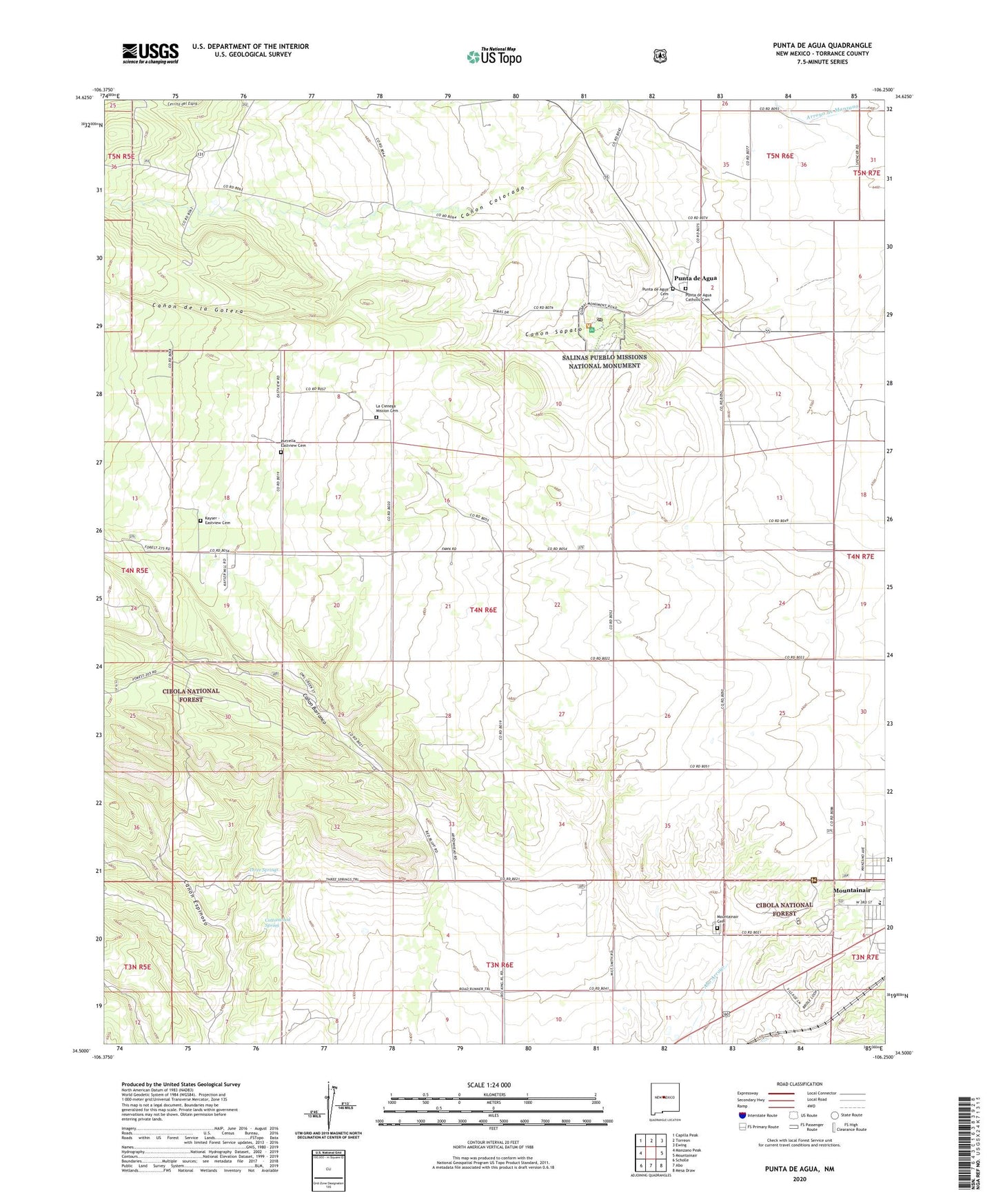
2020 topographic map quadrangle Punta de Agua in the state of New Mexico. Scale: 1:24000. Based on the newly updated USGS 7.5' US Topo map series, this map is in the following counties: Torrance. The map contains contour data, water features, and other items you are used to seeing on USGS maps, but also has updated roads and other features. This is the next generation of topographic maps. Printed on high-quality waterproof paper with UV fade-resistant inks.
Quads adjacent to this one:
West: Manzano Peak
Northwest: Capilla Peak
North: Torreon
Northeast: Ewing
East: Mountainair
Southeast: Mesa Draw
South: Abo
Southwest: Scholle
Contains the following named places: 10221 Water Well, Canon Colorado, Canon de la Gotera, Canon Sapato, Chato School, Clines Ranch, Cottonwood Spring, D Candelaria Ranch, Dean Ranch, Eastview School, El Gato, Fain Well, Gran Quivira Ruins National Monument Historical Marker, Hewitt Place, Hogg Ranch, Kayser - Eastview Cemetery, Kayser Well, Kaysers Ranch, La Cienega, La Cienega Mission, La Cienega Mission Cemetery, Los Chavez, Manzano State Park, Martin Place, Montano, Mountainair Cemetery, Mountainair High School, Mountainair Junior High School, Mountainair Ranger Station, Punta de Agua, Punta de Agua Catholic Cemetery, Punta de Agua Cemetery, Punta de Agua Census Designated Place, Punta De Agua Post Office, Purcella Eastview Cemetery, Quarai Post Office, Quarai Ruins Salinas National Monument Historical Marker, Ranger Station Picnic Ground, Salinas National Monument, Salinas National Monument Historical Marker, Three Springs, Town of Manzano Grant