MyTopo
Queen New Mexico US Topo Map
Couldn't load pickup availability
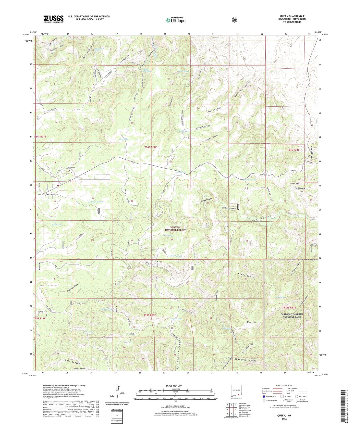
2020 topographic map quadrangle Queen in the state of New Mexico. Scale: 1:24000. Based on the newly updated USGS 7.5' US Topo map series, this map is in the following counties: Eddy. The map contains contour data, water features, and other items you are used to seeing on USGS maps, but also has updated roads and other features. This is the next generation of topographic maps. Printed on high-quality waterproof paper with UV fade-resistant inks.
Quads adjacent to this one:
West: Pickett Hill
Northwest: Ares Peak
North: Red Bluff Draw
Northeast: Bandanna Point
East: Serpentine Bends
Southeast: Grapevine Draw
South: Gunsight Canyon
Southwest: El Paso Gap
Contains the following named places: Bearup Well, Carson Seep, Corriente Cattle Company, Cottonwood Canyon, Cottonwood Storage Tank, Cottonwood Well, Cowboy Tank, Dinner Hill, East Well, Gilson Spring, Guadalupe Administrative Site, Guadalupe Church Camp, Hamilton Well, Horse Canyon, Horse Spring, Horse Well, Huapache Canyon, Juniper Lake, Juniper Well, Kellar Lake, Kirkland Canyon, Kirkland Seep, Kite Windmill, Kite Windmill Storage Tank, Pats Lake, Payne Canyon, Priestly Tank, Putman Cabin, Queen, Queen Cemetery, Queen Post Office, Queen Volunteer Fire Department, Red Lake, Reed Tank, Robinson Draw, Rock Tank, Sitting Bull Falls, Sitting Bull Falls Point of Interest, Sitting Bull Recreation Area, Sitting Bull Spring, Stone Canyon, Taylor Tank, Thayer Hill, The Pinnacle, Turkey Canyon, Turkey Well, Watkins Tank, White Oaks Spring