MyTopo
Ranchos De Taos New Mexico US Topo Map
Couldn't load pickup availability
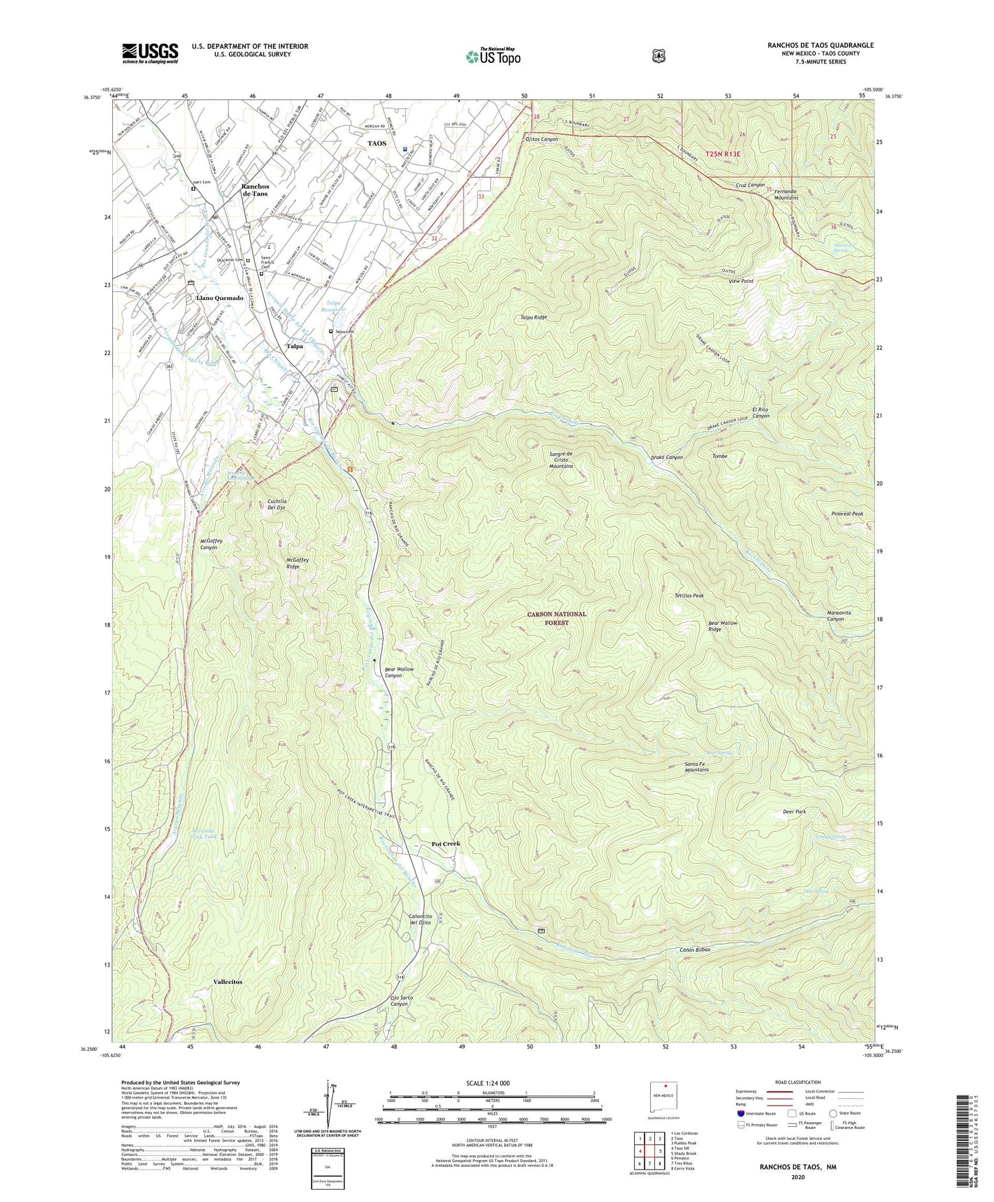
2020 topographic map quadrangle Ranchos De Taos in the state of New Mexico. Scale: 1:24000. Based on the newly updated USGS 7.5' US Topo map series, this map is in the following counties: Taos. The map contains contour data, water features, and other items you are used to seeing on USGS maps, but also has updated roads and other features. This is the next generation of topographic maps. Printed on high-quality waterproof paper with UV fade-resistant inks.
Quads adjacent to this one:
West: Taos SW
Northwest: Los Cordovas
North: Taos
Northeast: Pueblo Peak
East: Shady Brook
Southeast: Cerro Vista
South: Tres Ritos
Southwest: Penasco
Contains the following named places: Acequia de Avago la Loma, Acequia Madre del Rio Chiquito, American Spring, Andrew Dasburg House and Studio, Apartment Water Well, Arroyo Miranda, Bear Spring, Bear Wallow Canyon, Bear Wallow Ridge, Bear Wallow Trick Tank, Camposanto Jesus Nazareno, Canon Bilbao, Canoncito del Ojito, Cantonment Burgwin-1852-1860 Historical Marker, Cuchilla Del Ojo, Deer Park, Deer Spring, Descariso Cemetery, Drake Canyon, Duran Chapel, El Rito Canyon, Fort Water Well, Hart Cemetery, Holy Cross Hospital, Llano Quemado, Llano Quemado Census Designated Place, Manzanita Canyon, McGaffey Canyon, McGaffey Ridge, Miranda Trick Tank, Number 1 Water Well, Ojitos Canyon, Ojo Sarco Canyon, Pinoreal Peak, Ponce de Leon Springs, Pot Creek, Ranchos de Taos, Ranchos de Taos Census Designated Place, Ranchos De Taos Elementary School, Ranchos De Taos Post Office, RG-16225 Water Well, Rio Chiquito, Rito de la Olla, Saint Francis Cemetery, San Francisco De Asis School, San Francisco de Asisi Church Ranchos de Taos Historical Marker, San Francisco De Asissi Church, Talpa, Talpa Cemetery, Talpa Census Designated Place, Talpa Post Office, Talpa Reservoir, Talpa Ridge, Taos County Emergency Medical Services, Taos Division, Tetillas Peak, Tierra Azul, Tierra Azul Picnic Area, Tombe, Vallecitos, Venado Spring, View Point, Well Number 2 Water Well