MyTopo
San Jon New Mexico US Topo Map
Couldn't load pickup availability
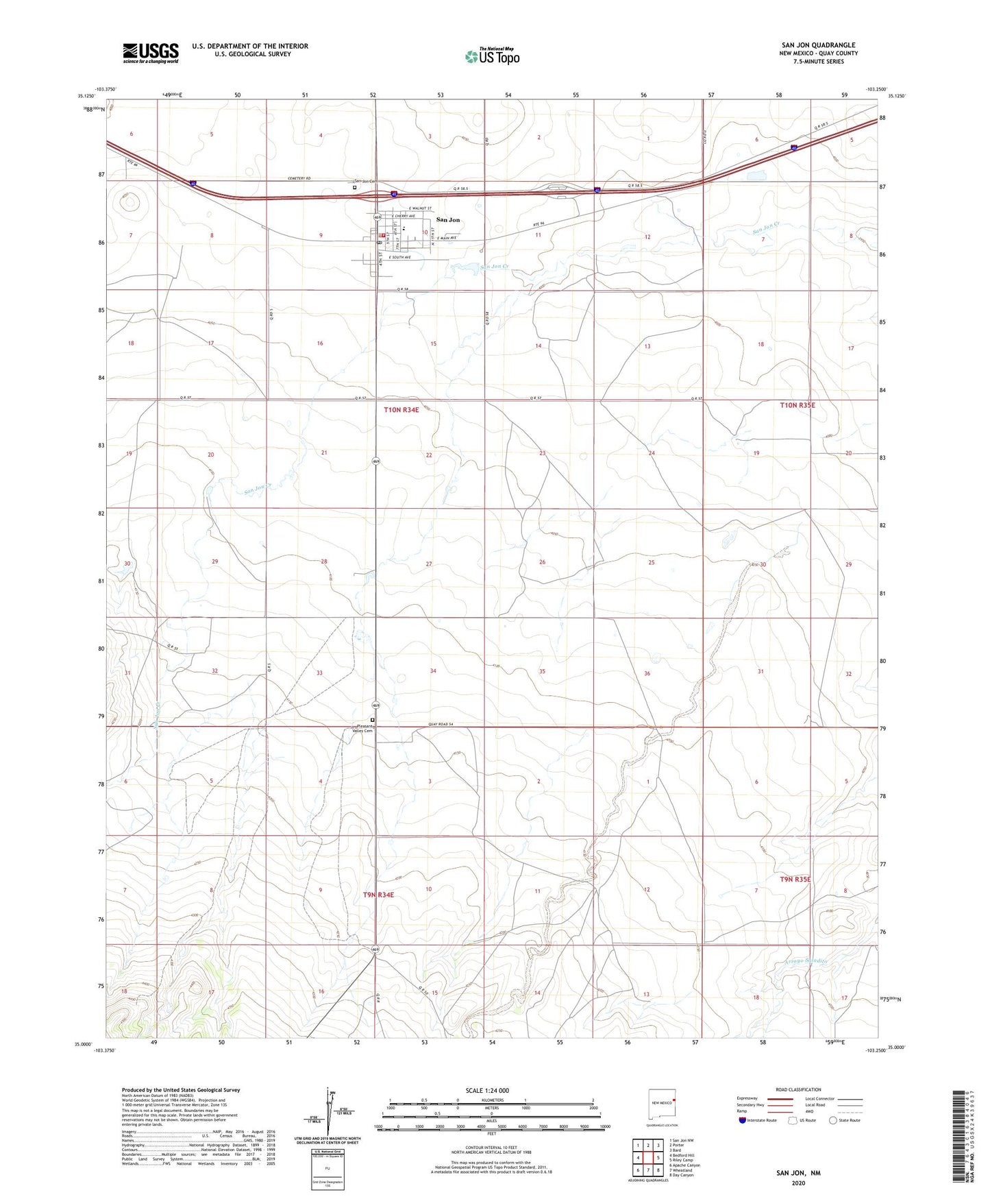
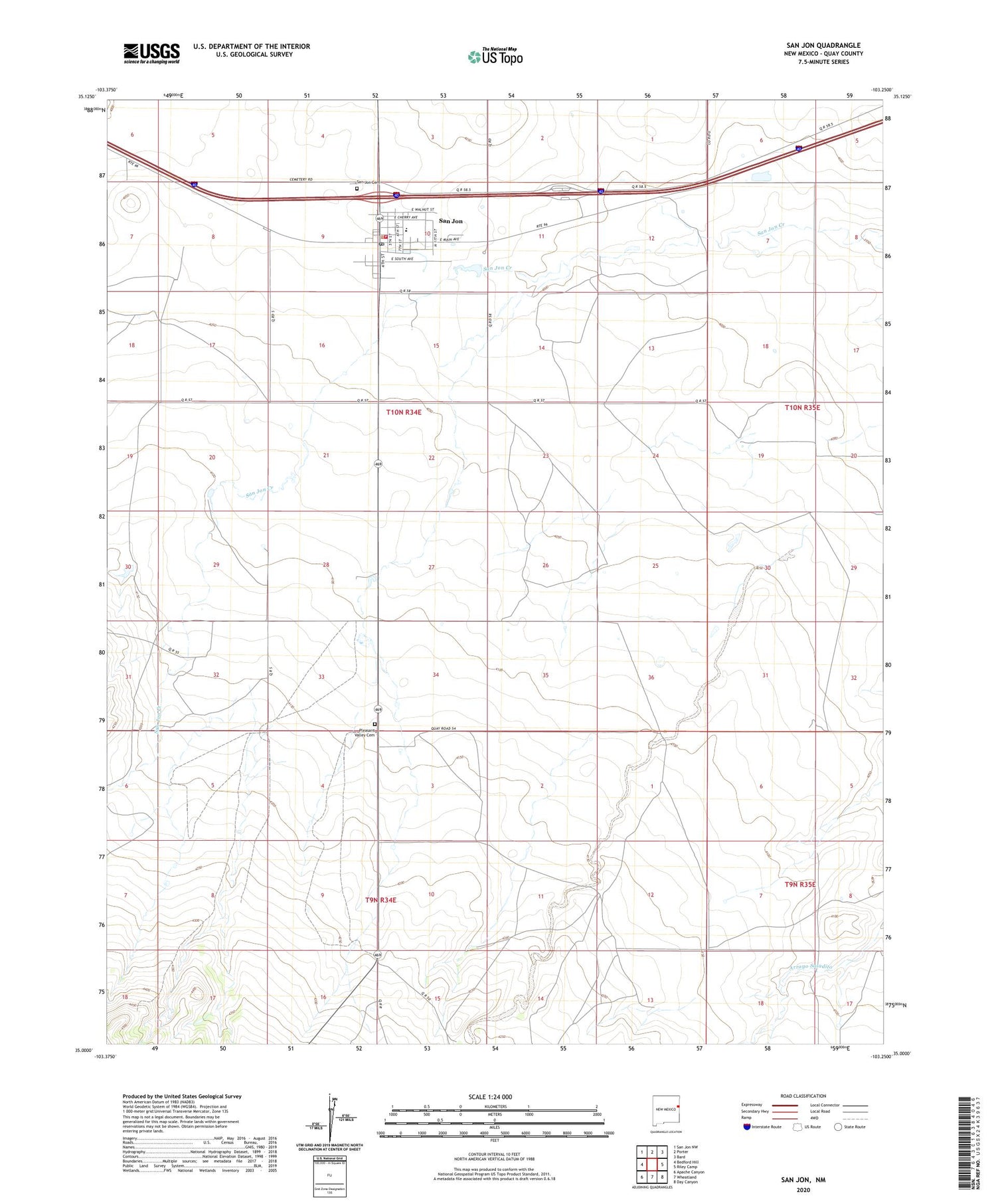
2020 topographic map quadrangle San Jon in the state of New Mexico. Scale: 1:24000. Based on the newly updated USGS 7.5' US Topo map series, this map is in the following counties: Quay. The map contains contour data, water features, and other items you are used to seeing on USGS maps, but also has updated roads and other features. This is the next generation of topographic maps. Printed on high-quality waterproof paper with UV fade-resistant inks.
Quads adjacent to this one:
West: Bedford Hill
Northwest: San Jon NW
North: Porter
Northeast: Bard
East: Riley Camp
Southeast: Day Canyon
South: Wheatland
Southwest: Apache Canyon
Contains the following named places: 05183 Water Well, 05187 Water Well, 05189 Water Well, 05192 Water Well, 05195 Water Well, 05196 Water Well, 05198 Water Well, 05199 Water Well, First Assembly of God Church, First Baptist Church, Garrett, Llano Estacado Historical Marker, Pleasant Valley, Pleasant Valley Cemetery, San Jon, San Jon Cemetery, San Jon elementary School, San Jon Fire Department, San Jon High School, San Jon Post Office, San Jon Volunteer Ambulance Service, San Jon Weather Station, South Coffman Windmill, Village of San Jon, West Well