
MyTopo
San Luis Pass New Mexico US Topo Map
Couldn't load pickup availability
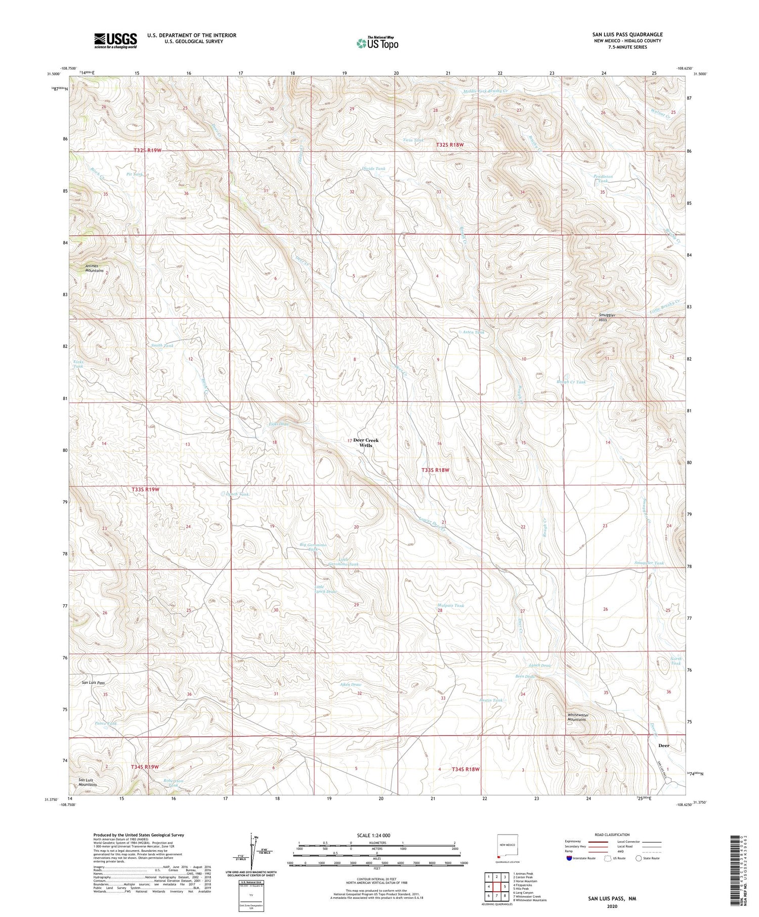
2020 topographic map quadrangle San Luis Pass in the state of New Mexico. Scale: 1:24000. Based on the newly updated USGS 7.5' US Topo map series, this map is in the following counties: Hidalgo. The map contains contour data, water features, and other items you are used to seeing on USGS maps, but also has updated roads and other features. This is the next generation of topographic maps. Printed on high-quality waterproof paper with UV fade-resistant inks.
Quads adjacent to this one:
West: Fitzpatricks
Northwest: Animas Peak
North: Center Peak
Northeast: Horse Mountain
East: Hilo Peak
Southeast: Whitewater Mountains
South: Whitewater Creek
Southwest: Lang Canyon
Contains the following named places: Aiken Draw, Asten Tank, Austin Tank, Been Draw, Big Geronimo Tank, Birch Creek, C Eckles Ranch, Deer, Deer Creek, Deer Creek Wells, Divide Tank, East Fork Brushy Creek, Eicks Draw, Eicks Tank, Little Geronimo Tank, Little Lynch Draw, Lower Deer Creek, Lynch Draw, Lynch Ranch, Lynch Tank, Malpais Tank, Middle Fork Brushy Creek, North Tank, Pasco Tank, Pendleton Tank, Pit Tank, Robertson Tank, Rough Creek, Rough Creek Tank, San Luis Pass, Smith Tank, Smuggler Hills, Smuggler Tank, Twin Tank, W T Sims Ranch


