MyTopo
Shady Brook New Mexico US Topo Map
Couldn't load pickup availability
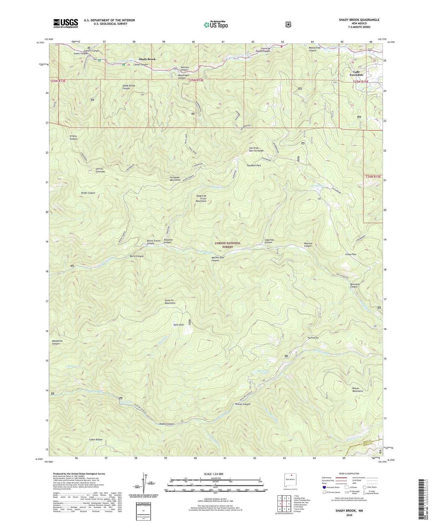
2020 topographic map quadrangle Shady Brook in the state of New Mexico. Scale: 1:24000. Based on the newly updated USGS 7.5' US Topo map series, this map is in the following counties: Taos, Mora. The map contains contour data, water features, and other items you are used to seeing on USGS maps, but also has updated roads and other features. This is the next generation of topographic maps. Printed on high-quality waterproof paper with UV fade-resistant inks.
Quads adjacent to this one:
West: Ranchos De Taos
Northwest: Taos
North: Pueblo Peak
Northeast: Palo Flechado Pass
East: Osha Mountain
Southeast: Chacon
South: Cerro Vista
Southwest: Tres Ritos
Contains the following named places: Bernardin Lake, Buena Suerte Canyon, Burro Canyon, Capulin Campground, Capulin Canyon, Casias Canyon, Casita de Piedra Canyon, Cerrito Colorado, Chosa Pass, Diablo Canyon, Fernando Mountains, Frijoles Creek, Garcia Park, La Sombra Campground, Lagunita Canyon, Mascarenas Canyon, Mexican Canyon, Mondragon Canyon, Muchos Ojos Canyon, Osha Park, Palociento Creek, Paradise Canyon, Paradise Park, Porky Spring, Puertocito, Quintana Canyon, Quintana Pass, Rancho del Rio Grande Grant, RG-18880 Water Well, RG-18880-S-5 Water Well, RG-18880-S-6 Water Well, Rincon Canyon, Rincon Mountains, Rio Chiquito Picnic Area, Rio Fernando Fire Department Main Station, Rito Bonito, Rito Osha, Rito Quien Sabe, Ryan Spring, Sanchez Canyon, Shady Brook, Shady Brook Canyon, Sierra de Don Fernando, Suazo Canyon, Taos, Tiendatas School, Tienditas, Valle Escondido