MyTopo
Skeleton Canyon New Mexico US Topo Map
Couldn't load pickup availability
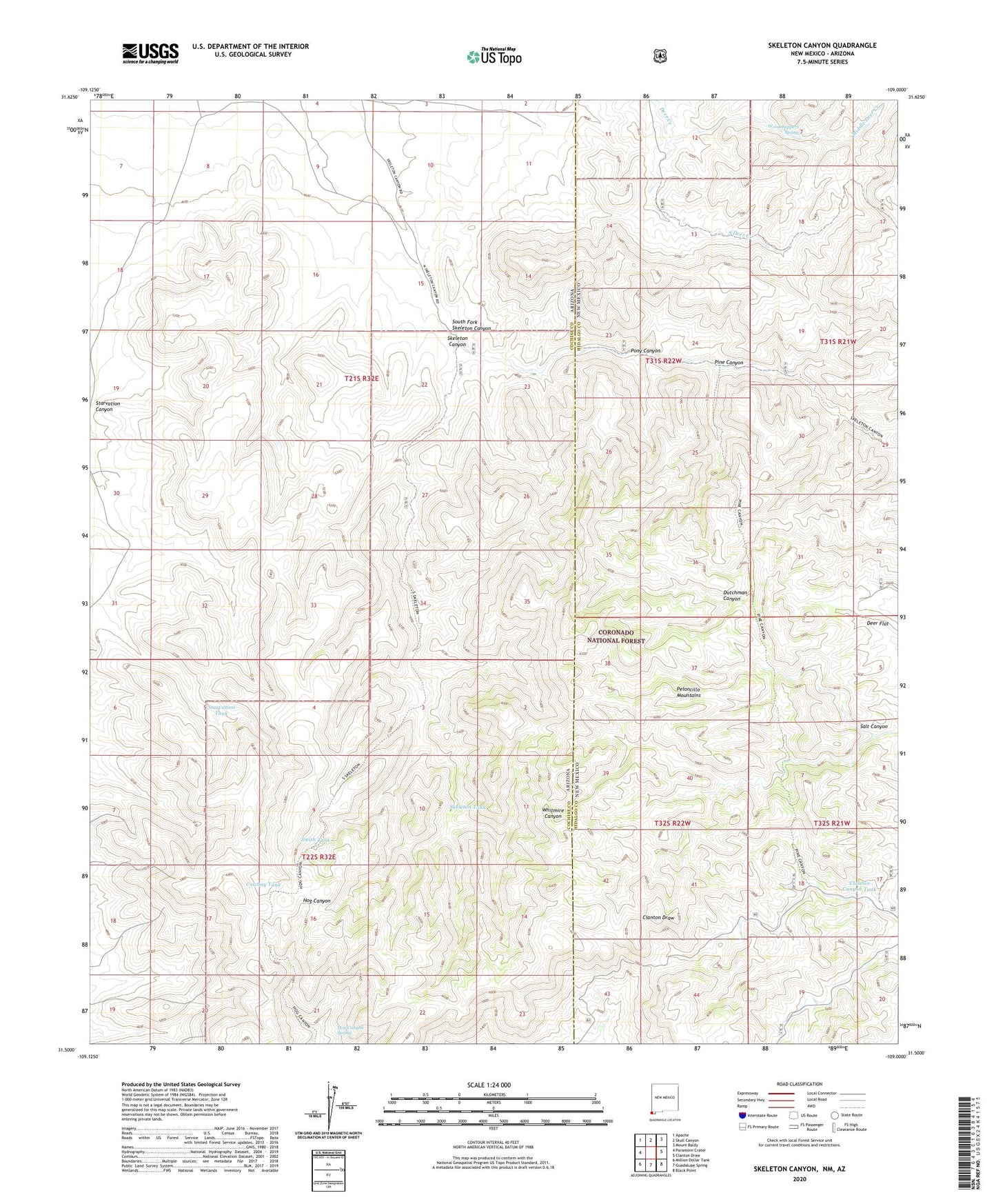
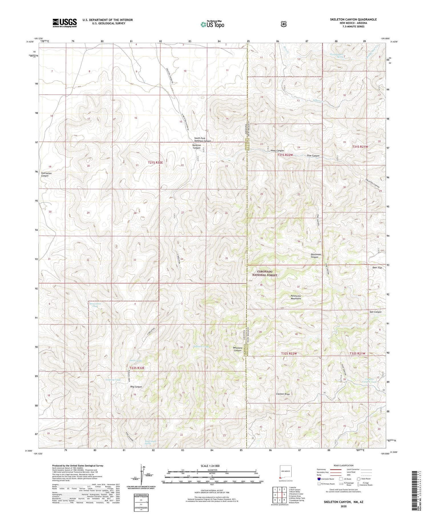
2020 topographic map quadrangle Skeleton Canyon in the states of Arizona, New Mexico. Scale: 1:24000. Based on the newly updated USGS 7.5' US Topo map series, this map is in the following counties: Hidalgo, Cochise. The map contains contour data, water features, and other items you are used to seeing on USGS maps, but also has updated roads and other features. This is the next generation of topographic maps. Printed on high-quality waterproof paper with UV fade-resistant inks.
Quads adjacent to this one:
West: Paramore Crater
Northwest: Apache
North: Skull Canyon
Northeast: Mount Baldy
East: Clanton Draw
Southeast: Black Point
South: Guadalupe Spring
Southwest: Million Dollar Tank
Contains the following named places: Ben Tank, Big Lake, Big Tank, Clanton Canyon Tank, Cowboy Tank, Deer Creek Tank, Deer Flat, Devils Kitchen, Geronimo Surrender Site, Geronimo Tank, Hog Canyon Spring, Lower Skeleton Tank, Mexican Tank, Middle Deer Creek, New Tank, Park Tank, Patterson Tank, Pine Canyon, Pine Canyon Tank, Pony Canyon, Rickys Tank, Salt Canyon, Skeleton Canyon, Skeleton Tank, Smith Tank, Snure Ranch, South Deer Creek, South Fork Skeleton Canyon, Starvation Canyon, Starvation Tank, Whitmire Canyon Wilderness Study Area, Woodchoppers Spring