MyTopo
Ashford Hollow New York US Topo Map
Couldn't load pickup availability
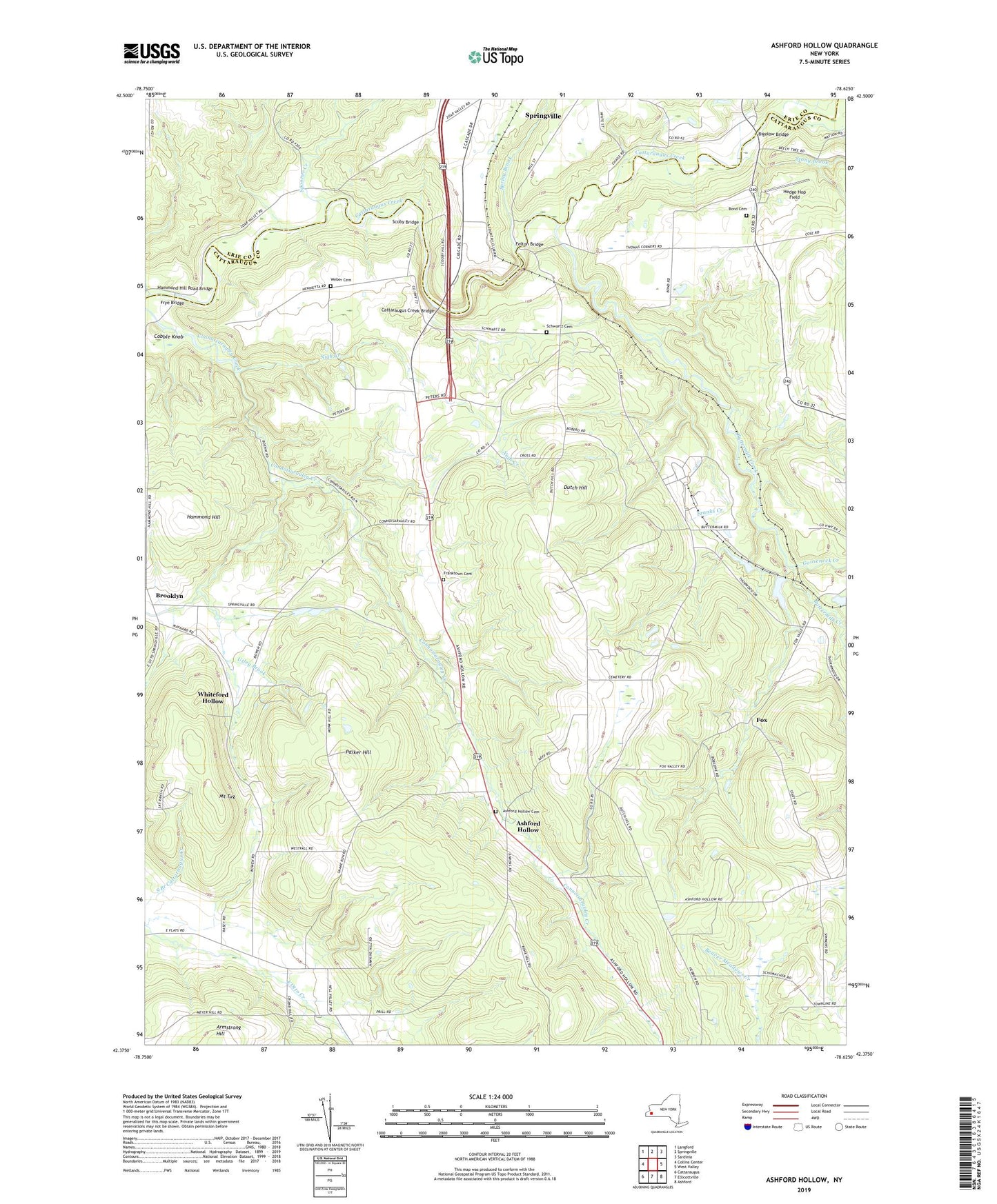
2019 topographic map quadrangle Ashford Hollow in the state of New York. Scale: 1:24000. Based on the newly updated USGS 7.5' US Topo map series, this map is in the following counties: Cattaraugus, Erie. The map contains contour data, water features, and other items you are used to seeing on USGS maps, but also has updated roads and other features. This is the next generation of topographic maps. Printed on high-quality waterproof paper with UV fade-resistant inks.
Quads adjacent to this one:
West: Collins Center
Northwest: Langford
North: Springville
Northeast: Sardinia
East: West Valley
Southeast: Ashford
South: Ellicottville
Southwest: Cattaraugus
Contains the following named places: Ashford Hollow, Ashford Hollow Cemetery, Bellow Corners, Bigelow Bridge, Bond Cemetery, Brooklyn, Buttermilk Creek, Cattaraugus Creek Bridge, Cobble Knob, Connoisarauley Creek, Derby Brook, Dutch Hill, Edies Siding, Felton Bridge, Fox, Fox Valley Greenhouse, Franks Creek, Franktown Cemetery, Frye Bridge, Gooseneck Creek, Hammond Hill, Hammond Hill Road Bridge, Hedge Hop Field, Lagoon Road Creek, Marivale Farms, Mount Tug, Nigh Creek, Parker Hill, Riceville Station, Schwartz Cemetery, Scoby Bridge, Spooner Creek, Spring Brook, Springville Country Club, Stony Brook, Thomas Corners, Town of Ashford, Town of East Otto, Trinity Church, Weber Cemetery, Western New York Nuclear Service Center, Whiteford Hollow, WSPQ-AM (Springville), ZIP Codes: 14171, 14729