MyTopo
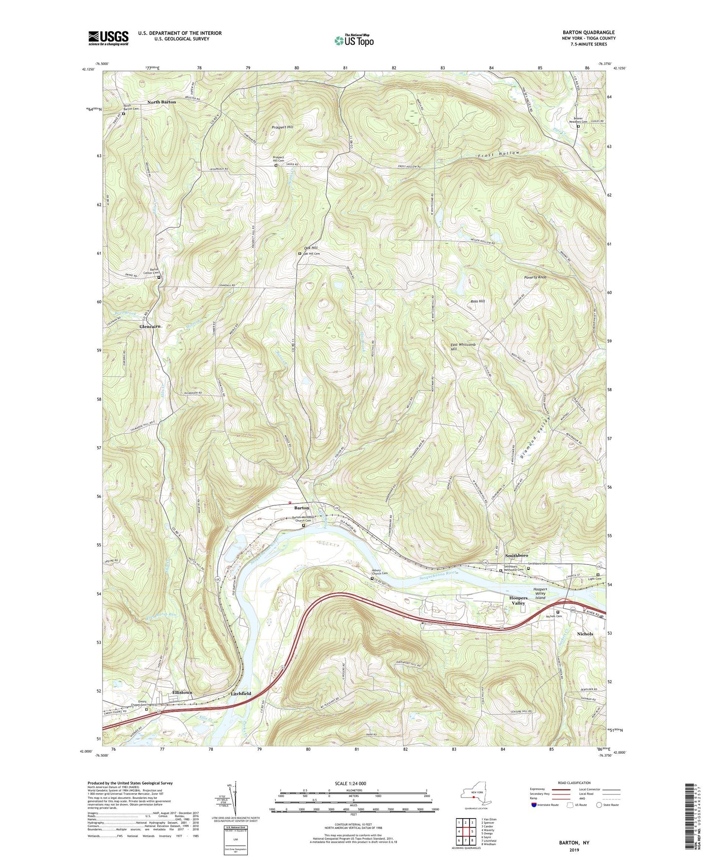
Barton New York US Topo Map
Couldn't load pickup availability
2019 topographic map quadrangle Barton in the state of New York. Scale: 1:24000. Based on the newly updated USGS 7.5' US Topo map series, this map is in the following counties: Tioga. The map contains contour data, water features, and other items you are used to seeing on USGS maps, but also has updated roads and other features. This is the next generation of topographic maps. Printed on high-quality waterproof paper with UV fade-resistant inks.
Quads adjacent to this one:
West: Waverly
Northwest: Van Etten
North: Spencer
Northeast: Candor
East: Owego
Southeast: Windham
South: Litchfield
Southwest: Sayre
Contains the following named places: Asbury Church, Asbury Church Cemetery, Barton, Barton Center Cemetery, Barton Methodist Church Cemetery, Barton United Methodist Church, Beaver Meadows Cemetery, Butson Creek, East Whitcomb Hill, Ellis Brook, Ellis Creek, Ellistown, Emory Chapel, Emory Chapel Cemetery, Evelin Hill Creek, Flag Marsh Run, Frost Hollow, Glencairn, Hoopers Valley, Hoopers Valley Island, Howland Mobile Home Park, Johnson Farms, Light Cemetery, Litchfield, Little Wapessening Creek, Maple Lane Mobile Home Park, Miami Creek, Negro Hollow, Nichols Cemetery, Nichols Post Office, Nichols Southbound Rest Area, North Barton, North Barton Cemetery, Oak Hill, Oak Hill Cemetery, Park Terrace, Parks Creek, Poverty Knob, Prospect Hill, Prospect Hill Cemetery, Reed Brook, Ross Hill, Sackett Creek, Shipman Hollow, Smithboro, Smithboro Cemetery, Smithboro Methodist Cemetery, Town of Barton, Waverly Barton Fire District Station 2, WCII-FM (Spencer), ZIP Code: 13734