MyTopo
Bolivar New York US Topo Map
Couldn't load pickup availability
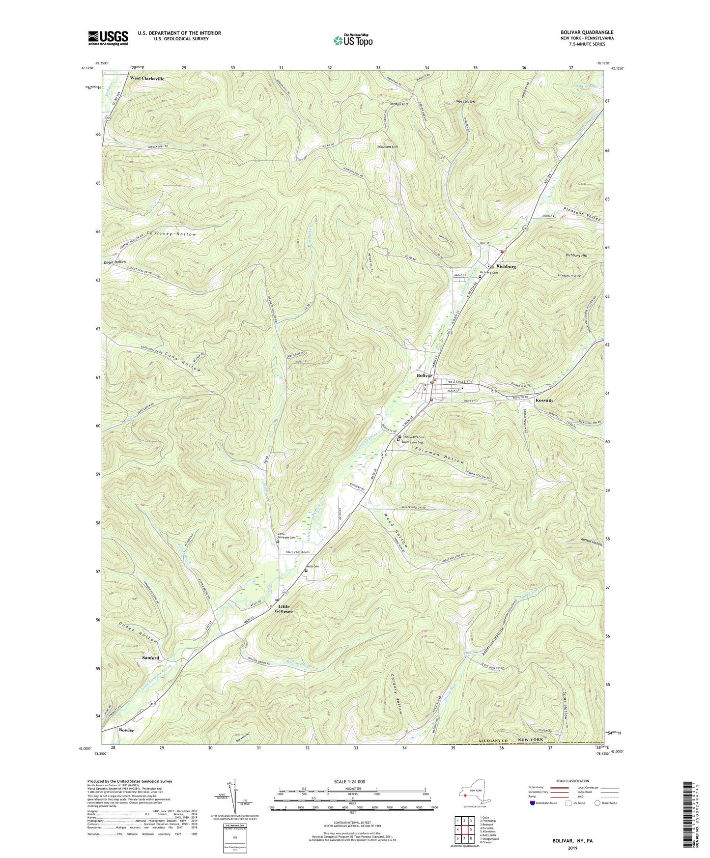
2019 topographic map quadrangle Bolivar in the state of New York. Scale: 1:24000. Based on the newly updated USGS 7.5' US Topo map series, this map is in the following counties: Allegany, Potter. The map contains contour data, water features, and other items you are used to seeing on USGS maps, but also has updated roads and other features. This is the next generation of topographic maps. Printed on high-quality waterproof paper with UV fade-resistant inks.
Quads adjacent to this one:
West: Portville
Northwest: Cuba
North: Friendship
Northeast: Belmont
East: Allentown
Southeast: Oswayo
South: Shinglehouse
Southwest: Bullis Mills
Contains the following named places: Anderson Hollow, Belleigh Acres Hunt Club, Bolivar, Bolivar - Richburg Elementary School, Bolivar - Richburg Junior - Senior High School, Bolivar Fire Department, Bolivar Free Library, Bolivar Post Office, Bolivar United Methodist Church, Bowler, Colonial Library, Cordory Hollow, Cottrell School, Courtney Hollow, Dodge Hollow, Eastman School, Evergreen Golf Course, Foreman Hollow, Foster Brook, Genesee Public Library, Johnson Hill, Jordan Hill, Kossuth, Kossuth Community Chapel, Little Genesee, Little Genesee Cemetery, Little Genesee Post Office, Maple Lawn Cemetery, Mead Hollow, Miller Hollow, Paradise Lake, Pine Grove School, Pleasant Valley, Richburg, Richburg Cemetery, Richburg Hill, Richburg Post Office, Richburg Volunteer Fire Company, Saint Marys Cemetery, Sanford, School Number 13, School Number 2, School Number 3, Scott Hollow School, Seventh Day Baptist Church, Skunk Hollow, Southside Union Chapel, Town of Bolivar, Town of Genesee, Village of Bolivar, Village of Richburg, WCID-FM (Friendship), Wells Cemetery, West Notch, Willow Brook, Wilson Hollow, Windfall Creek, ZIP Codes: 14715, 14754, 14774