MyTopo
Cheney Pond New York US Topo Map
Couldn't load pickup availability
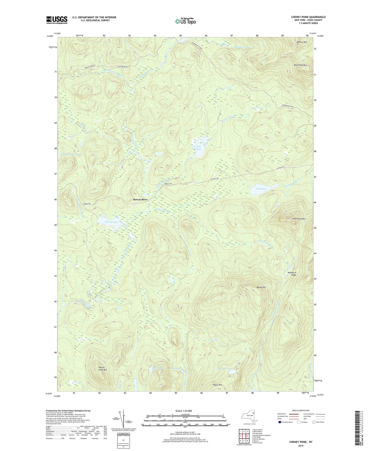
2019 topographic map quadrangle Cheney Pond in the state of New York. Scale: 1:24000. Based on the newly updated USGS 7.5' US Topo map series, this map is in the following counties: Essex. The map contains contour data, water features, and other items you are used to seeing on USGS maps, but also has updated roads and other features. This is the next generation of topographic maps. Printed on high-quality waterproof paper with UV fade-resistant inks.
Quads adjacent to this one:
West: Vanderwhacker Mountain
Northwest: Mount Adams
North: Mount Marcy
Northeast: Dix Mountain
East: Blue Ridge
Southeast: Schroon Lake
South: Minerva
Southwest: Dutton Mountain
Contains the following named places: Andrew Brook, Bailey Hill, Bailey Pond Inlet, Black Pond, Boreas River, Brace Dam, Brant Brook, Cheney Pond, Durgin Brook, Fly Pond, Hewitt Pond Mountain, Lester Dam, Lester Flow, Marion Pond, Mud Pond, Sand Pond, Sand Pond Mountain, Walter Coon Brook, Washburn Ridge, Wolf Pond, Wolf Pond Brook, Wolf Pond Mountain