MyTopo
Copake New York US Topo Map
Couldn't load pickup availability
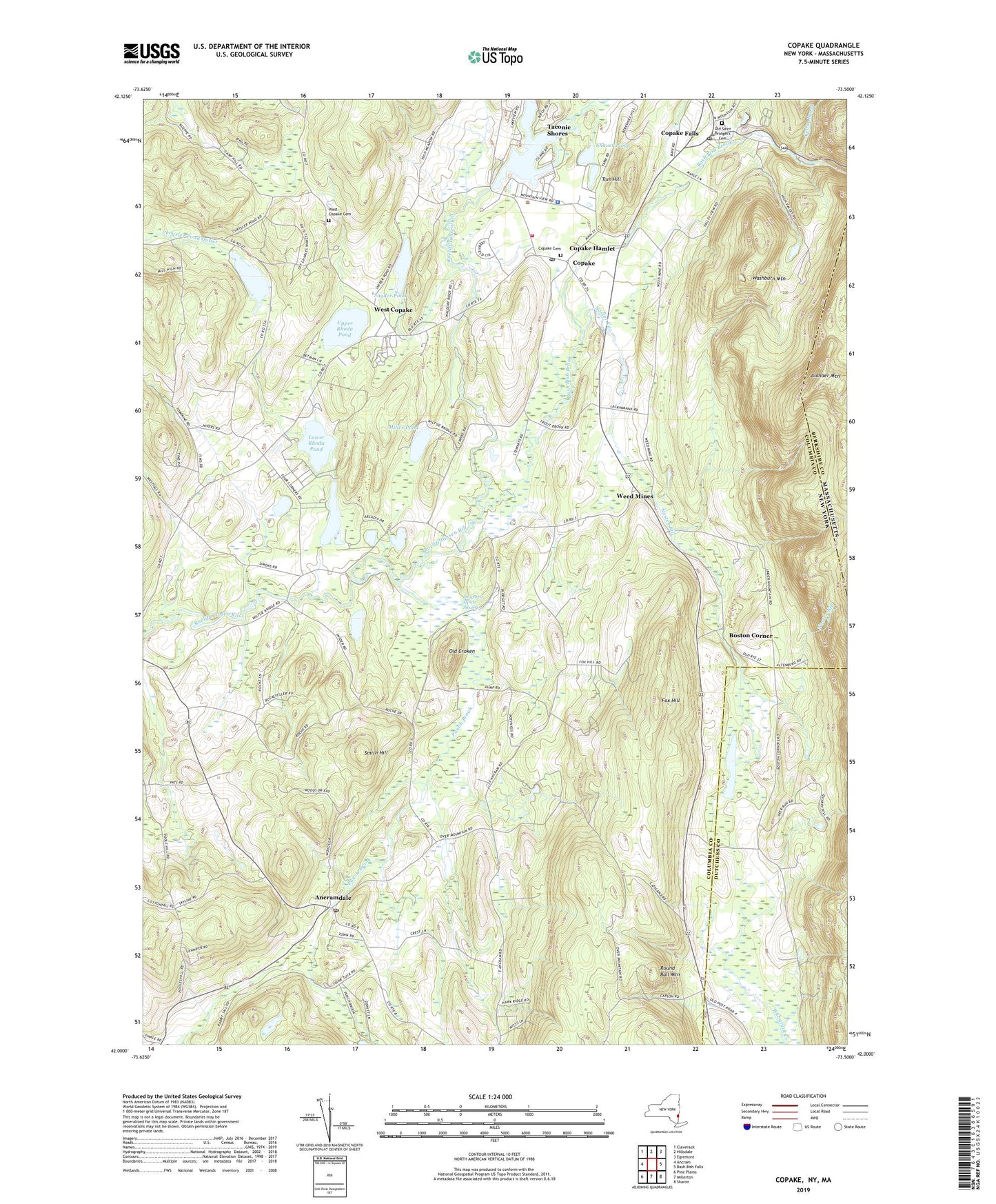
2019 topographic map quadrangle Copake in the state of New York. Scale: 1:24000. Based on the newly updated USGS 7.5' US Topo map series, this map is in the following counties: Columbia, Dutchess, Berkshire. The map contains contour data, water features, and other items you are used to seeing on USGS maps, but also has updated roads and other features. This is the next generation of topographic maps. Printed on high-quality waterproof paper with UV fade-resistant inks.
Quads adjacent to this one:
West: Ancram
Northwest: Claverack
North: Hillsdale
Northeast: Egremont
East: Bash Bish Falls
Southeast: Sharon
South: Millerton
Southwest: Pine Plains
Contains the following named places: Ancramdale, Ancramdale Post Office, Ancramdale Presbyterian Church, Barton Corners, Bash Bish Brook, Boston Corner, Camp Waubeeka, Camp Waubeeka Family Campground, Chrysler Pond, Clausson Raught Community Rescue Squad, Copake, Copake Cemetery, Copake Census Designated Place, Copake Falls, Copake Falls Census Designated Place, Copake Falls Post Office, Copake Fire District, Copake Post Office, Copake Town Hall, Copake United Methodist Church, Drowned Lands Swamp, Fox Hill, Long Pond, Lower Rhoda Pond, Miller Pond, Millerhurst Farm, Noster Kill, Old Croken, Old Saint Bridget's Cemetery, Oleana Family Campground, Preechey Hollow Brook, Punch Brook, Robinson Pond, Round Ball Mountain, Saint Bridget's Church, Shaver Pond, Smith Hill, Snyder Pond, Taconic Shores, Taconic Shores Census Designated Place, Taconic State Park, Thompson-Finch Farm, Tom Hill, Town of Ancram, Undermountain Golf Course, Upper Rhoda Pond, Washburn Mountain, Weed Mines, West Copake, West Copake Cemetery, West Copake Church, Whitehouse Crossing, ZIP Codes: 12503, 12516, 12517