MyTopo
Corbett New York US Topo Map
Couldn't load pickup availability
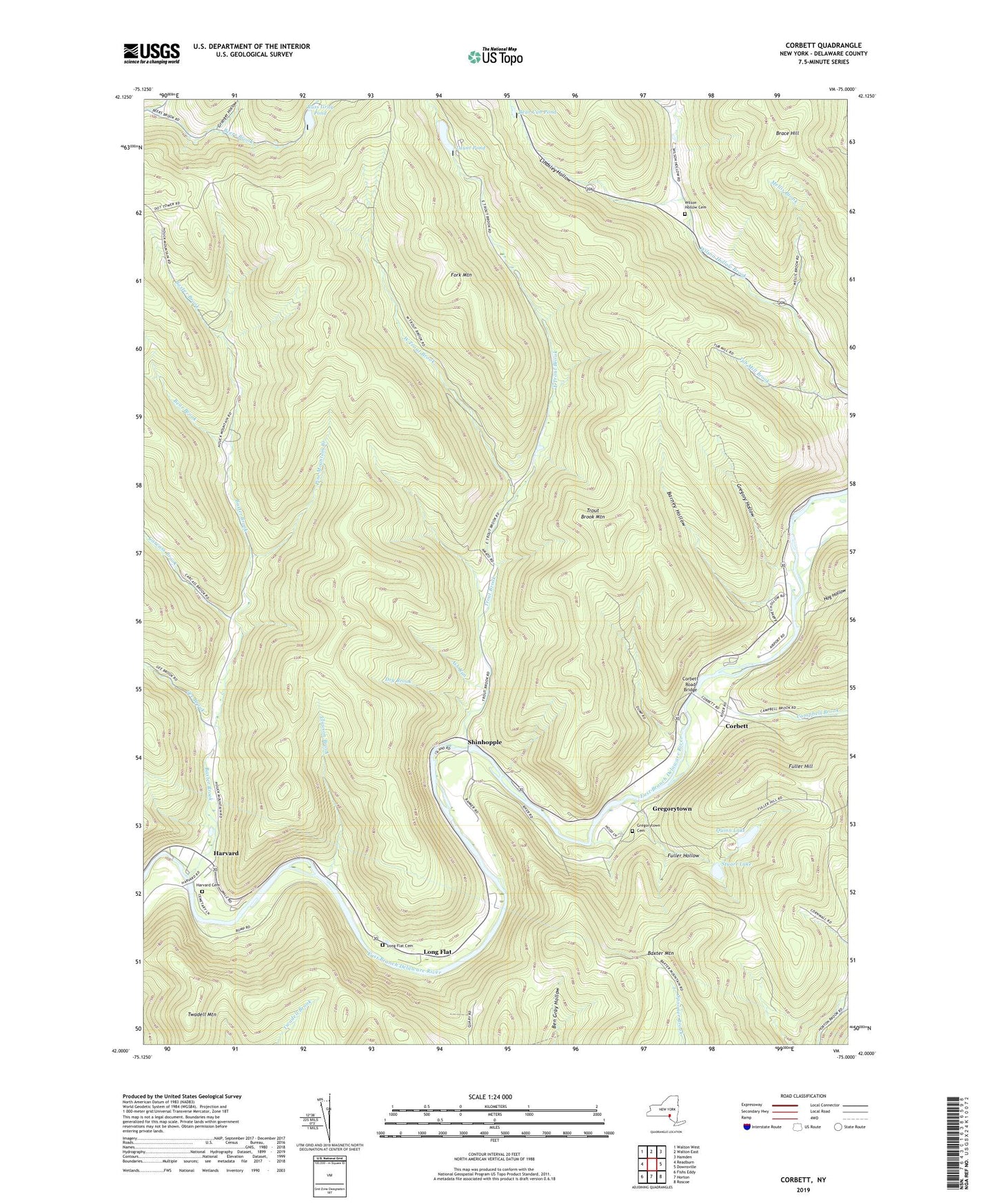
2019 topographic map quadrangle Corbett in the state of New York. Scale: 1:24000. Based on the newly updated USGS 7.5' US Topo map series, this map is in the following counties: Delaware. The map contains contour data, water features, and other items you are used to seeing on USGS maps, but also has updated roads and other features. This is the next generation of topographic maps. Printed on high-quality waterproof paper with UV fade-resistant inks.
Quads adjacent to this one:
West: Readburn
Northwest: Walton West
North: Walton East
Northeast: Hamden
East: Downsville
Southeast: Roscoe
South: Horton
Southwest: Fishs Eddy
Contains the following named places: Ash Run, Barney Hollow, Baxter Brook, Baxter Mountain, Bear Brook, Bear Cub Pond, Bear Spring Mountain Game Management Area, Brace Hill, Campbell Brook, Carcass Brook, Cherry Grove Picnic Area, Clauson Brook, Corbett, Corbett Road Bridge, Downsville Airport, Dry Brook, East Trout Brook, Fork Mountain, Fuller Hollow, Gee Brook, Granger Hollow, Gregory Hollow, Gregorytown, Gregorytown Cemetery, Harvard, Harvard Cemetery, Hog Hollow, Horton Brook Church, Launt Pond, Lindsley Hollow, Little Fuller Brook, Long Flat, Long Flat Cemetery, Mahoney Quarry, Mellis Brook, Mills Hollow, Notch Hollow, Pine Mountain Branch, Possession Hollow, Quinn Lake, Russ Gray Pond, Shinhopple, Stuart Lake, Thayer Hollow, Trout Brook, Trout Brook Mountain, Tub Mill Brook, Twadell Mountain, West Trout Brook, Wilson Hollow Cemetery, ZIP Code: 13756