MyTopo
Deerland New York US Topo Map
Couldn't load pickup availability
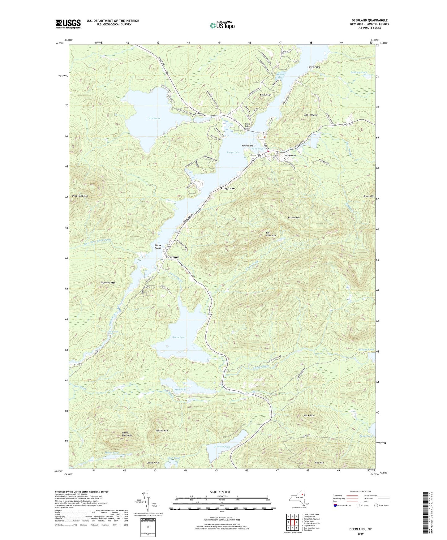
2019 topographic map quadrangle Deerland in the state of New York. Scale: 1:24000. Based on the newly updated USGS 7.5' US Topo map series, this map is in the following counties: Hamilton. The map contains contour data, water features, and other items you are used to seeing on USGS maps, but also has updated roads and other features. This is the next generation of topographic maps. Printed on high-quality waterproof paper with UV fade-resistant inks.
Quads adjacent to this one:
West: Forked Lake
Northwest: Little Tupper Lake
North: Grampus Lake
Northeast: Kempshall Mountain
East: Dun Brook Mountain
Southeast: Rock Lake
South: Blue Mountain Lake
Southwest: Sargent Ponds
Contains the following named places: Buck Mountain, Buttermilk Falls, Camp Saint Mary, Castle Rock, Chub Pond, Deerland, East Inlet Brook, East Inlet Mountain, Helms Pond, Kellers Bay, Lake Eaton, Lake Eaton State Camp, Little Blue Mountain, Long Lake, Long Lake Bridge, Long Lake Cemetery, Long Lake Census Designated Place, Long Lake Central School, Long Lake Library, Long Lake Post Office, Long Lake Reservoir, Long Lake Volunteer Fire Department and Rescue Squad, Long Lake Wesleyan Church, Long Lake-Helms Seaplane Base, Long Lake-Sagamore Marina and Seaplane Base, Minnow Pond, Moose Island, Mount Sabattis, Mud Pond, Mud Pond Outlet, Oven Point, Owls Head Mountain, Owls Head Pond Outlet, Park Lake, Peaked Mountain, Pine Island, Polliwog Pond, Salmon River, Sandy Creek, Shaw Brook, Shaw Pond, South Pond, South Pond Outlet, Sugarloaf Mountain, The Pinnacle, Triplet Hill, ZIP Code: 12812