MyTopo
Eldred New York US Topo Map
Couldn't load pickup availability
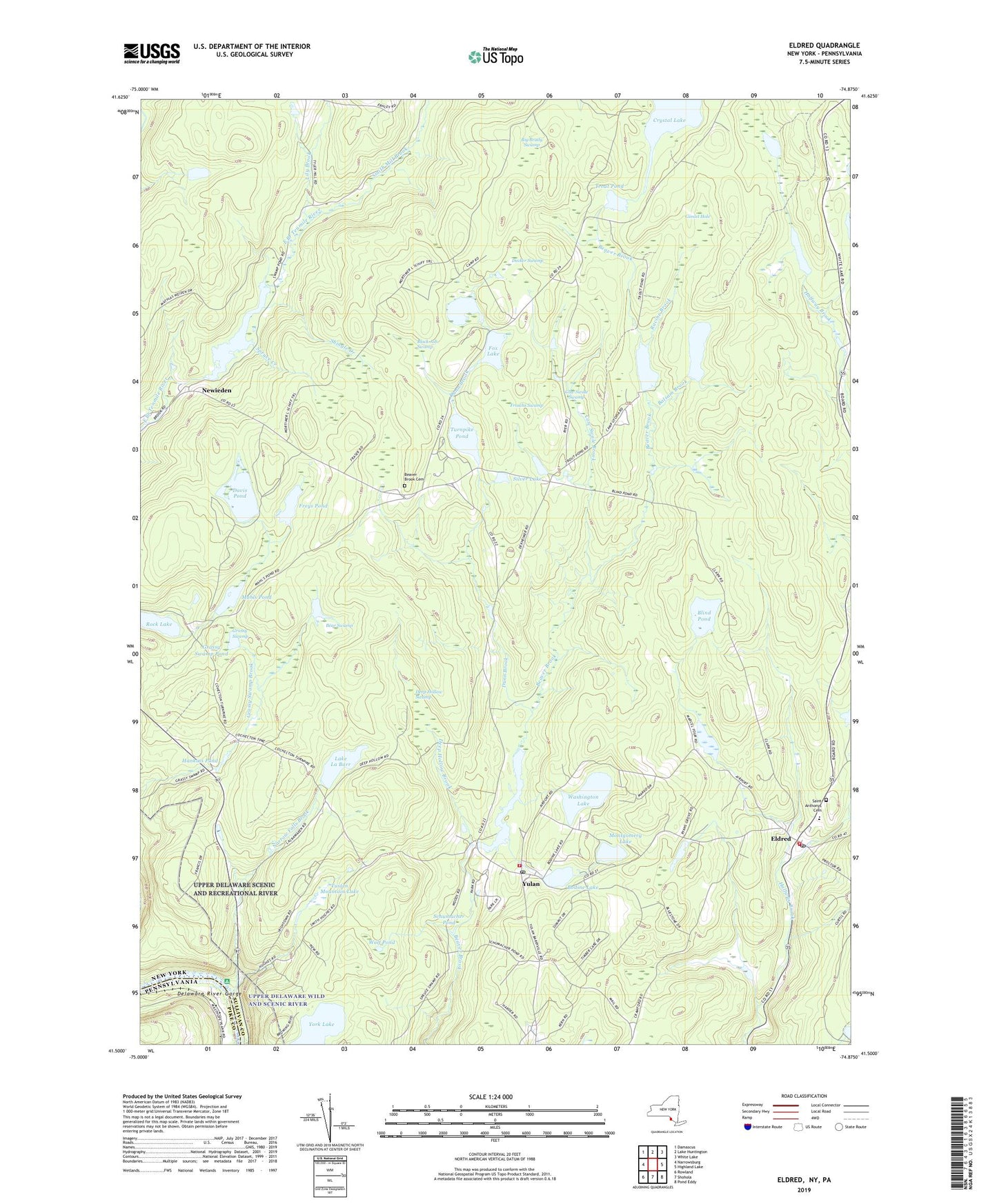
2019 topographic map quadrangle Eldred in the state of New York. Scale: 1:24000. Based on the newly updated USGS 7.5' US Topo map series, this map is in the following counties: Sullivan, Pike. The map contains contour data, water features, and other items you are used to seeing on USGS maps, but also has updated roads and other features. This is the next generation of topographic maps. Printed on high-quality waterproof paper with UV fade-resistant inks.
Quads adjacent to this one:
West: Narrowsburg
Northwest: Damascus
North: Lake Huntington
Northeast: White Lake
East: Highland Lake
Southeast: Pond Eddy
South: Shohola
Southwest: Rowland
Contains the following named places: Balsam Brook, Balsam Pond, Bear Swamp, Beaver Brook Cemetery, Beaver Brook Corners, Big Brady Swamp, Black Ash Swamp, Blind Pond, Bodine Lake, Cow Swale Brook, Cow Swale Swamp, Crystal Lake, Davis Pond, Decker Swamp, Deep Hollow Brook, Deep Hollow Swamp, Dunn Brook, Eldred, Eldred Census Designated Place, Eldred Junior - Senior High School, Eldred Post Office, Fox Lake, Freys Pond, Froschs Swamp, Gimlet Hole, Grassy Swamp, Grassy Swamp Pond, Halfmoon Lake, Hankins Pond, Highland Town Hall, Lake La Barr, Lily Brook, Mahls Pond, Montgomery Lake, Narrow Falls Brook, Newieden, Racine Brook, Rock Lake, Saint Anthonys Cemetery, Schiff Trail, Schumacher Pond, Shingle Creek, Silver Lake, Smith Mill Brook, Spruce Creek, Sunshine Hall Free Library, Swamp Pond, Toasperns Pond, Town of Highland, Town of Tusten, Trout Pond, Turnpike Pond, Tusten Mountain Lake, Washington Lake, Welmet Camps, Welmet Lake, Wolf Pond, York Lake, Yulan, Yulan Post Office, Yulan Volunteer Fire Department Eldred Station, Yulan Volunteer Fire Department Yulan Station, ZIP Codes: 12764, 12792