MyTopo
Elizabethtown New York US Topo Map
Couldn't load pickup availability
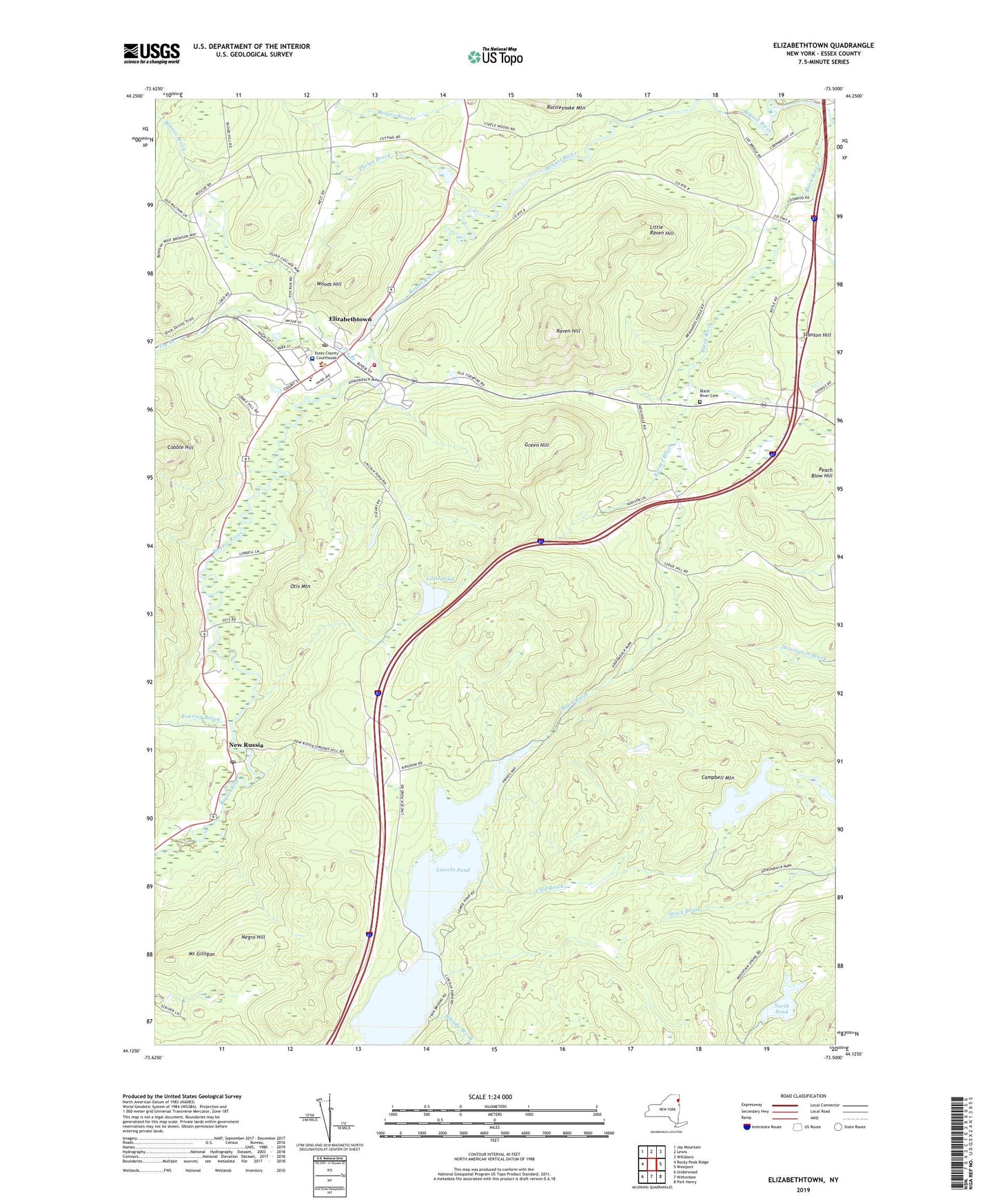
2019 topographic map quadrangle Elizabethtown in the state of New York. Scale: 1:24000. Based on the newly updated USGS 7.5' US Topo map series, this map is in the following counties: Essex. The map contains contour data, water features, and other items you are used to seeing on USGS maps, but also has updated roads and other features. This is the next generation of topographic maps. Printed on high-quality waterproof paper with UV fade-resistant inks.
Quads adjacent to this one:
West: Rocky Peak Ridge
Northwest: Jay Mountain
North: Lewis
Northeast: Willsboro
East: Westport
Southeast: Port Henry
South: Witherbee
Southwest: Underwood
Contains the following named places: Barton Brook, Black River, Black River Cemetery, Brandy Brook, Campbell Mountain, Central School, Church of the Good Shepherd, Cobble Hill, Cobble Hill Golf Course, Cold Brook, Elizabethtown, Elizabethtown Census Designated Place, Elizabethtown Community Hospital, Elizabethtown Library, Elizabethtown Northbound Rest Area, Elizabethtown Post Office, Elizabethtown United Church of Christ, Elizabethtown Volunteer Fire Department, Green Hill, Horace Nye Nursing Home, Kerner Brook, Lincoln Pond, Little Pond, Little Raven Hill, Mount Gilligan, Negro Hill, New Russia, New Russia Post Office, Nichols Pond, North Pond, Otis Mountain, Phelps Brook, Pleasant Valley, Raven Hill, Roaring Brook, The Branch, Town of Elizabethtown, Westport Bible Church, Woods Hill, ZIP Code: 12932