
MyTopo
Franklin New York US Topo Map
Couldn't load pickup availability
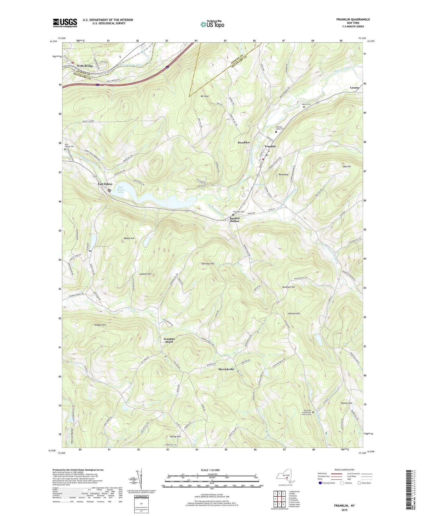
2019 topographic map quadrangle Franklin in the state of New York. Scale: 1:24000. Based on the newly updated USGS 7.5' US Topo map series, this map is in the following counties: Delaware, Otsego. The map contains contour data, water features, and other items you are used to seeing on USGS maps, but also has updated roads and other features. This is the next generation of topographic maps. Printed on high-quality waterproof paper with UV fade-resistant inks.
Quads adjacent to this one:
West: Unadilla
Northwest: Gilbertsville
North: Otego
Northeast: Oneonta
East: Treadwell
Southeast: Walton East
South: Walton West
Southwest: Trout Creek
Contains the following named places: Barnes Cemetery, Bartlett Hollow, Bennett Hollow, Brier Creek, Brooklyn, Chapel Hill School, Community Bible Church, East Branch Handsome Brook, East Sidney, East Sidney Cemetery, East Sidney Lake, Franklin, Franklin Central School, Franklin Depot, Franklin Fire Department Fire House, Franklin Free Library, Franklin Post Office, Gallop Hill, Handsome Brook, Heathen Hill, Hodges Hill, Johnson Hill, Lawton Hill, Leonta, Merrickville, Mount Zion, Oak Hill, Ouleout Valley Cemetery, Palmer Hill, Pat Pond, Plymouth Community Church Cemetery, Roundtop, Saint Paul's Episcopal Church, School Number 16, School Number 18, School Number 4, School Number 6, Sherman Hill, The Knoll Cemetery, Treadwell Creek, Unatego Junior - Senior High School, Village of Franklin, Wells Bridge, Wells Bridge Census Designated Place, Wells Bridge Post Office, Wells Bridge Volunteer Fire Department, West Branch Handsome Brook, Wheat Hill, Woodford, ZIP Codes: 13775, 13859


