
MyTopo
Gilboa New York US Topo Map
Couldn't load pickup availability
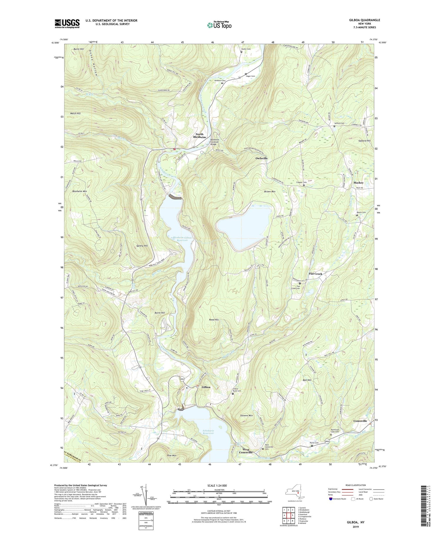
2019 topographic map quadrangle Gilboa in the state of New York. Scale: 1:24000. Based on the newly updated USGS 7.5' US Topo map series, this map is in the following counties: Schoharie, Delaware. The map contains contour data, water features, and other items you are used to seeing on USGS maps, but also has updated roads and other features. This is the next generation of topographic maps. Printed on high-quality waterproof paper with UV fade-resistant inks.
Quads adjacent to this one:
West: Stamford
Northwest: Summit
North: Breakabeen
Northeast: Middleburgh
East: Livingstonville
Southeast: Ashland
South: Prattsville
Southwest: Roxbury
Contains the following named places: B/G Heliport, Bear Kill, Blenheim Covered Bridge, Blenheim Gilboa Reservoir, Blenheim Hose Company, Blenheim Mountain, Bornt Hill, Bridge School, Brown Mountain, Bull Hill, Burnt Hill, Central School, Clapper Cemetery, Conesville, Conesville Town Hall, Country Road Campground, Doney Hollow, Five Corners, Flat Creek, Flat Creek Cemetery, Gilboa, Gilboa Dam, Gilboa Post Office, Gilboa Rural Cemetery, Hager Cemetery, Kniskern Cemetery, Mackey, Manor Kill, Manorkill Falls, Mill Creek, Mine Kill, Mine Kill Falls, Mine Kill State Park, Moore Cemetery, Nickerson Park Campground, North Blenheim, North Blenheim Census Designated Place, North Blenheim Post Office, Owlsville, Patrie Cemetery, Platter Kill, Quiery Hill, Reed Hill, Richtmyer Case Cemetery, Safford Cemetery, Safford Hill, Shafer Cemetery, Shew Hollow, Stevens Mountain, Town of Blenheim, Town of Gilboa, United Methodist Church, Upper Blenheim Gilboa Reservoir, Welch Hill, West Conesville, West Conesville Cemetery, West Kill, ZIP Codes: 12076, 12131


