MyTopo
Lake Huntington New York US Topo Map
Couldn't load pickup availability
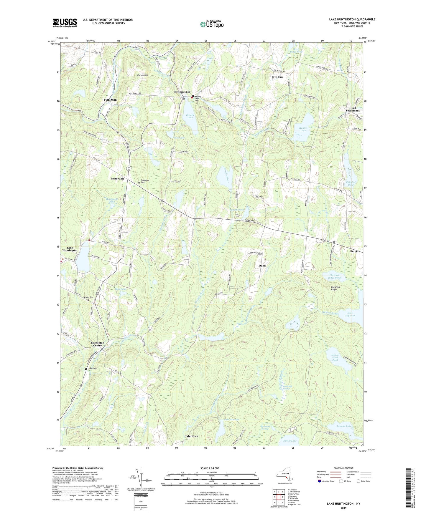
2019 topographic map quadrangle Lake Huntington in the state of New York. Scale: 1:24000. Based on the newly updated USGS 7.5' US Topo map series, this map is in the following counties: Sullivan. The map contains contour data, water features, and other items you are used to seeing on USGS maps, but also has updated roads and other features. This is the next generation of topographic maps. Printed on high-quality waterproof paper with UV fade-resistant inks.
Quads adjacent to this one:
West: Damascus
Northwest: Callicoon
North: Jeffersonville
Northeast: Liberty West
East: White Lake
Southeast: Highland Lake
South: Eldred
Southwest: Narrowsburg
Contains the following named places: Angel Mill Brook, Barnhardt Pond, Bethel Post Office, Birch Ridge, Birch Ridge Brook, Birch Ridge Pond, Campanellis Poultry Farm, Chestnut Ridge, Chestnut Ridge Pond, Cochecton Center, Cochecton Volunteer Ambulance Corps, Falls Mills, Filippini Pond, Fosterdale, Fosterdale Cemetery, Fulton Hill, Hunter Lake, Hurd Brook, Hurd Settlement, Hust Pond, Indian Field Pond, Island Glen Country Club, Jaketown Creek, Johanson Farms, Jones Brook, Kazens Pond, Kenoza Lake, Kenoza Lake Cemetery, Kenoza Lake Post Office, Kenoza Lake Volunteer Fire Department, Lake Huntington, Lake Huntington Census Designated Place, Lake Huntington Volunteer Fire Company Station 1, Lake Huntington Volunteer Fire Company Station 2, Lake Kabau, Lake Nianque, Lake Superior, Laurel Cemetery, Lillies Pond, Lynchs Pond, Mallory Brook, Mallory Pond, Mud Pond, Mud Pond Swamp, Nearing Cemetery, Nebraska Brook, Odell, Perry Pond Brook, Pine Lake, Smith Mill Swamp, Sullivan West High School, Tenmile River Camps, Toronto Lake, Town of Cochecton, Tylertown, ZIP Codes: 12720, 12750, 12752