
MyTopo
Lewbeach New York US Topo Map
Couldn't load pickup availability
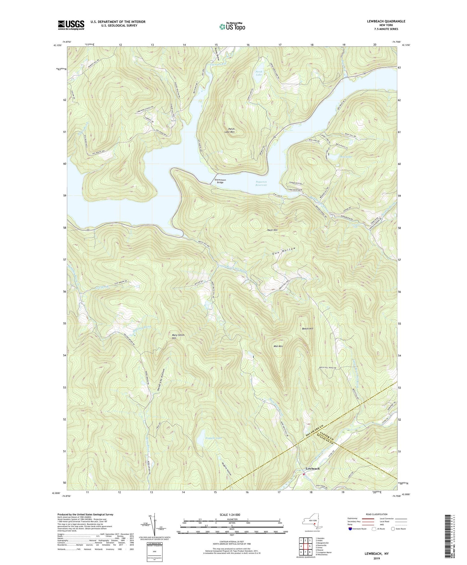
2019 topographic map quadrangle Lewbeach in the state of New York. Scale: 1:24000. Based on the newly updated USGS 7.5' US Topo map series, this map is in the following counties: Delaware, Sullivan, Ulster. The map contains contour data, water features, and other items you are used to seeing on USGS maps, but also has updated roads and other features. This is the next generation of topographic maps. Printed on high-quality waterproof paper with UV fade-resistant inks.
Quads adjacent to this one:
West: Downsville
Northwest: Hamden
North: Andes
Northeast: Margaretville
East: Arena
Southeast: Willowemoc
South: Livingston Manor
Southwest: Roscoe
Contains the following named places: Barkaboom Stream, Beaverkill Valley Fire Department, Beech Hill, Bush Kill, Bussey Hollow, Deerlick Brook, Del Savio Airport, Flynn Brook, Gulf Brook, Gun Hollow, Hendricks Hollow, Huggins Lake, Hunt Hill, Laurel Lake, Lewbeach, Little Falls EMS Heliport, Lower Beech Hill Brook, Mary Smith Brook, Mary Smith Hill, Middle Mountain, Mud Lake, Perch Lake, Perch Lake Mountain, Pleasant Valley Church, Shaver Hollow, Shavertown Bridge, Shavertown Church, Shin Creek, Tompkins Falls, Tremper Kill, Upper Beech Hill Brook, Whitcomb Hollow


