MyTopo
Montauk Point New York US Topo Map
Couldn't load pickup availability
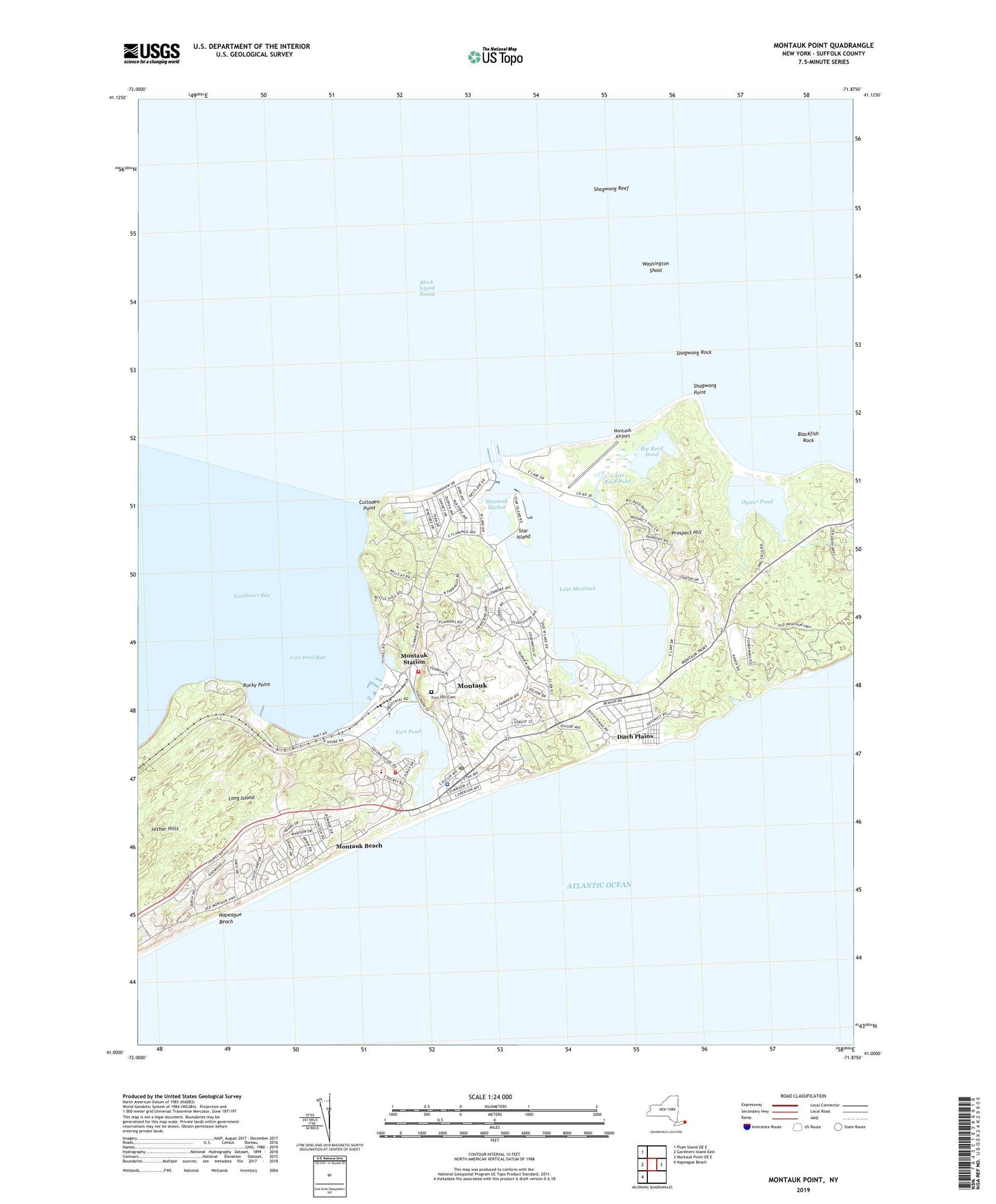
2019 topographic map quadrangle Montauk Point in the state of New York. Scale: 1:24000. Based on the newly updated USGS 7.5' US Topo map series, this map is in the following counties: Suffolk. The map contains contour data, water features, and other items you are used to seeing on USGS maps, but also has updated roads and other features. This is the next generation of topographic maps. Printed on high-quality waterproof paper with UV fade-resistant inks.
Quads adjacent to this one:
West: Gardiners Island East
Northwest: Plum Island OE E
East: Montauk Point OE E
Southwest: Napeague Beach
Contains the following named places: Amagansett Gun Club, Big Reed Pond, Blackfish Rock, Coast Guard Station Montauk, Culloden Point, Ditch Plain Life Saving Station, Ditch Plains, Easthampton Gun Club, Fort Hill Cemetery, Fort Pond, Fort Pond Bay, Hither Hills, Hither Plain Life Saving Station, Hither Woods Preserve, Lake Montauk, Lee Koppelman Nature Preserve, Little Reed Pond, Montauk, Montauk Air Force Station, Montauk Airport, Montauk Beach, Montauk Census Designated Place, Montauk Community Church, Montauk County Park, Montauk Downs State Park, Montauk Downs State Park Golf Course, Montauk Fire Station, Montauk Gun Club, Montauk Harbor, Montauk Library, Montauk Manor, Montauk Point State Park, Montauk Post Office, Montauk Public School, Montauk Seaplane Base, Montauk Station, Montauk Tennis Auditorium, Montauk Yacht Club, Montauk Yacht Club Light, Oyster Pond, Prospect Hill, Rocky Point, Saint Therese of Lisieux Church, Shagwong Point, Shagwong Reef, Shagwong Rock, Star Island, Washington Shoal, WMNK-FM (Montauk), ZIP Code: 11954