MyTopo
Randall New York US Topo Map
Couldn't load pickup availability
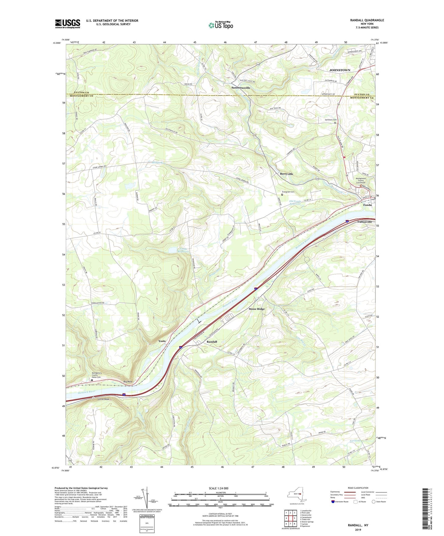
2019 topographic map quadrangle Randall in the state of New York. Scale: 1:24000. Based on the newly updated USGS 7.5' US Topo map series, this map is in the following counties: Montgomery, Fulton. The map contains contour data, water features, and other items you are used to seeing on USGS maps, but also has updated roads and other features. This is the next generation of topographic maps. Printed on high-quality waterproof paper with UV fade-resistant inks.
Quads adjacent to this one:
West: Canajoharie
Northwest: Lassellsville
North: Peck Lake
Northeast: Gloversville
East: Tribes Hill
Southeast: Esperance
South: Carlisle
Southwest: Sharon Springs
Contains the following named places: Appleridge Farm, B and B Crop Farms, Bellinger's Apple Orchard, Berryville, Big Nose, Briggs Run, Buckler Christian Academy, Cashins Farm, Cayadutta Creek, Crum Creek, Evergreen Cemetery, Fonda, Fonda Reformed Church, Fonda Reservoir, Frothingham Free Library, Hickory Hill School, Johnstown Industrial Park, Kecks Center Creek, Knauderack Creek, Lasher Creek, Little Nose, Longmeadow Farm, Mohawk Volunteer Fire Department, Montgomery County, Montgomery County Home, Montgomery County Home Cemetery, Nellis Center School, Nestle School, Old Fonda Reservoir, Randall, Saint Cecilia Church, Sammons Cemetery, Sammonsville, Sand Flats Orchard, Saving Grace Baptist Church, School Number 10, School Number 3, School Number 6, School Number 7, Shady Lane Mobile Home Park, Stone Ridge, Tekakwitha Friary, Town of Mohawk, Van Wie Creek, Willing Helpers Home for Old Ladies, Winnie School, WSHQ-FM (Cobleskill), Yatesville Creek, Yosts, ZIP Code: 12068