MyTopo
Rensselaerville New York US Topo Map
Couldn't load pickup availability
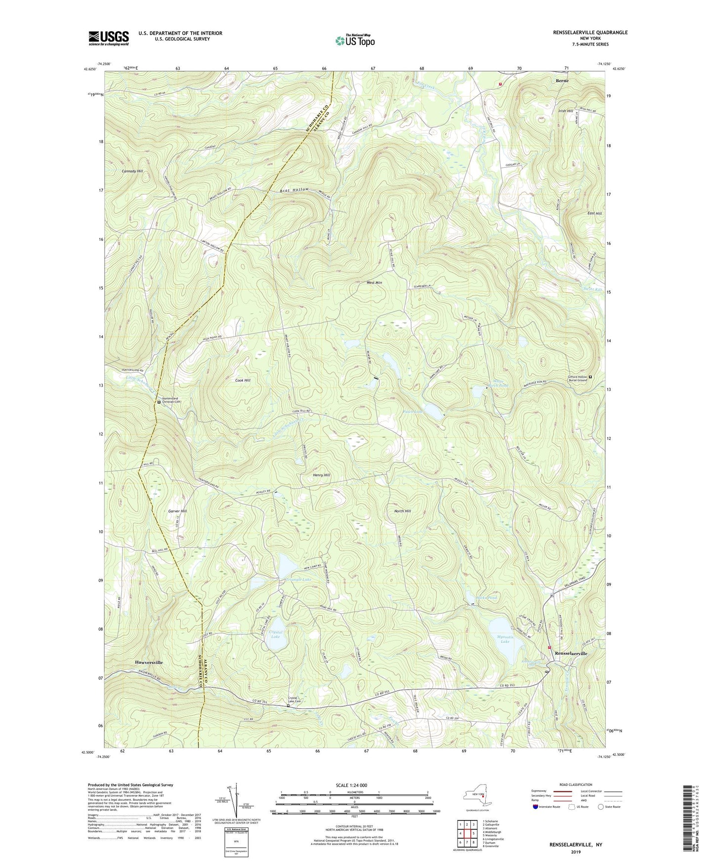
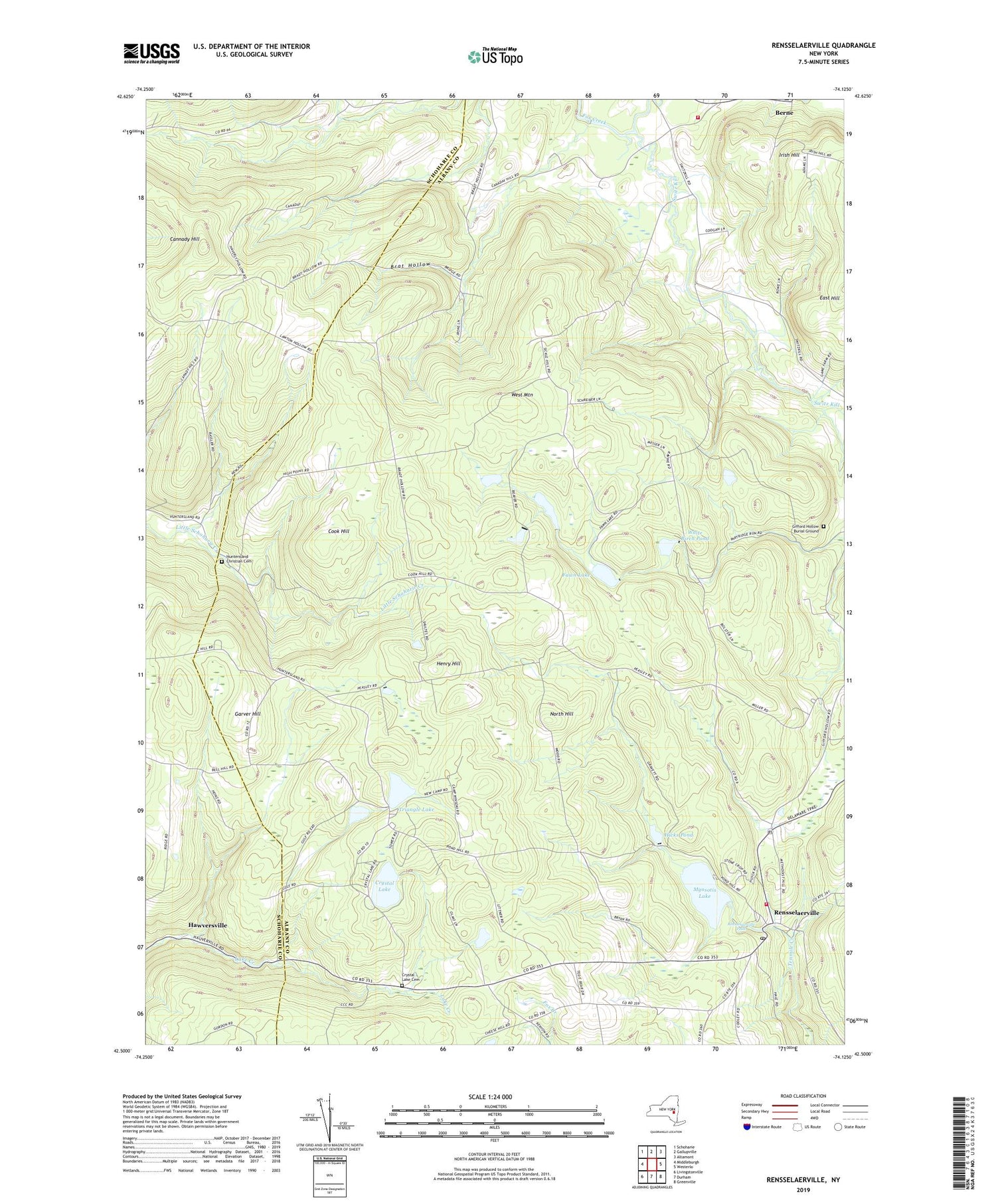
2019 topographic map quadrangle Rensselaerville in the state of New York. Scale: 1:24000. Based on the newly updated USGS 7.5' US Topo map series, this map is in the following counties: Albany, Schoharie. The map contains contour data, water features, and other items you are used to seeing on USGS maps, but also has updated roads and other features. This is the next generation of topographic maps. Printed on high-quality waterproof paper with UV fade-resistant inks.
Quads adjacent to this one:
West: Middleburgh
Northwest: Schoharie
North: Gallupville
Northeast: Altamont
East: Westerlo
Southeast: Greenville
South: Durham
Southwest: Livingstonville
Contains the following named places: Berne Volunteer Fire Department, Brat Hollow, Brat Hollow School, Cannady Hill, Cook Hill, Crystal Lake, Crystal Lake Cemetery, East Hill, Fawn Lake, Garver Hill, Gifford Hollow Burial Ground, Hawversville, Henry Hill, Hicks Pond, Huntersland Christian Cemetery, Messer School, Myosotis Lake, North Hill, Partridge Run Game Management Area, Peasley School, Rensselaerville, Rensselaerville Falls, Rensselaerville Post Office, Rensselaerville Volunteer Fire Department, School Number 2, Shoefelt Corners, Switz Kill, The Gulf, Triangle Lake, West Mountain, White Birch Pond, Zucks Corners, ZIP Codes: 12023, 12147