MyTopo
Sodus Point New York US Topo Map
Couldn't load pickup availability
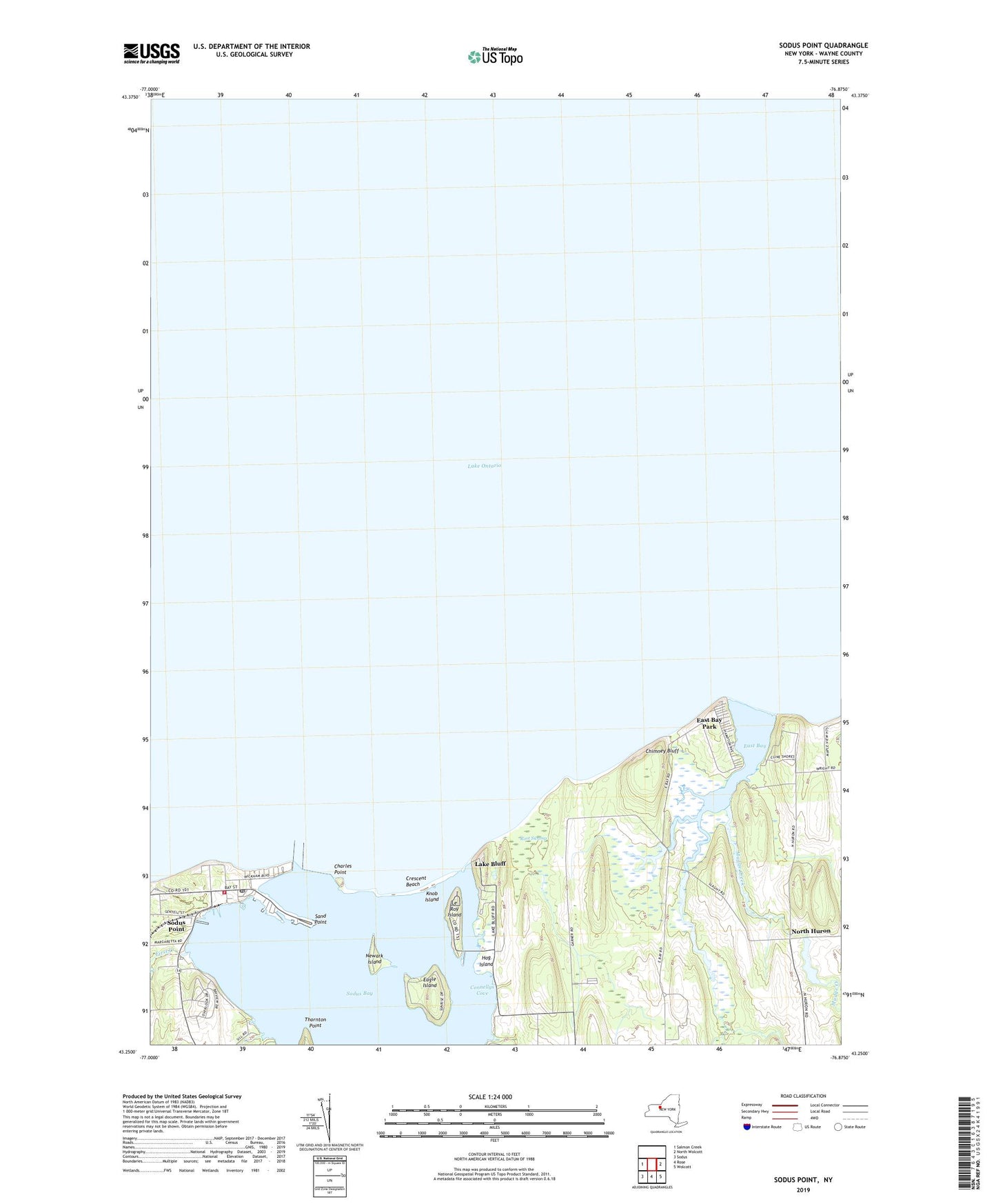
2019 topographic map quadrangle Sodus Point in the state of New York. Scale: 1:24000. Based on the newly updated USGS 7.5' US Topo map series, this map is in the following counties: Wayne. The map contains contour data, water features, and other items you are used to seeing on USGS maps, but also has updated roads and other features. This is the next generation of topographic maps. Printed on high-quality waterproof paper with UV fade-resistant inks.
Quads adjacent to this one:
West: Salmon Creek
East: North Wolcott
Southeast: Wolcott
South: Rose
Southwest: Sodus
Contains the following named places: Arneys Marina, Charles Point, Chimney Bluff, Connellys Cove, Crescent Beach, Eagle Island, East Bay, East Bay Park, East Pier Light, First Creek, Hog Island, Knob Island, Lake Bluff, Lake Bluff Campground, Le Roy Island, Mudge Creek, Newark Island, North Huron, Root Swamp, Saint Johns Chapel, Sand Point, School Number 13, School Number 9, Sills Marina, Skippers Landing Marina, Sodus Bay, Sodus Bay Marina, Sodus Bay Yacht Club, Sodus Outer Light, Sodus Point, Sodus Point Fire Department, Sodus Point Lighthouse, Sodus Point Post Office, Thornton Point, Thorpe Vineyard, Village of Sodus Point, ZIP Code: 14555