MyTopo
Tupper Lake New York US Topo Map
Couldn't load pickup availability
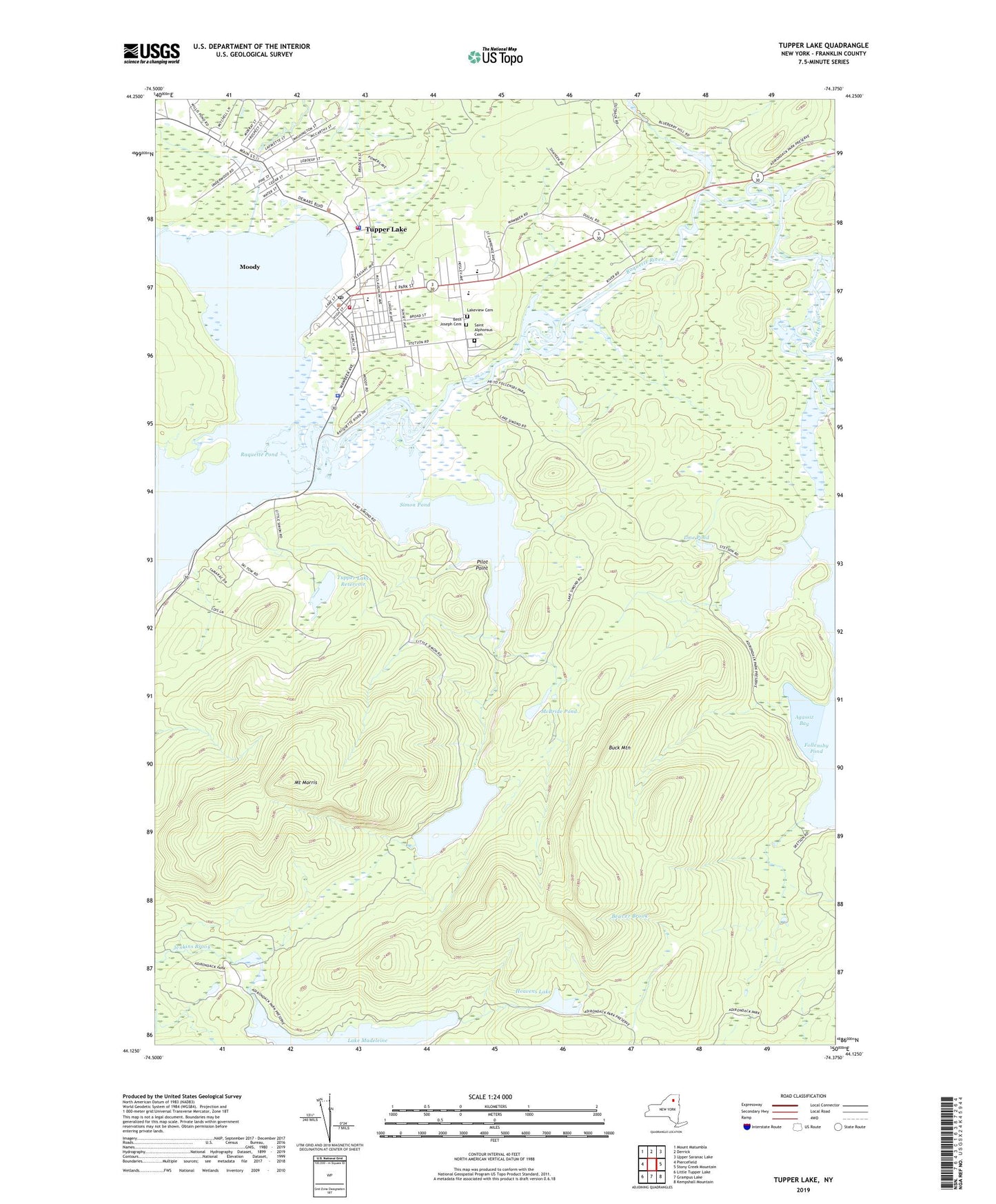
2019 topographic map quadrangle Tupper Lake in the state of New York. Scale: 1:24000. Based on the newly updated USGS 7.5' US Topo map series, this map is in the following counties: Franklin. The map contains contour data, water features, and other items you are used to seeing on USGS maps, but also has updated roads and other features. This is the next generation of topographic maps. Printed on high-quality waterproof paper with UV fade-resistant inks.
Quads adjacent to this one:
West: Piercefield
Northwest: Mount Matumbla
North: Derrick
Northeast: Upper Saranac Lake
East: Stony Creek Mountain
Southeast: Kempshall Mountain
South: Grampus Lake
Southwest: Little Tupper Lake
Contains the following named places: Agassiz Bay, Beth Joseph Cemetery, Buck Mountain, Follensby Pond, Goff - Nelson Memorial Library, Heavens Lake, Holy Ghost Academy, Holy Name Catholic Church, Holy Name Cemetery, L P Quinn Elementary School, Lake Madeleine, Lakeview Cemetery, Line Pond, Little Simon Pond, McBride Pond, Mercy General Hospital, Mercy Health Care Center, Moody, Mount Morris, Pilot Point, Quinn School, Raquette Pond, Saint Alphonsus Cemetery, Saint Alphonsus Church, Saint Thomas Episcopal Church, Simon Pond, Town of Tupper Lake, Tupper Lake, Tupper Lake Country Club, Tupper Lake Fire Department, Tupper Lake Middle - High School, Tupper Lake Police Department, Tupper Lake Post Office, Tupper Lake Reservoir, Tupper Lake Village Wastewater Treatment Plant, Tupper Lake Volunteer Ambulance and Emergency Squad, Tupper Lake Volunteer Fire Department Station 1, Tupper Lake Volunteer Fire Department Station 2, United Community Church of Tupper Lake, Village of Tupper Lake, WRGR-FM (Tupper Lake), ZIP Code: 12986