MyTopo
Wyoming New York US Topo Map
Couldn't load pickup availability
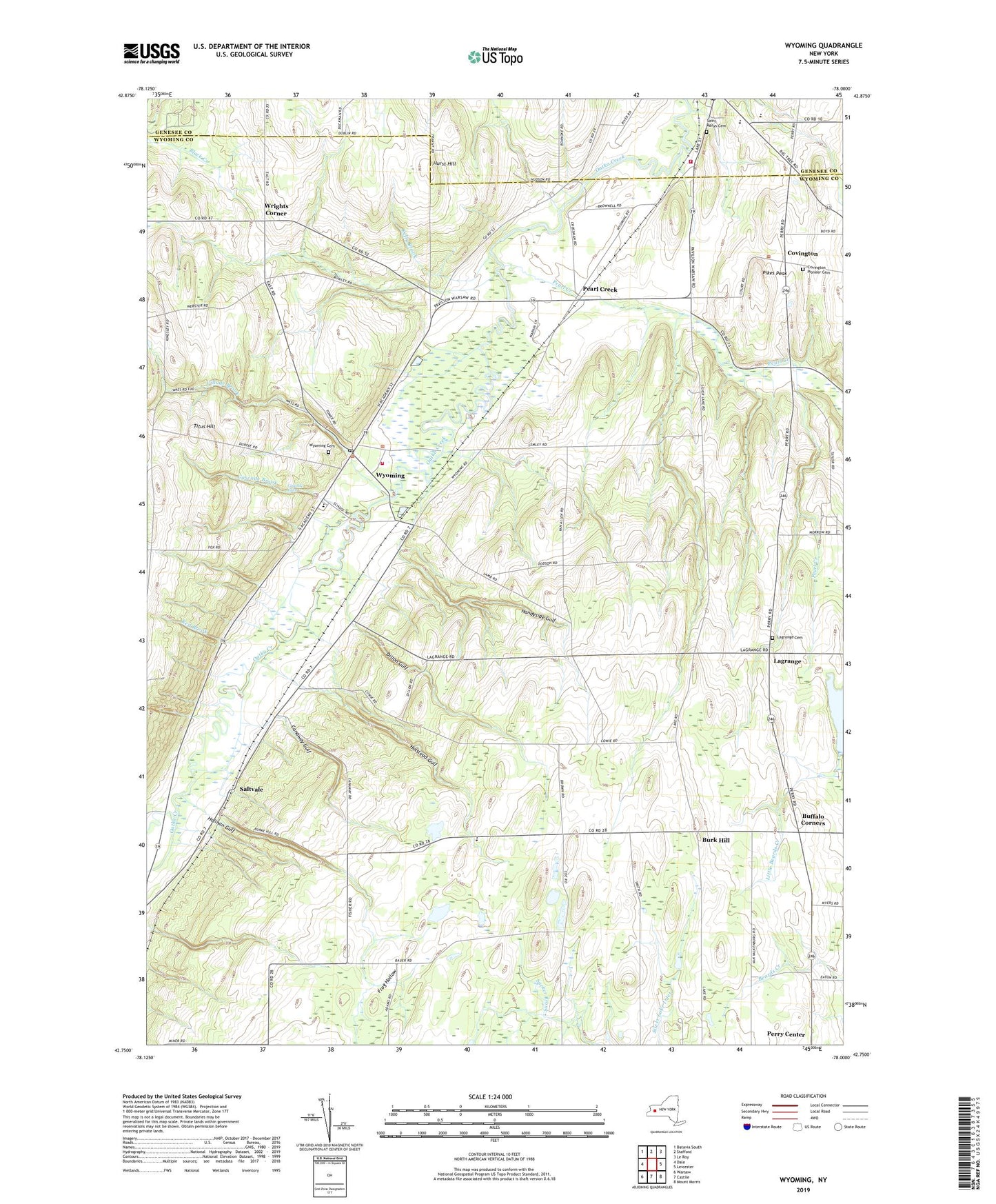
2019 topographic map quadrangle Wyoming in the state of New York. Scale: 1:24000. Based on the newly updated USGS 7.5' US Topo map series, this map is in the following counties: Wyoming, Genesee. The map contains contour data, water features, and other items you are used to seeing on USGS maps, but also has updated roads and other features. This is the next generation of topographic maps. Printed on high-quality waterproof paper with UV fade-resistant inks.
Quads adjacent to this one:
West: Dale
Northwest: Batavia South
North: Stafford
Northeast: Le Roy
East: Leicester
Southeast: Mount Morris
South: Castile
Southwest: Warsaw
Contains the following named places: Bow Hill Farms, Buffalo Corners, Burk Hill, Canaway Gulf, Cascade Brook, Cascade Falls, Covington, Covington Pioneer Cemetery, Dillon Gulf, Ewells Corner, First Baptist Church, First Presbyterian Church, Frog Hollow, Handyside Gulf, Hillsides, Hilltop Acres Mobile Home Park, Holihan Gulf, Holstead Gulf, Hurst Hill, Kelly Brook, Lagrange, Lagrange Cemetery, Lake Le Roy, Lambs Corner, Middlebury Academy, Millers Corner, Paines Corner, Pavilion Fire Department, Pavilion Junior - Senior High School, Pearl Creek, Pierson Farms, Pikes Peak, Pioneer Salt Well, Red Brook, Ridge Corners, Saint Marys Cemetery, Saltvale, School Number 1, School Number 10, Spragues Corner, Titus Hill, Town of Covington, Town of Perry, Village Brook, Village of Wyoming, Woodvale Farms, Wrights Corner, WYDM-TV (Batavia), Wyoming, Wyoming Cemetery, Wyoming Central School, Wyoming Free Library, Wyoming Gulf, Wyoming Hook and Ladder Volunteer Fire Company Station 1, Wyoming Post Office, Wyoming United Methodist Church, Wyoming Valley, Wyoming Village Hall, Wyoming Village Historic District, ZIP Code: 14591