MyTopo
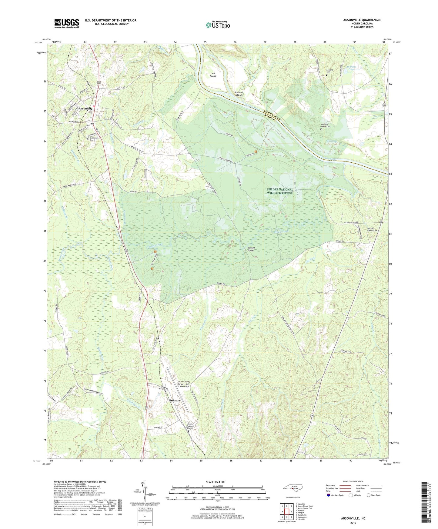
Ansonville North Carolina US Topo Map
Couldn't load pickup availability
2019 topographic map quadrangle Ansonville in the state of North Carolina. Scale: 1:24000. Based on the newly updated USGS 7.5' US Topo map series, this map is in the following counties: Anson, Richmond. The map contains contour data, water features, and other items you are used to seeing on USGS maps, but also has updated roads and other features. This is the next generation of topographic maps. Printed on high-quality waterproof paper with UV fade-resistant inks.
Quads adjacent to this one:
West: Polkton
Northwest: Aquadale
North: Mount Gilead West
Northeast: Mount Gilead East
East: Mangum
Southeast: Lilesville
South: Wadesboro
Southwest: Russellville
Contains the following named places: Andrews Pond, Anson County Airport-Jeff Cloud Field, Ansonville, Ansonville Fire Department and Rescue Squad, Ansonville Post Office, Ansonville School, Bennett Bridge, Bethlehem Cemetery, Beverly, Birmingham Hough School, Brown Creek, Buffalo Creek, Buzzard Island, Cabbage Branch, Canal Branch, Dula Thoroughfare, Dumass Ferry, Flat Fork, Gaddys Goose Pond Dam, Gaddys Goose Ponds, Garris Grove Church, Goulds Fork, Grindstone Branch, Hough School, Hurricane Creek, Ingold Pond, Leak Island, Legrand Cemetery, Machine House Cemetery, Mount Pleasant Church, Old Leak Ferry, Pee Dee National Wildlife Refuge, Permetter Branch, Pinkston, Pressley Creek, Red Hill Church, Red Hill Church Cemetery, Rosenwald School, Salem Church, Town of Ansonville, Township of Ansonville, West Ansonville School, ZIP Code: 28007