MyTopo
Eleazer North Carolina US Topo Map
Couldn't load pickup availability
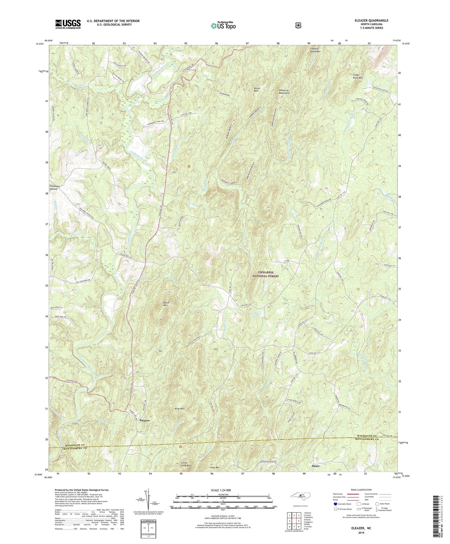
2019 topographic map quadrangle Eleazer in the state of North Carolina. Scale: 1:24000. Based on the newly updated USGS 7.5' US Topo map series, this map is in the following counties: Randolph, Montgomery. The map contains contour data, water features, and other items you are used to seeing on USGS maps, but also has updated roads and other features. This is the next generation of topographic maps. Printed on high-quality waterproof paper with UV fade-resistant inks.
Quads adjacent to this one:
West: Handy
Northwest: Denton
North: Farmer
Northeast: Asheboro
East: Seagrove
Southeast: Star
South: Lovejoy
Southwest: Badin
Contains the following named places: Bandys Store, Betty McGees Creek, Birkhead Mountains Wilderness, Birkhead Trail, Black Mountain, Brush Mountain, Callicutts Church, Cedar Rock Mountain, Coolers Knob Mountain, Eleazer, Hannahs Creek, High Pine Church, King Mountain, Lakes Creek, Laniers Creek, Little Long Mountain, Mill Creek, Mount Lebanon Church, Narrows Branch, North Prong Hannahs Creek, Oak Grove Church, Robbins Branch, Sand Branch, Second Creek, Silver Run Creek, South Prong Hannahs Creek, Springs Lake, Springs Lake Dam, Strieby Church, Toms Creek, Twomile Creek, Walkers Creek