
MyTopo
Holly Ridge North Carolina US Topo Map
Couldn't load pickup availability
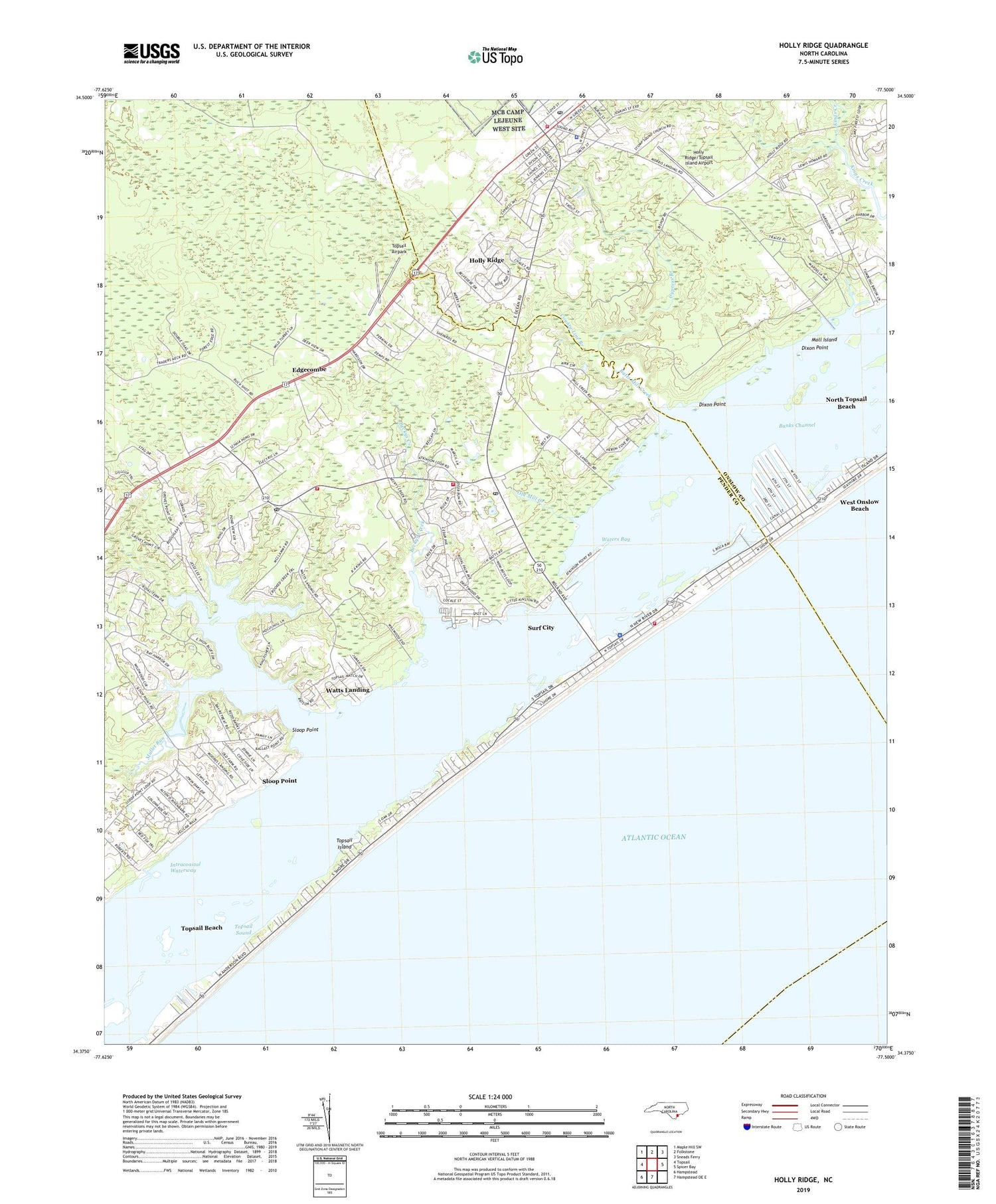
2019 topographic map quadrangle Holly Ridge in the state of North Carolina. Scale: 1:24000. Based on the newly updated USGS 7.5' US Topo map series, this map is in the following counties: Pender, Onslow. The map contains contour data, water features, and other items you are used to seeing on USGS maps, but also has updated roads and other features. This is the next generation of topographic maps. Printed on high-quality waterproof paper with UV fade-resistant inks.
Quads adjacent to this one:
West: Topsail
Northwest: Maple Hill SW
North: Folkstone
Northeast: Sneads Ferry
East: Spicer Bay
South: Hampstead OE E
Southwest: Hampstead
Contains the following named places: Banks Channel, Barlow Vista Church, Barlowes, Batts Mill Creek, Beckys Creek, Bell Form Landing, County Line Branch, Cypress Branch, Deactivated - Fire Department, Dixon Point, Edens Landing, Edgecombe, Holly Hills Mobile Home Estate, Holly Ridge, Holly Ridge Church of God, Holly Ridge Fire and Rescue, Holly Ridge Police Department, Holly Ridge Post Office, Holly Ridge/Topsail Island Airport, J and M Mobile Home Park, Lewis Landing, Life Christian Academy, MacMillan Landing, Manhollow Church, Mill Creek Mobile Home Park, Moll Island, Moore Landing, Morris Landing, Mullet Run, New Life Christian Center, Old Landing, Old Mill Creek, Pender Volunteer Emergency Medical Services and Rescue SPender County EMS Station 6, Powells Mobile Home Park, Providence Church, Sears Landing, Sloop Point, Sloop Point Post Office, Stump Sound Church, Surf City, Surf City Fire Department Station Number 1, Surf City Police Department, Surf City Post Office, Topsail Airpark, Town of Holly Ridge, Town of Surf City, Virginia Creek, Vista, Waters Bay, Watts Landing, West Onslow Beach, Yow-Williams Pond, Yow-Williams Pond Dam, ZIP Code: 28445


