MyTopo
Jacksonville South North Carolina US Topo Map
Couldn't load pickup availability
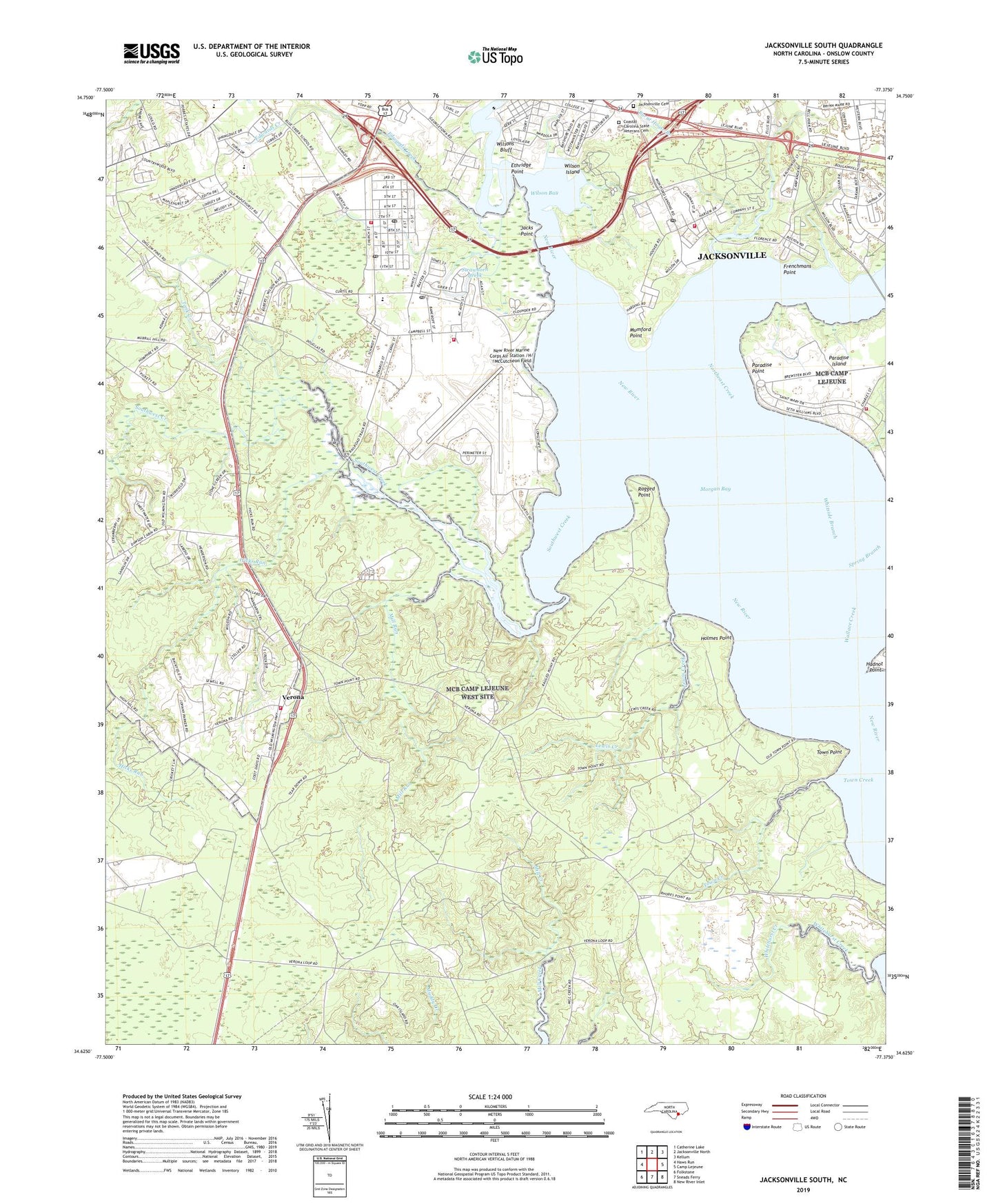
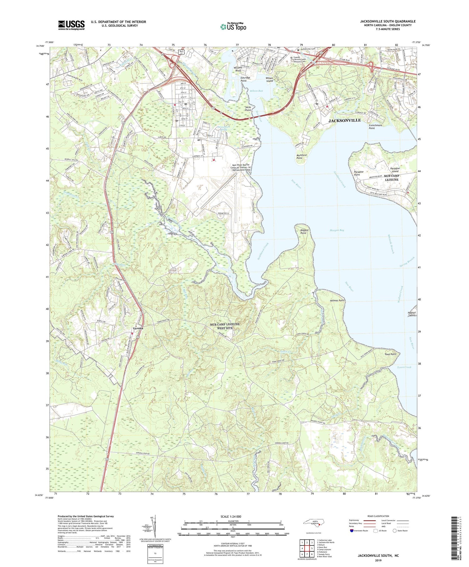
2019 topographic map quadrangle Jacksonville South in the state of North Carolina. Scale: 1:24000. Based on the newly updated USGS 7.5' US Topo map series, this map is in the following counties: Onslow. The map contains contour data, water features, and other items you are used to seeing on USGS maps, but also has updated roads and other features. This is the next generation of topographic maps. Printed on high-quality waterproof paper with UV fade-resistant inks.
Quads adjacent to this one:
West: Haws Run
Northwest: Catherine Lake
North: Jacksonville North
Northeast: Kellum
East: Camp Lejeune
Southeast: New River Inlet
South: Sneads Ferry
Southwest: Folkstone
Contains the following named places: Bay Church, Bayshore, Briar Creek Mobile Home Park, Brinson Creek, Bryan Mobile Home Park, Brynn Marr Shopping Center, Camp Geiger Post Office, Camp Johnson Post Office, Camp Lejeune Fire Department Station 1, Camp Lejeune Fire Department Station 4, Camp Lejeune Fire Department Station 6, Camp Lejeune Fire Department Station 8, City of Jacksonville, Coastal Carolina State Veterans Cemetery, D Street Military Post Office, Edwards Creek, Ethridge Point, Faith Body of Christ Assembly Church, Frenchmans Point, Georgetown, Gerogetown High School, Hadnot Point, Hicks Run, Holmes Point, Jacks Point, Jacksonville City Cemetery, Jacksonville Post Office, Kingdom Hall of Jehovahs Witnesses, Knox Area, Knox Trailer Park, Lewis Creek, Lutheran Church of Our Savior, McCutcheon Field Post Office, Mill Run, Momford Landing, Montford Point, Mount Sinai Holy Church, Mumford Point, New River Marine Corps Air Station /H/ /McCutcheon Field, North Carolina State Highway Patrol Troop B District 3, Northeast Creek, Onslow County, Onslow County Emergency Medical Services Station 2, Onslow County Health Department, Onslow County Recreation Park, Paradise Island, Paradise Park, Paradise Point, Plum Point Estates, Ragged Point, Saint Julia African Methodist Episcopal Zion Church, Scales Creek, South Gate Mobile Home Park, Southwest Creek, Springdale Acres, Stick Creek, Strawhorn Creek, Tank Creek, Tarawa Terrace Elementary School, Tarawa Terrace II, Town Creek, Town Point, Trent River Missionary Baptist Church, Utopia Mobile Home Park, Verona, Verona Free Will Baptist Church, Verona United Methodist Church, Verona Volunteer Fire Department, Walter M Thompson Elementary School, Whitside Branch, Wilson Bay, Wilson Bay Park, Wilson Island, Wilsons Bluff, WJIK-AM (Camp Lejeune), WJNC-AM (Jacksonville), Word of Life Fellowship Church, WRCM-FM (Jacksonville), ZIP Code: 28543