MyTopo
Maple Springs North Carolina US Topo Map
Couldn't load pickup availability
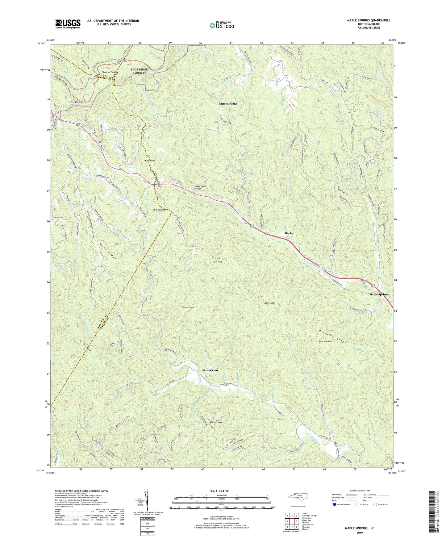
2019 topographic map quadrangle Maple Springs in the state of North Carolina. Scale: 1:24000. Based on the newly updated USGS 7.5' US Topo map series, this map is in the following counties: Wilkes, Watauga, Ashe. The map contains contour data, water features, and other items you are used to seeing on USGS maps, but also has updated roads and other features. This is the next generation of topographic maps. Printed on high-quality waterproof paper with UV fade-resistant inks.
Quads adjacent to this one:
West: Deep Gap
Northwest: Todd
North: Glendale Springs
Northeast: Horse Gap
East: Purlear
Southeast: Boomer
South: Grandin
Southwest: Buffalo Cove
Contains the following named places: Cascade Falls, Cascade Overlook, Chestnut Mountain, Dividing Ridge, Fall Creek, Fire Scale Mountain, Fletcher Creek, Flint Knob, Flowers Branch, Fox Branch, Greens Ridge, Harley, Hendrix, Highland View Church, Husons Ridge, Ivy Point Ridge, Jeffress Park, Johnson Mountain, Laurel Branch, Laurel Spur Ridge, Left Prong Stony Fork, Lewis Fork Overlook, Little Creek, Maple Springs, Meadow Branch, Mill Creek, Miller Mountain, Mount Zion, Mount Zion Baptist Church, Mountain View Church, Parmer Mountain, Pattons Ridge, Pattons Ridge Church, Pumpkin Run, Shell Creek, Stony Fork, Stony Fork Church, Stony Fork School, Summit, Thomkins Knob Overlook, Tomkins Knob, Township of Jobs Cabin, Wade Harris Bridge, Wildcat Creek, Wolf Knob, Yates Knob, Yellow Hill Church, ZIP Codes: 28624, 28665